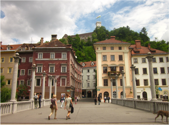
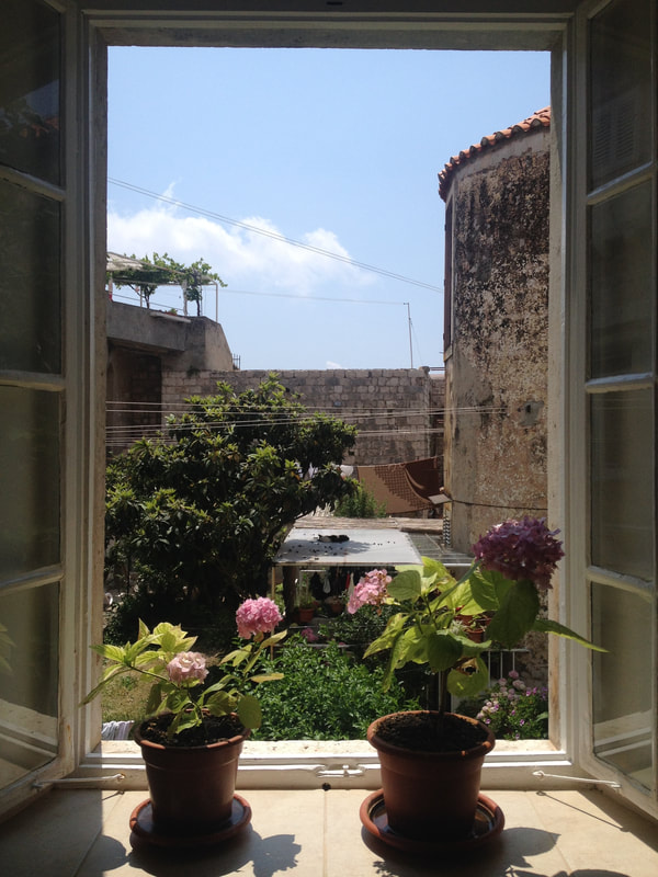
 Ljubljana Castle above Old Town, Ljubljana, Slovenia "It's like living in a fairytale until you realize there isn't much to do," we were told by an older couple we met in Copenhagen. On the train, we mentioned to a German man that we were stopping in Ljubljana because we heard that it was nice. He paused and said, "Maybe." These experiences did not inspire confidence about our upcoming time in Ljubljana, but then we arrived. And we were greeted with the most charming city in the most charming country, and it became a highlight on our European Adventure. 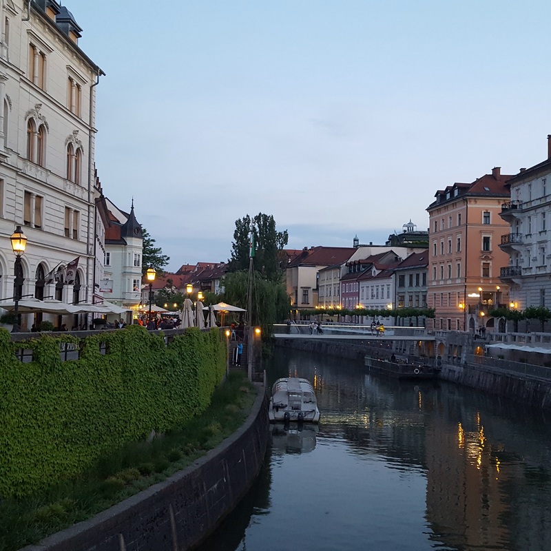 Ljubljanica River, Ljubljana, Slovenia Ljulbjana's Old TownLjubljana's Old Town is filled with picture perfect buildings and cobblestone streets. A number of bridges span the Ljubljanica River flowing through town. Along the river banks, cafe tables line the sidewalks and locals sit outside, sipping wine. The Old Town is small but fun to wander through, stopping in cafes, exploring shops, and walking along the river. We spent a couple of warm summer afternoons sitting outside at cafes, sampling Slovenian wine. A particular favorite was TOZD. The symbol of the city is a dragon. Local legend says that the founder of Ljubljana killed a dragon. There are dragons all over the city, including a Dragon Bridge, dragon statues, and dragon souvenirs. I though this was a fun quirk, something different than you encounter in other European capitals. Another thing I noticed in Ljubljana was the number of garbage cans. On the street, I saw receptacles lined up for various types of waste. I learned the Ljubljana was given the "European Green Capital Award" in 2016. The honor is awarded based on 12 environmental factors, including transport, green urban areas, waste production and management, nature and biodiversity, air, water consumption, and energy performance, among others. So, it makes sense that I saw evidence of Ljubljana's efficient waste management while walking the city streets. 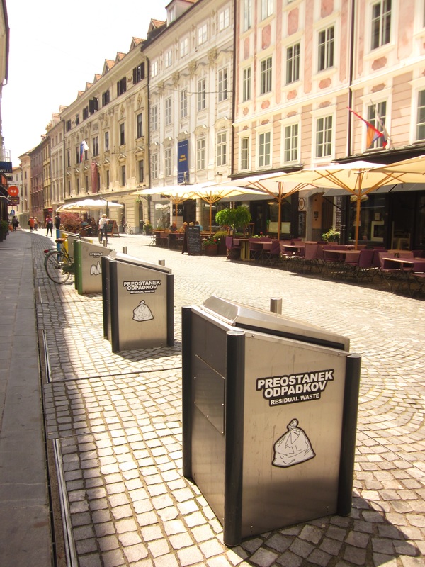 Evidence of the European Green Capital 2016 Award, Ljubljana, Slovenia 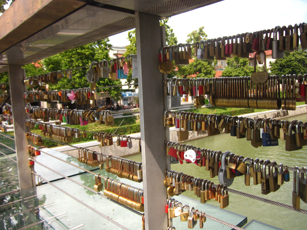 Lovers' Padlocks on Butchers' Bridge, Ljubljana, Slovenia 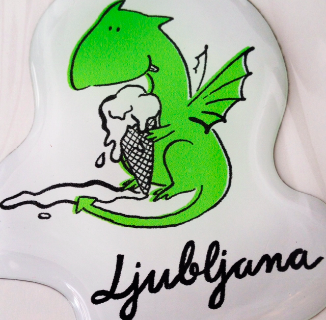 Dragon sticker, Ljubljana, Slovenia Ljubljana CastleWhat fairytale would be complete without its very own castle? Ljubljana Castle is perched on top of a hill in the middle of Old Town. It's a majestic stone structure, originally a medieval fortress. There is a funicular that ferries visitors up Castle Hill for a price, but we chose to walk up the hill, which ended up being a nice way to look out over the city. At the top, we did not end up paying the entrance fee, since we were able to look out from the castle walls, walk through the courtyard, and enter a small chapel without a ticket. Looking down over the red roofs of Ljubljana was quite a sight! 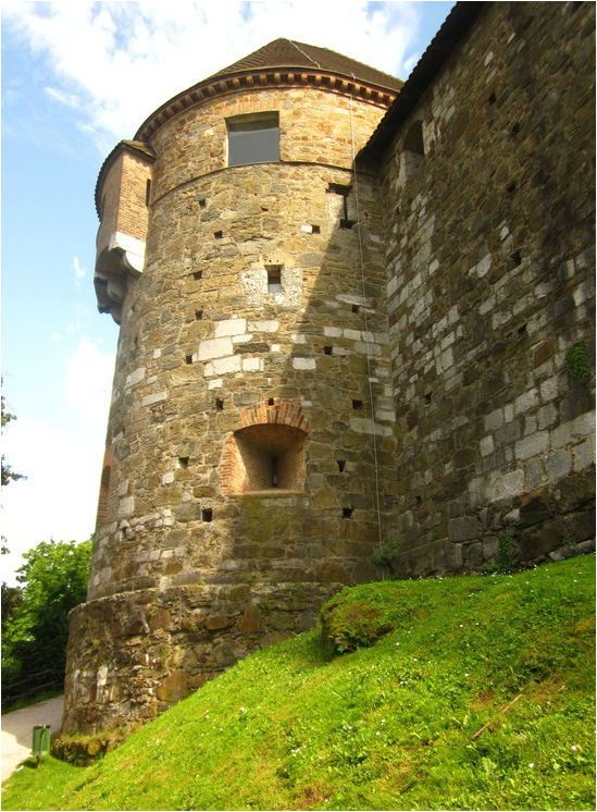 Ljubljana Castle, Ljubljana, Slovenia 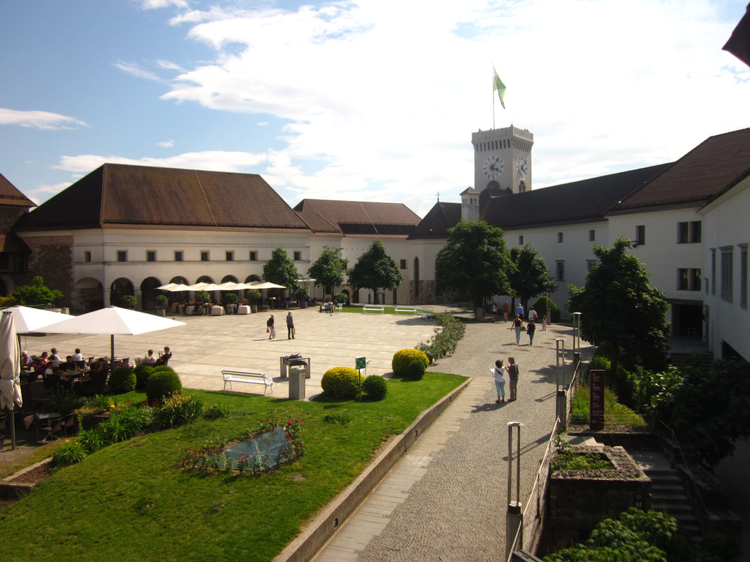 Courtyard of Ljubljana Castle, Ljubljana, Slovenia 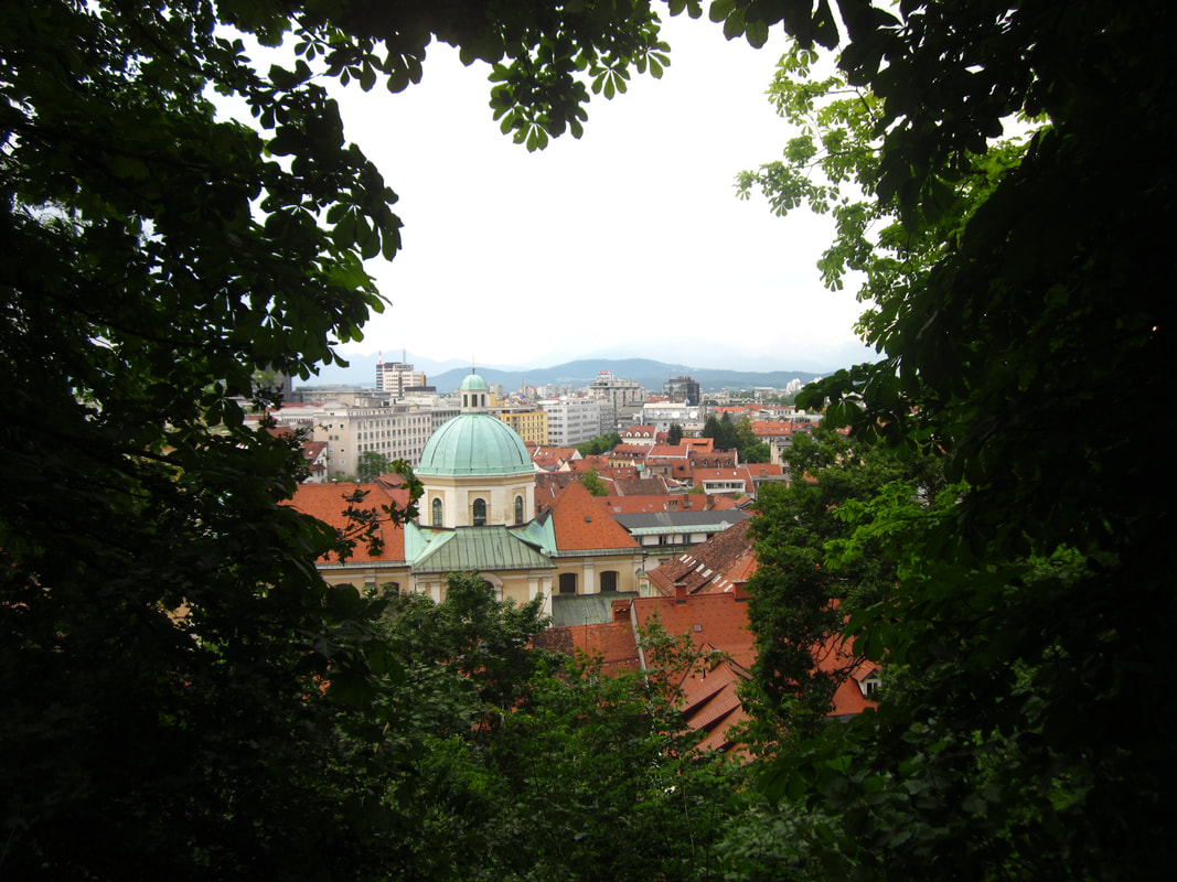 View from the climb to Ljubljana Castle, Ljubljana, Slovenia 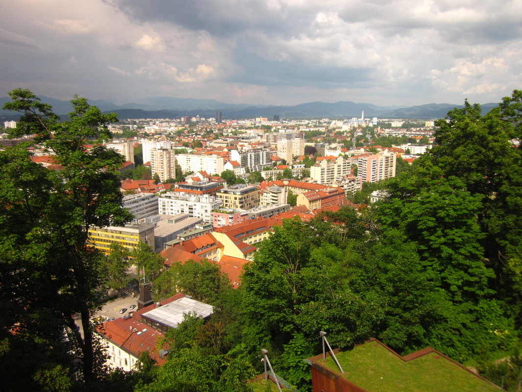 View from Ljubljana Castle, Ljubljana, Slovenia Ljubljanajam Food TourOne of the activities that we chose to pay for on our European Adventure was a food tour in Ljubljana with a company called Ljubljanajam. I HIGHLY recommend a food tour with Iva, who owns this company. She was very knowledgeable, was very accommodating to food allergies, and put together a lovely food tour that highlighted some traditional dishes from Slovenia. We went for the Ljubljana Essentials Tour, but tours focused on craft beer, Slovenian wine, and desserts are also offered! On our food tour, we stopped by the farmer's market and sampled bear sausage. We tried soup, pumpkin oil, a fish plate, a chicken dish, Slovenian liquor and wine, gelato, and coffee. For a longer summary of our Food Walk, read my full review here. 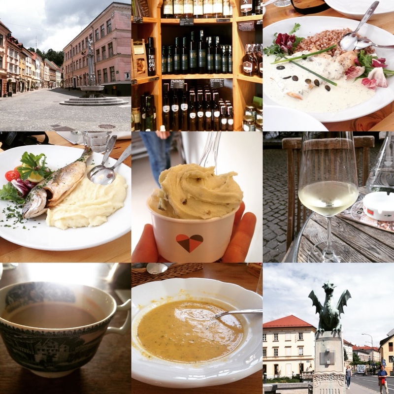 Images from our food walk with Ljubljanajam, Ljubljana, Slovenia 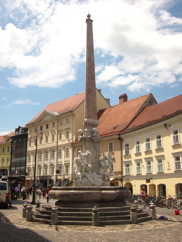 Old Town, Ljubljana, Slovenia Hanging with localsWe stayed in an Airbnb just across the river from Old Town Ljubljana, right across from the Rog Factory, an abandoned bicycle factory that is occupied by squatters and operates a variety of community spaces. We stayed there during protests in June 2016 against the demolition of the building, and we could hear protesters from our room throughout our stay. Our Airbnb was fantastic! We had lovely hosts who chatted with us, made us feel welcome, gave us a demo record (they were all dancers, artists, musicians), and even arranged for us to come to a small, local yoga class when we couldn't find a yoga class to attend on our own. Our apartment was located on Trubarjeva Cesta, just across the Dragon Bridge from Old Town. Trubarjeva Cesta was lined with shops and restaurants, most of the buildings colorfully adorned with graffiti. Shoes hung from a few of the telephone wires overhead. This street contrasted with the clean and tidy streets of Old Town. I liked the contrast and the visual interest of the graffiti along this street. 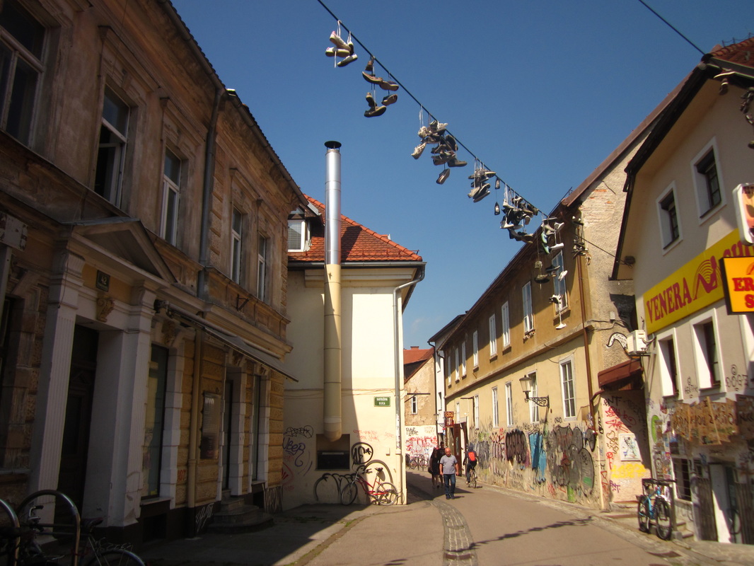 Shoes on wire, Trubarjeva Cesta, Ljubljana, Slovenia 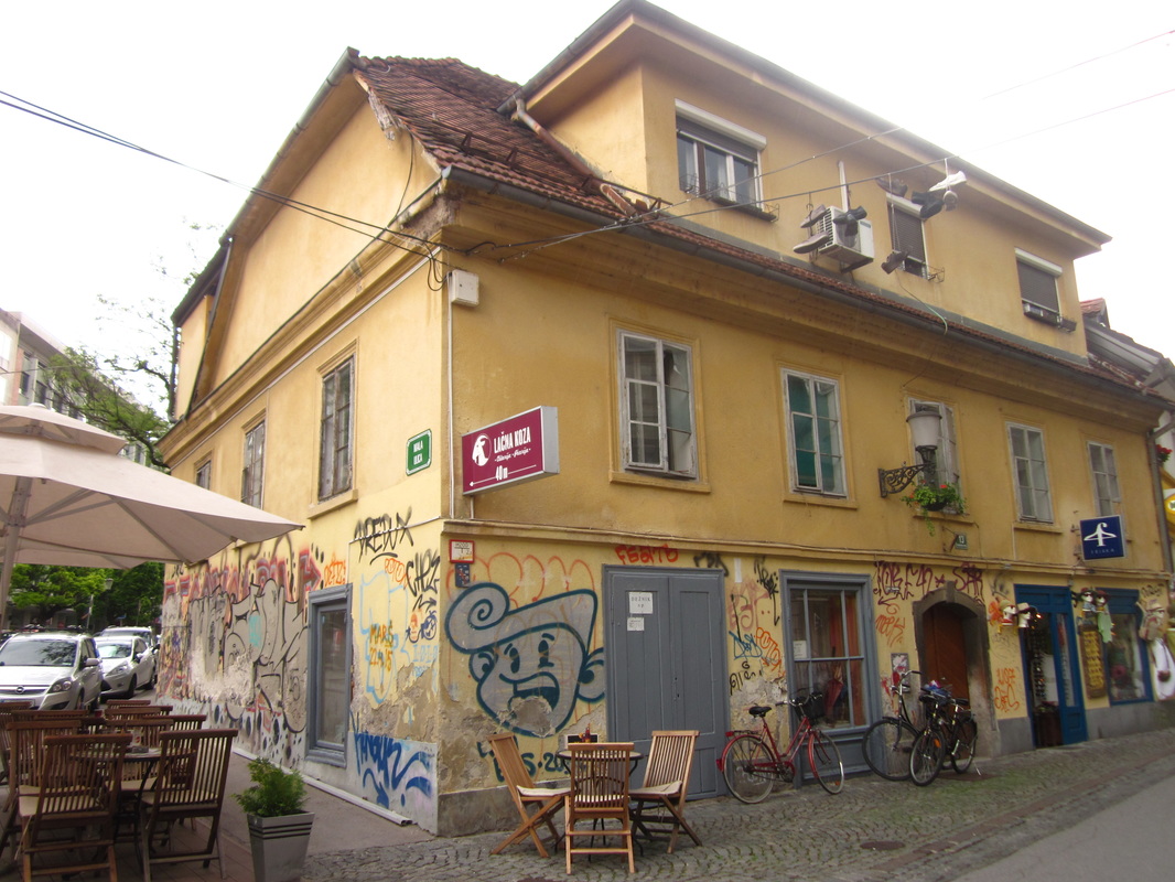 Trubarjeva Cesta, Ljubljana, Slovenia 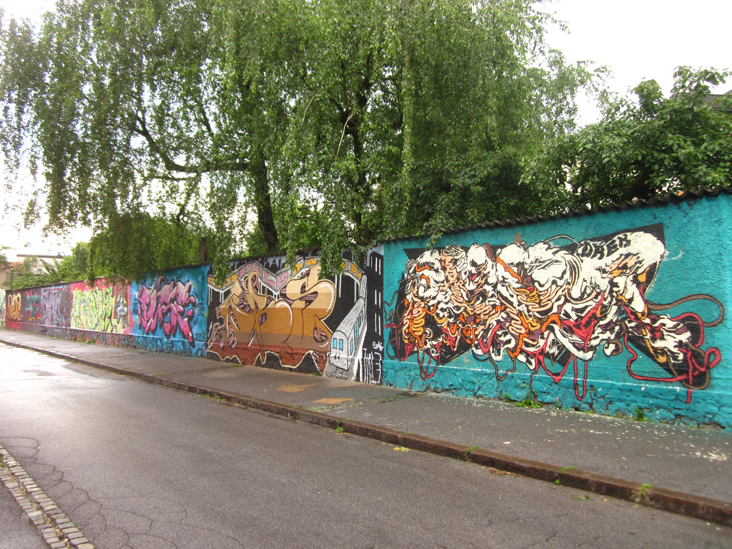 Boundary of Rog Bicycle Factory, Trubarjeva Cesta, Ljubljana, Slovenia ModernaIn our never-ending search for coffee, we ended up at Moderna, a minimalist coffee shop located inside the Museum of Modern Art. As we entered the building, we heard some other-worldly sounds, coming from a modern art exhibit, I presume. But Moderna was a lovely treat, with delicious, hand-poured coffee. Curiously, it was served in wine glasses. We spent a few hours relaxing in Moderna, drinking coffee and taking advantage of their wi-fi. If you are a modern art fan, I'm sure the museum would be a fun stop either before or after the coffee shop. 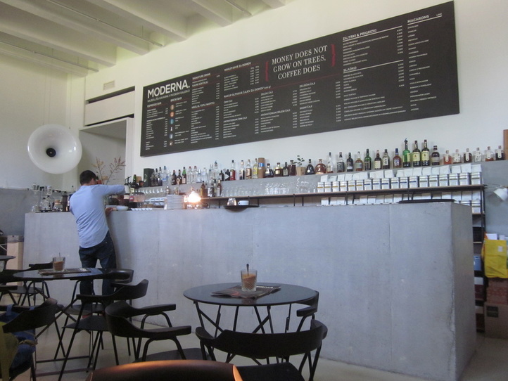 Moderna Coffee Shop, Ljubljana, Slovenia 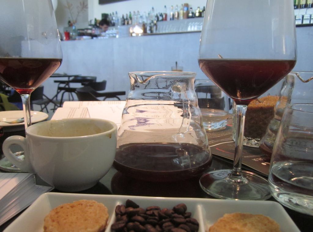 Coffee and sweets at Moderna, Ljubljana, Slovenia We spent two days in Ljubljana, which was enough to explore the central part of the city. The architecture was charming, and the people we met were friendly. There are not a ton of big "attractions" in the city, but we were happy enough wandering through the streets of Old Town and taking advantage of the cafes. The relaxed pace and small feel is a nice break from some of the bigger, busier cities in Europe. The wine is delicious. And there are dragons. Ljubljana is also a great jumping off point for heading into the Julian Alps. We took a bus to stunning Lake Bled, which took about an hour, but more about Lake Bled is coming in another blog post! 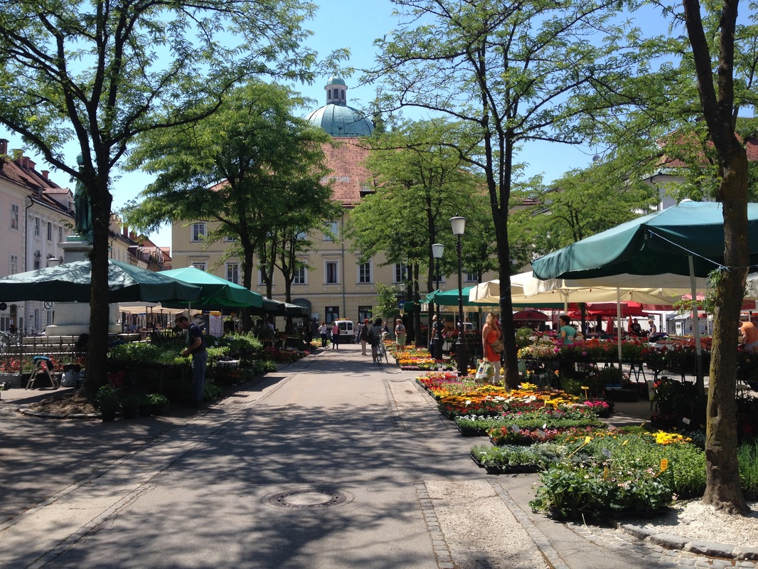 Farmer's Market, Ljubljana, Slovenia 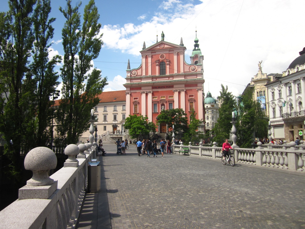 Triple Bridge, Ljubljana, Slovenia
1 Comment
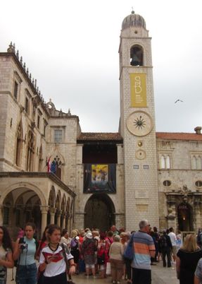
Ahh, Dubrovnik. The "pearl of the Adriatic". I had heard so much about Dubrovnik before we visited. A co-worker told me it was one of her favorite places she's ever visited. A friend insisted that we HAD to go to Dubrovnik on our European trip. I heard rumors that some obscure television show is filmed there. (I actually don't watch Game of Thrones.) 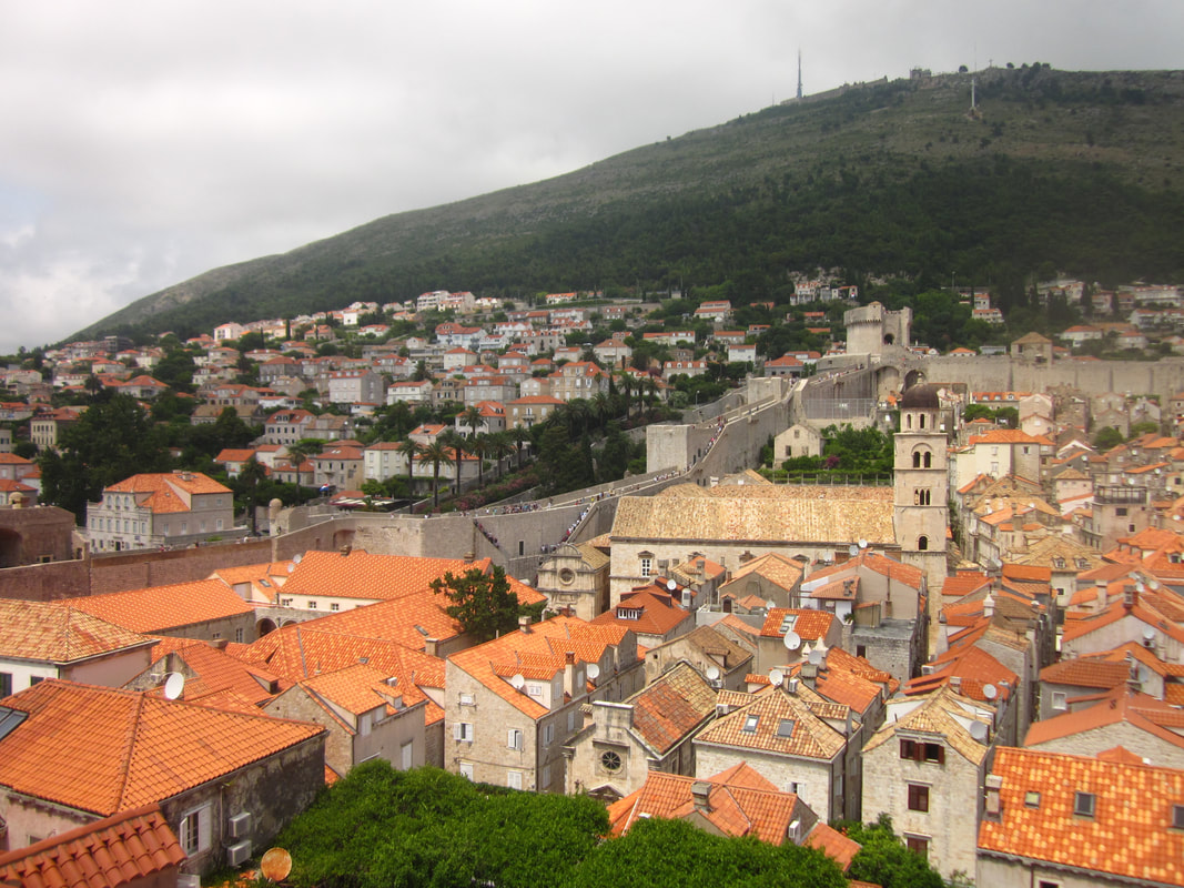 Looking over Dubrovnik from the Ethnographic Museum, Dubrovnik, Croatia 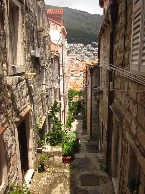 Old Town Staircases, Dubrovnik, Croatia But, when we arrived in Dubrovnik...I felt disappointed. The streets were packed with hordes of tourists who had docked for the day on cruise ships. I mean, packed. It was hard to take a picture of the beautiful medieval walls without a crowd in front. A steady stream of tourists were on the city walls, walking the perimeter like a line of ants, one right after the other. A late-2000s guidebook that my friend had given me listed admission to the city walls as 50 HRK (almost $8) per person. My husband and I felt that we could pay that for what we heard was a "must-do" attraction. And, it's not every day that you get to walk on medieval walls. We were shocked to learn that, in 2016, admission to the city walls had tripled to 150 HRK, which, at today's exchange rate is over $23 per person! On a backpacker's budget, we couldn't afford nearly $50 for one attraction. Nearly every restaurant inside the walled city of Dubrovnik had the same menu at higher prices than we had seen anywhere else in the Balkans, giving us very little choice in food or price point. Game of Thrones t-shirts waved from shops. I felt like we had arrived in a medieval theme park that had been set up for cruise ship visitors that docked during the day.
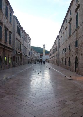
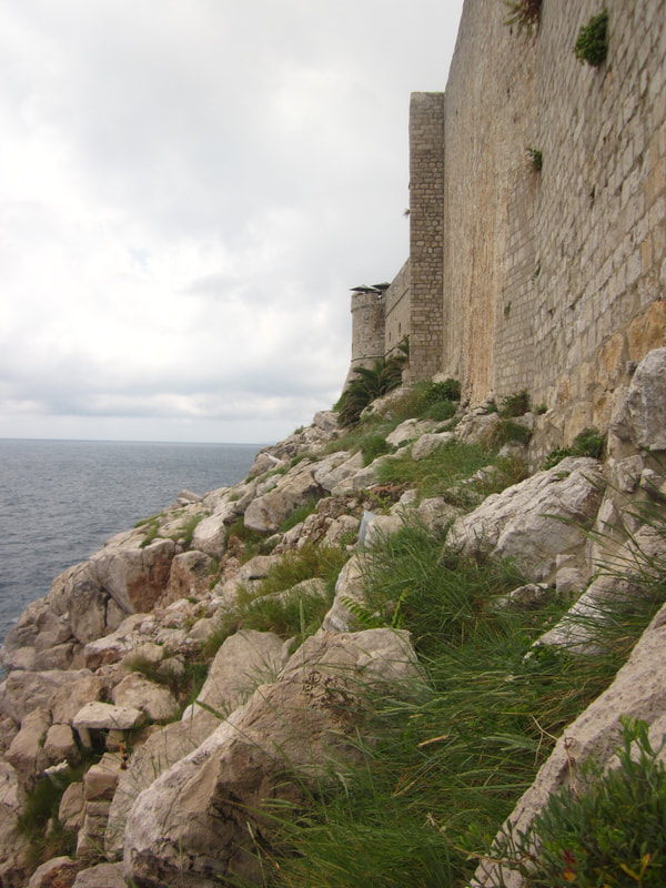
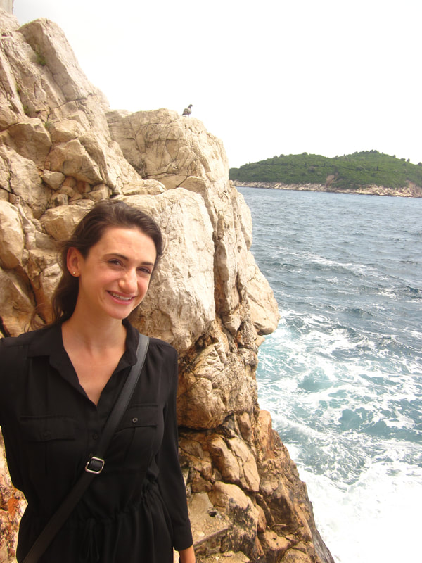
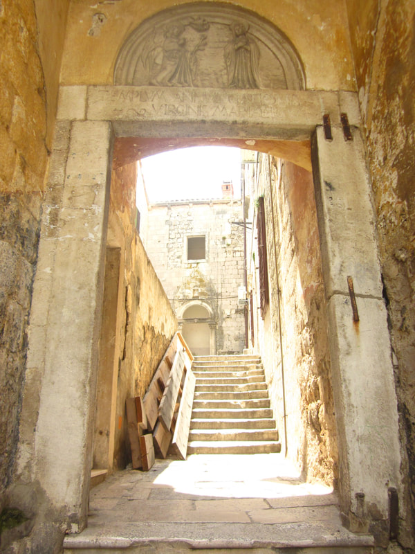
But, simultaneously, the fact that Dubrovnik exists is SO COOL. The Old Town is a UNESCO World Heritage Site and one of the best-preserved medieval walled cities in the world, despite being under siege during the Yugoslav Wars. Tiny pathways wind between stone buildings, and, once the masses of people re-board their cruise ships, you get this incredible feeling of being transported back in time. The architecture is stunning. The coastline is stunning. So, I can't really blame everyone for wanting to come here, dock here, and flood the city with tourists. What I learned from two days in Dubrovnik was that I had planned this part of the trip all wrong. And, I would like a do-over with Dubrovnik. I would do basically everything differently in order to better enjoy this lovely area. 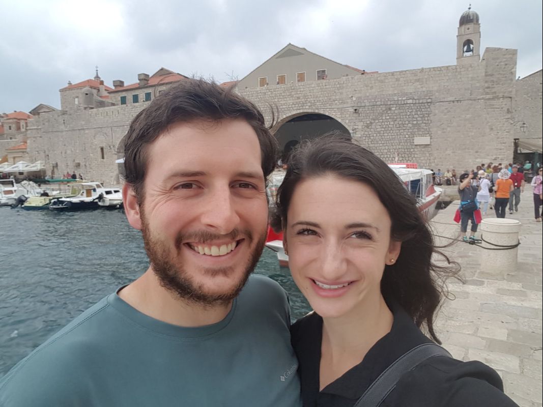 Brett and I outside Old Town, Dubrovnik, Croatia 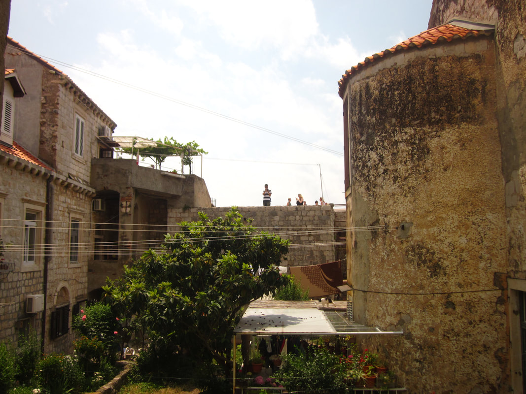 View from our window, Dubrovnik, Croatia 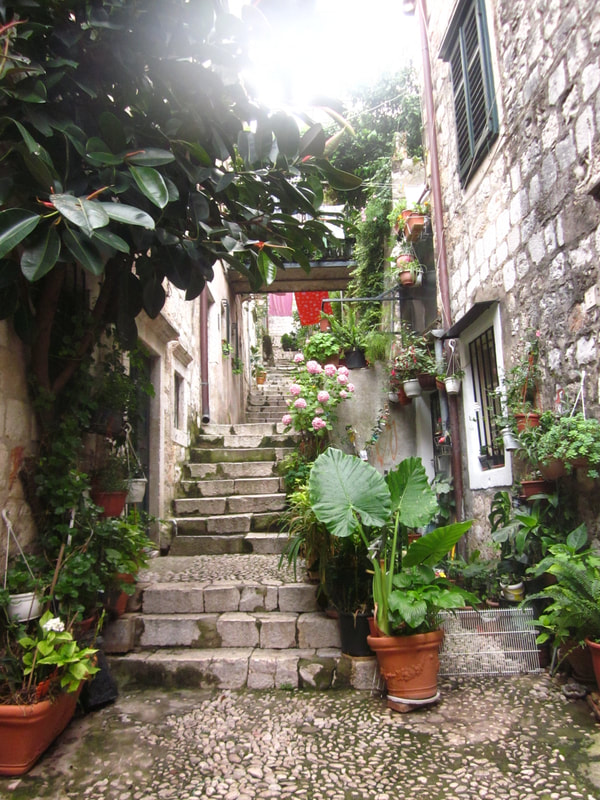 Lovely medieval streets in Old Town, Dubrovnik, Croatia What we did in dubrovnikCroatia was the last stop on our European adventure, and our wallets were feeling thin. We tried to be as cheap as possible and do free or cheap activities. Also, the weather was rainy during our time in Dubrovnik, so a few of our planned activities, like going to the beach or hiking up the mountain weren't possible. Walking the city streets - Always free. The tiny labyrinth of alleyways was fun to explore, and we came across charming houses with flowers spilling out of the windows and worn stone staircases. On the side streets, the crowds thinned out slightly, compared with the packed Stradun, the main path through Old Town. Cafe Buza - I expected this cliffside bar to be more crowded than it was, even though we stopped by mid-afternoon. This bar is situated on the other side of the medieval walls, on the edge of the cliff overlooking the ocean. When I stepped through the hole in the wall to enter Cafe Buza, I was rewarded with views of the ocean, the rocky coastline, the small island of Lokrum, and the outside of the walls. Various staircases lead down to additional seating areas. It was windy but a lovely spot to sit, and it only cost the price of a drink! 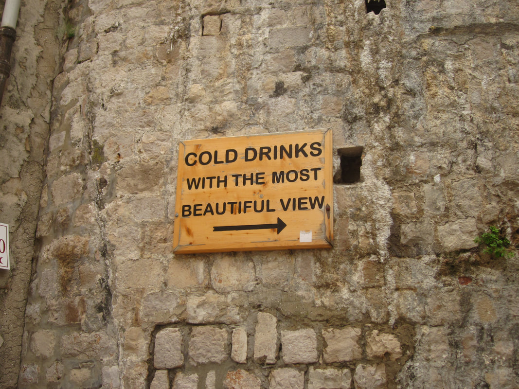 Sign to Cafe Buza, Dubrovnik, Croatia
Dubrovnik Museum Pass - We discovered that Dubrovnik offers a museum pass with admission to a variety of museums and historical houses. Brett and I aren't big on spending a lot of time in museums when we travel. However, I ended up being glad that we got this pass for a few reasons. First, it was rainy during our time in Dubrovnik, so outdoor activities were limited. Second, we were able to buy student tickets for 25 HRK (less than $4). Regular adult museum passes are 100 HRK (around $15). Third, it allowed us to explore some of the beautiful architecture of the Rector's Palace, and we unexpectedly got a view over the city at the Ethnographic Museum.
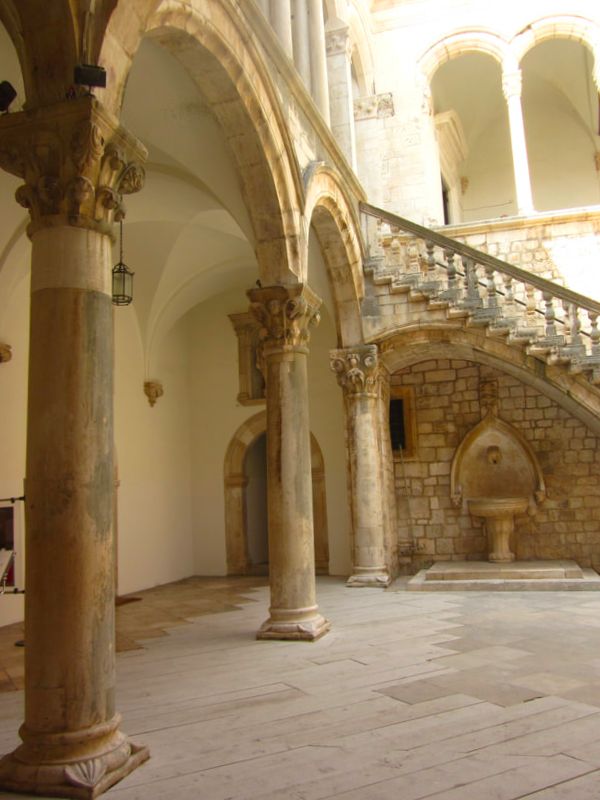 Rector's Palace, Dubrovnik, Croatia 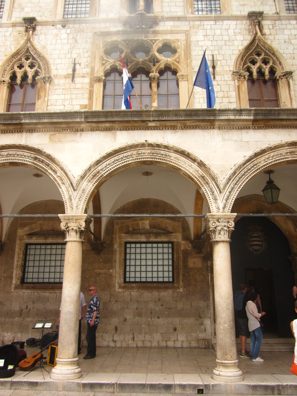 Rector's Palace, Dubrovnik, Croatia  Stunning architecture, Dubrovnik, Croatia War Photo Limited - A photojournalism museum with a permanent exhibit called "The End of Yugoslavia", with images from the break-up of Yugoslavia and the wars in Croatia, Bosnia and Herzegovina, and Kosovo. It also contains rotating photojournalist exhibits. When we visited, there were two rotating exhibits: Under Siege: Dubrovnik, 1991 with images from the bombing of Dubrovnik during the Yugoslav Wars, and The Balkan Route, with images from refugees traveling across Eastern Europe. The admission price is 50 HRK ($7.73) for adults, and I highly recommend this museum for more insight into the recent history of the region. Watching Croatia in Euro Cup - Lucky for us, Croatia's soccer team was playing in the European Cup 2016 while we were there, which gave us an opportunity to sit at a cafe with a bunch of jersey-clad supporters to watch the match. This was exciting because a lot of the cafes with outdoor seating had large screens set up and large groups of people gathered to watch. We were able to take part in the excitement surrounding a big soccer game. Malvasija Wine Bar - Croatia has amazing wine. The country is filled with vineyards to visit and bottles of wine to sample. Without time to spend exploring Croatia's wine country, we found Malvasija Wine Bar in Dubrovnik, a little family-run gem tucked into a side street in Old Town. We spent our last night in Dubrovnik sipping wine and chatting with the friendly family who runs the shop. We let them pick the wines that we tried, since they knew the best varieties. It was a lovely evening and a highlight of our time in Dubrovnik. 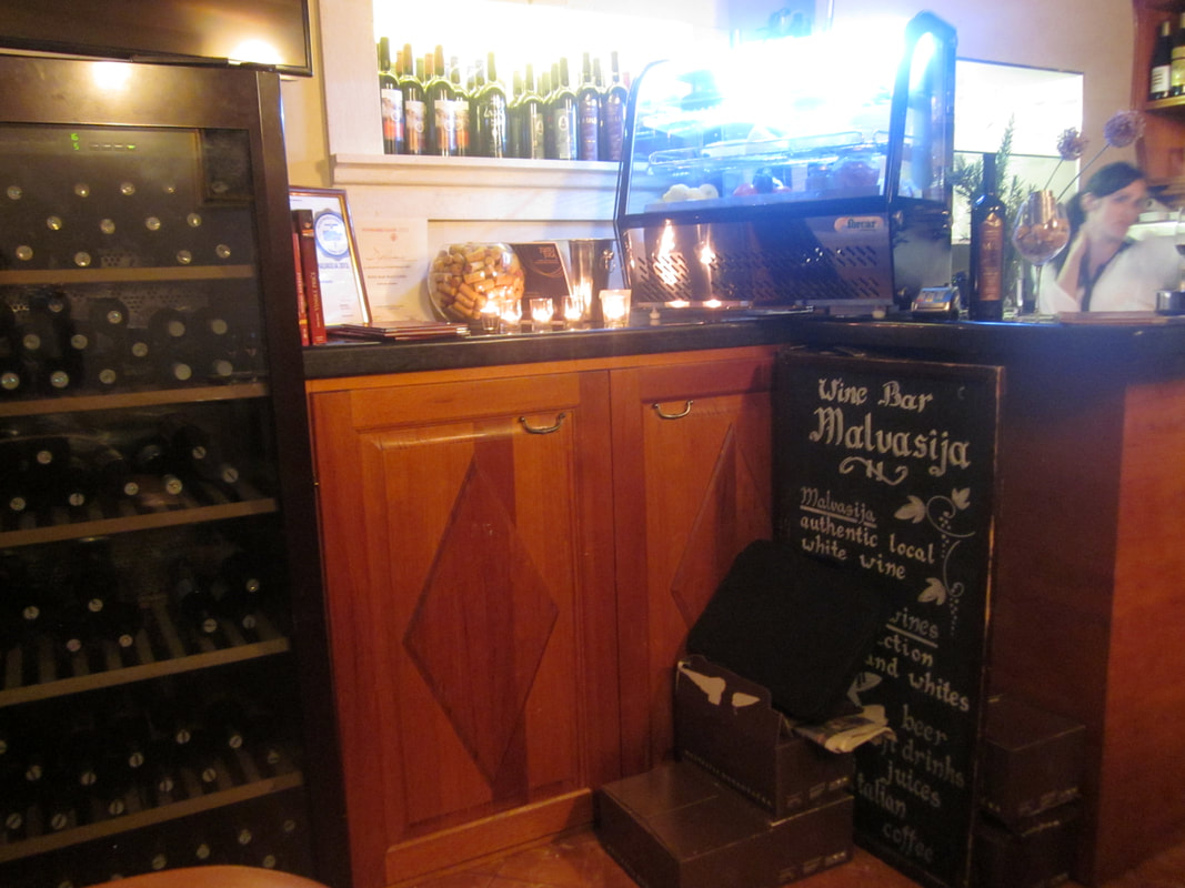 Malvasija Wine Bar, Dubrovnik, Croatia 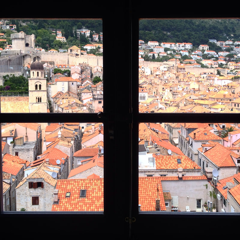 Picture Perfect Views, Dubrovnik, Croatia WHAT I WOULD DO DIFFERENTLYIf I were to return to Croatia tomorrow, I would change a lot of things about my time in Dubrovnik. First, I would not book accommodation in Old Town Dubrovnik. Prior to visiting, I felt like I had to stay in Old Town, in order to be close to the "cool" things. This backfired when we were stuck with overpriced, touristy restaurant options for every meal and had tourists looking into our window from the medieval city walls. The Airbnb was very nice and clean, but I would prefer to book accommodation outside the city walls or even in a nearby, smaller town. This would allow us to take advantage of cheaper lodging prices, relax and enjoy the beautiful seaside location away from crowds, spend less money on subpar food, and still head into Dubrovnik if we wanted to. Second, I would try to limit my time within the Old Town walls to early morning or the evening, when the cruise ships have not yet arrived or have already departed. By doing this, I would minimize my time spent fighting crowds and explore at a more leisurely pace, as well as take pictures without a hundred people in them. Third, I would perhaps spend half a day in the Old Town, but I would want to explore more of the region on a return trip. There is SO much more to do in this region than Dubrovnik's Old Town. We narrowly focused our sights on things inside the city walls, but felt like we had seen a lot of it within a single day. For example, Cavtat, a small, less touristy town only 30 minutes from Dubrovnik, with its own Rector's Palace, beautiful architecture, and beaches. Plus, it's connected to Dubrovnik by public bus. Or what about Montenegro, less than 2 hours from Dubrovnik? It has rugged mountains, sandy beaches, red roofed towns, and its own UNESCO World Heritage Site - the walled city of Kotor. Mostar in Bosnia and Herzegovina is also a daytrip from Dubrovnik. It's a charming little town, with scars from the Yugoslav wars still visible, a well-photographed bridge, and an old bazaar for shopping. I could spend a day exploring vineyards of the region, either independently or with an organized wine tour. The options seem endless, varied, and exciting. 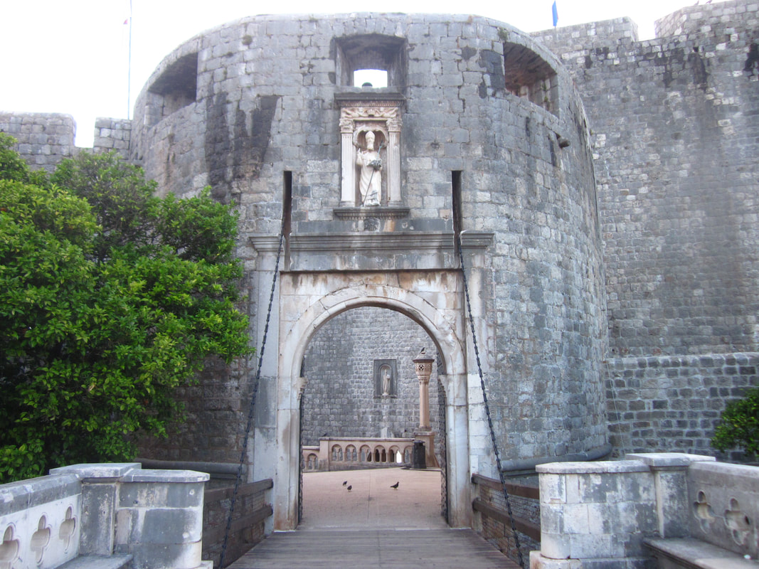 Entrance to Old Town, Dubrovnik, Croatia I expected to fall in love with Dubrovnik. There's a lot to love, but its growing popularity as a tourist destination rubbed me the wrong way. It's a shame that we ended up eager to leave Dubrovnik pretty quickly. We were not prepared for how expensive it would be or how crowded. But, it was also such a lovely piece of the past, with the medieval passageways and stone buildings. In hindsight, I realized that I didn't dislike Dubrovnik. I just didn't do Dubrovnik correctly. I hope that I get the opportunity to give it, and the surrounding area, another chance.
This is a continuation of my series on the Annapurna Circuit Trek, which we trekked in late November. Check out our itinerary here.  Waking up on Day 10, it was disconcerting to realize that we were done trekking. We had decided to stop at Muktinath due to time constraints, but we still needed to get back to Pokhara for our Yeti Airlines flight to Kathmandu. Initially, our group thought, "There's no way it will take us two full days to get back to Pokhara." We hadn't yet discovered how travel works in rural Nepal. 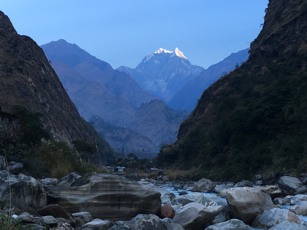 Around 11:00am, we walked to the Jeep stand in Muktinath. There were groups of other trekkers there, negotiating prices for a jeep to Jomsom. It was a first-come, first-served situation. Whoever put together enough people to fill a jeep got the next one. We joined several groups and solo trekkers to fill a jeep. They told us they were stopping in Tatopani for the night to enjoy the hot springs and invited us to join them. In the spirit of adventure, we agreed. We started with a jeep from Muktinath to Jomsom. Jomsom is the biggest town on the other side of Thorong La Pass. It even has a small airport with flights to Pokhara. We knew some trekkers who opted to fly back. When we arrived in Jomsom, no jeeps were available because all the drivers were at lunch. So we had to wait in the dusty, windy town of Jomsom. Eventually, we crammed into a jeep to Tatopani and set off along the one-lane, winding mountain roads. The jeep ride was incredibly bumpy, particularly when we went off-roading onto the dry riverbed, bouncing over massive rocks. The scenery on this side of the pass was no less magnificent than during the first part of our trek. We were treated to views of Annapurna I and a vibrantly blue river. Because we started the jeep ride after lunch, we were still bouncing along when the sun set. I found it disconcerting to be on the curvy mountain roads after dark, with a sheer cliff on one side of us. Also, apparently it is common for drivers to make seemingly random stops, to talk to people along the side of the road, pick up sacks of things, or exchange money. This happened consistently along the way, making us think "What is going on?", but since we could not understand their conversations, we had to go along with it. It was dark, and we were hungry, when the jeep dropped us off in Tatopani. The whole group from the jeep set off to find a hotel. One girl went barreling through town, demanding cheaper rates and storming out when owners refused. Eventually, we separated from her and her friends, since they were passing up perfectly decent guesthouses, and we didn't mind paying $3 for a room. By the time we finished dinner, I didn't want to try to find the hot springs in the dark. After being bounced around all day, I really just wanted to climb in bed. So I did. 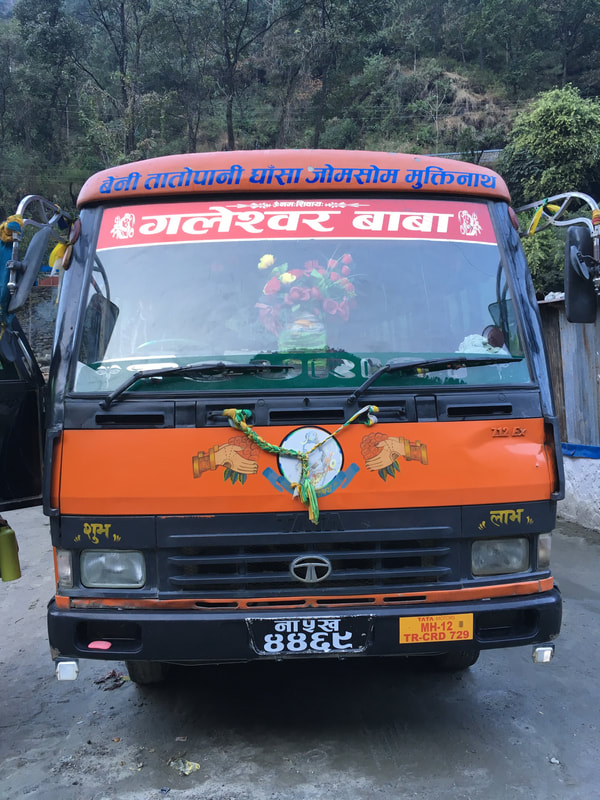 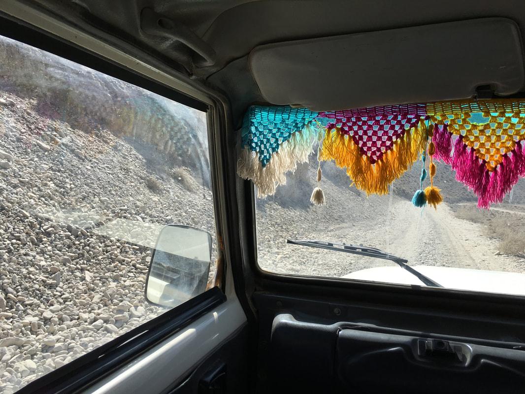  In the morning (Day 11), we ate breakfast with our traveling companions in a beautiful courtyard surrounded by trees before walking to the bus stop. We didn't have any idea what time the local bus to Pokhara would arrive or depart, but we figured that we should arrive early and wait. When the bus arrived, the driver loaded our bags on top of the bus, and we set off. We stopped at a checkpoint to get our permits stamped for exiting the Annapurna Conservation Area. Then, a few hundred feet down the road, we stopped again. The driver got out, started talking with a family at a roadside ship, ordered some tea, leaned on the wall and stared at the bus, and we thought, "What is going on?" There was no announcement, as there had been on our bus from Pokhara to the Annapurna Circuit, that we were taking a bathroom break. Eventually, another bus pulled up alongside ours, and the driver announced that we had to move to the other bus. We all piled out and then on to the next bus....to find that it was almost full of Nepalese people who had spread out packages, backpacks, and suitcases across the seats, refusing to move the packages to allow us to sit down. We realized that the original driver had held us there on another bus in order to let the locals save all the seats. However, we had paid our fare for seats, so we were not getting off the bus. I ultimately got a seat by moving a backpack, and some of the male trekkers stood in order to let older passengers sit. Some trekkers ended up in arguments with locals, who told them there was no room on the bus. However, the bus driver had collected our money, so the trekkers insisted they had paid the fare and that they were riding the bus. The bumpy, one-lane mountain roads caused the bus to tip wildly, and us to fly out of our seats on some bumps. The Nepalese man in front of me began throwing up out the window. It was an incredibly uncomfortable bus ride that lasted for about 4.5 hours. 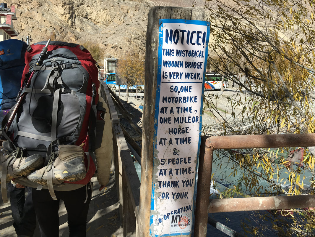  The local bus dropped us in Beni, where we had to find yet another jeep for the last leg to Pokhara. There wasn't really an option for lunch, so we just had to eat remnants from our packs and wait until Pokhara. The final jeep ride took place on roads rather than stream beds and mountain ledges, meaning it was a bit smoother than our previous jeep and bus rides. However, knowing it was the last leg before Pokhara made the time crawl by. We finally arrived in Pokhara in the late afternoon. Getting from Muktinath to Pokhara took our group 2 days, 3 separate jeep rides, 1 local bus, and a LOT of negotiating.  This is a continuation of my series on the Annapurna Circuit Trek, which we trekked in late November. Check out our itinerary here.  Sunrise, Annapurna Circuit, Nepal When my phone alarm went off at 3:45am, I had a difficult time getting out of my sleeping bag because the temperature was extremely cold and it was extremely early. I peeled myself out of my sleeping bag and began putting on layer after layer clothing, in order to keep warm while crossing Thorong La Pass. I was wearing nearly every piece of clothing I had packed - thick socks, two pairs of leggings, hiking pants over the leggings, gaiters, tank top, long-sleeved shirt, fleece, down jacket, rain coat, buff, warm hat, thin gloves, ski gloves over the top. When we had dressed most of the way, we headed to the dining room to eat breakfast, sitting with some of our trail friends and discussing the day ahead. Group after group trickled out of the dining room, so we decided we should hit the trail as well. As we gathered our packs, we saw a line of headlamps coming up from Thorong Phedi and passing through High Camp. These were the people who had slept at the lower camp and completed the steep uphill to High Camp that morning. Once again, I was grateful to have stayed at High Camp the night before. Everyone starts before sunrise because it is a long day of trekking and the winds at the pass pick up around 10:00am, meaning that hikers want to be across the pass well before 10:00am. The estimated time from High Camp to Thorong La Pass was 3 hours of hiking, so that means an early start is essential. Overnight, water had frozen in the barrel where you could fill up your water bottle. This meant we were unable to top off our water bottles before setting off toward Thorong La Pass. We left the water barrel and headed for the trail...except, in the dark, it was impossible to orient myself. Even with my headlamp, I couldn't tell where the trail up to the pass began, and most of the groups had departed ahead of us. I think this is important to mention because it hadn't even occurred to me that I would have trouble finding the route in the dark. Luckily, with the headlamps of other trekkers, we were able to find the trail and began the journey up to Thorong La Pass. Day 9 of the Annapurna Circuit was a long, grueling, and emotional day, but it was also incredibly rewarding to cross the Thorong La Pass, which we had been climbing toward for eight days! 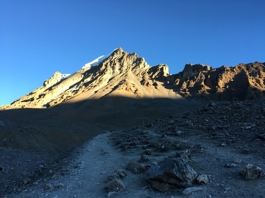 Landscape on the way to Thorong La Pass, Annapurna Circuit, Nepal 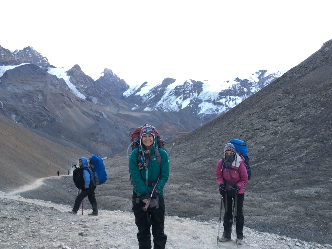 Ciara and I heading up to Thorong La Pass, Annapurna Circuit, Nepal During the first section, we hiked completely in the dark with only our headlamps lighting the way. Slowly, the sky took on a rosy tint behind the mountain peaks, and the landscape began to lighten as the sun rose. The scenery looked remarkable in the glow of the sunrise. The air was cold, and I felt it in my hands, even with ski gloves. Breathing was difficult due to the altitude and - though I didn't realize it at the time - a cold that I had developed along the Circuit. The icy air irritated my lungs with every breath and caused coughing fits, so I pulled my buff over my nose and mouth. It was a little suffocating but protected me from the cold air and eased my breathing. For the most part, the trail was less steep than the hike between Thorong Phedi and High Camp. However, this doesn't mean that the hike was easy. Because breathing was extra hard for me, I lagged behind our group a bit and had to stop frequently to cough. Time became a fluid concept because I was so concerned with the effort of breathing, moving uphill, and staying warm. The morning seemed to simultaneously fly by and drag on. It seemed as though there would never be a moment when I wasn't trudging uphill. Luckily, I realized that I needed to enjoy the moment and paused to take in my surroundings, not caring about anyone else's pace. The surrounding peaks with the sun rising behind them were awesome. I hadn't ever started a trek before dawn, so seeing the sun rise in the mountains was a special treat. The nearby mountains were beautiful with the contrast between dark rock and white snow drifts. And, despite the effort, I was grateful that I was in Nepal. As I admired the scenery and gave myself a pep talk, I heard Rachel and Ciara shouting down to me, "THAT'S THE PASS!" My first thought was, 'No way. I will be hiking forever before I get to the pass.' But, I looked up, and there were prayer flags waving just above the spot where my friends were standing. I was SO CLOSE to the top. 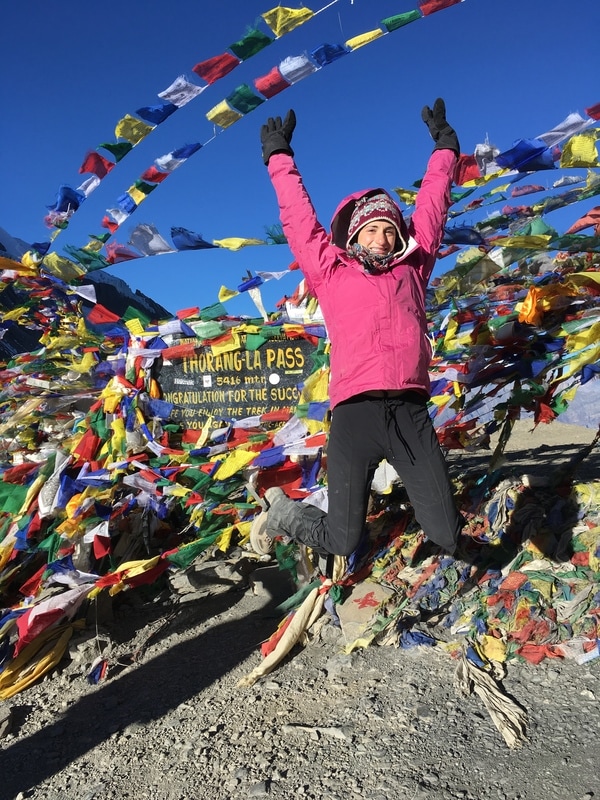 At the top of Thorong La Pass, Annapurna Circuit, Nepal 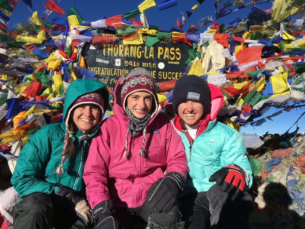 Trekking group on top of Thorong La, Annapurna Circuit, Nepal Together, we hiked the last few meters to Thorong La Pass, where I saw the sign draped with strings of prayer flags. A little teahouse stood by the side of the path, and cold trekkers huddled near the entrance for warmth.
After working so hard to reach the pass, our group took a lot of pictures by the sign and the prayer flags, commemorating our achievement. I also strung prayer flags that I had bought in Manang, took a moment to say a prayer, and watched the flags flutter in the wind, carrying my intention out into the world. Thorong La Pass was cold and windy. I had to step in the teahouse for a minute, just to get out of the wind, which cut through my layers and chilled me quickly. Around us, mountains were capped with snow, but we did not encounter any snow or ice on the pass itself. We were told that this was unusual for late November and that it was an unseasonably warm year. I didn't end up needing the gaiters for snow protection, but they did act as leg warmers, helping to shield the wind a bit. I was glad that I had worn all my layers. Even wearing all our warmest clothes, we were ready to head down after about 20 minutes. 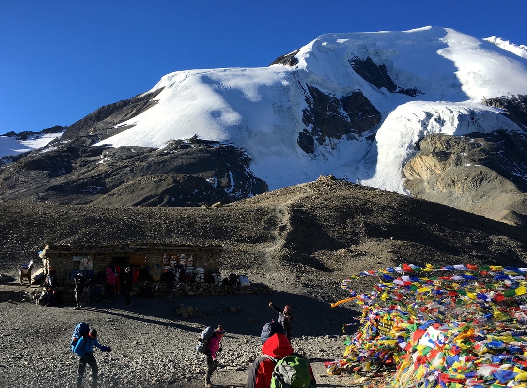 Thorong La Pass Teahouse, Annapurna Circuit, Nepal 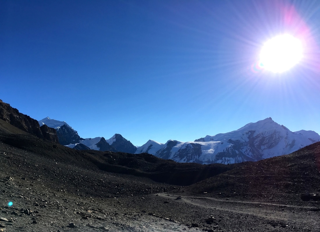 View from Thorong La Pass, Annapurna Circuit, Nepal The trusty "Altitude Trekking Time" sign from earlier in the trek had estimated 3 hours from High Camp to Thorong La Pass, and we had reached the pass in 2.5 hours. I felt so proud of myself, and it was literally all downhill from there. From Thorong La Pass, we headed down to Muktinath, descending 1600 meters (5249 feet) in 4 hours. The descent was very hard on my knees, calves, and toes, but I was able to move a lot faster than the uphill portion of the day. As we descended, the temperature increased, a result of decreasing altitude, moving out of the wind at the top of the pass, and the sun rising higher in the sky. We began shedding layers. Eventually, I was down to one pair of leggings and a long sleeved shirt, removing my rain coat, down jacket, fleece, extra long sleeved shirt, gaiters, hiking pants, extra pair of leggings, gloves, and hat. On the other side of the Thorong La Pass, we entered the Mustang region of Nepal, a region with an interesting history and landscape. The Annapurna Circuit cuts through Lower Mustang, whereas Upper Mustang was restricted to visitors until recently, meaning it is a remote and isolated region. Due to this isolation, Upper Mustang area is one of the most well-preserved regions of Tibetan culture and traditional Tibetan languages in the world. Even today, though visitors are allowed, they cannot enter Upper Mustang without a special permit and guide. We did not need any special permits to trek through Lower Mustang on the Annapurna Circuit. Visually, Lower Mustang was very different than the part of the Circuit that we had already completed. Almost immediately, I noted the very dry, brown, rocky, desert-like landscape. To me, it looked almost otherworldly. In the distance, we could see the tops of more snow-capped mountains, including Dhaulagiri, an 8000 meter peak and the seventh highest mountain in the world. 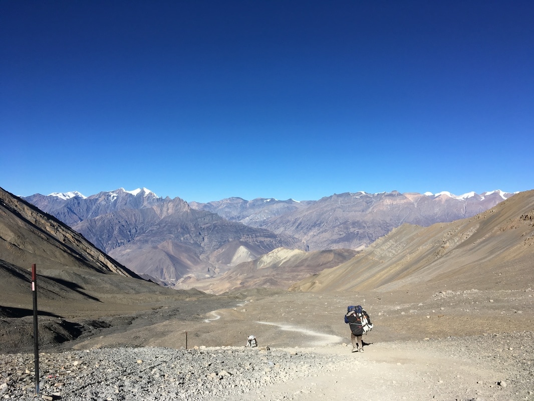 Headed down to Muktinath, Annapurna Circuit, Nepal 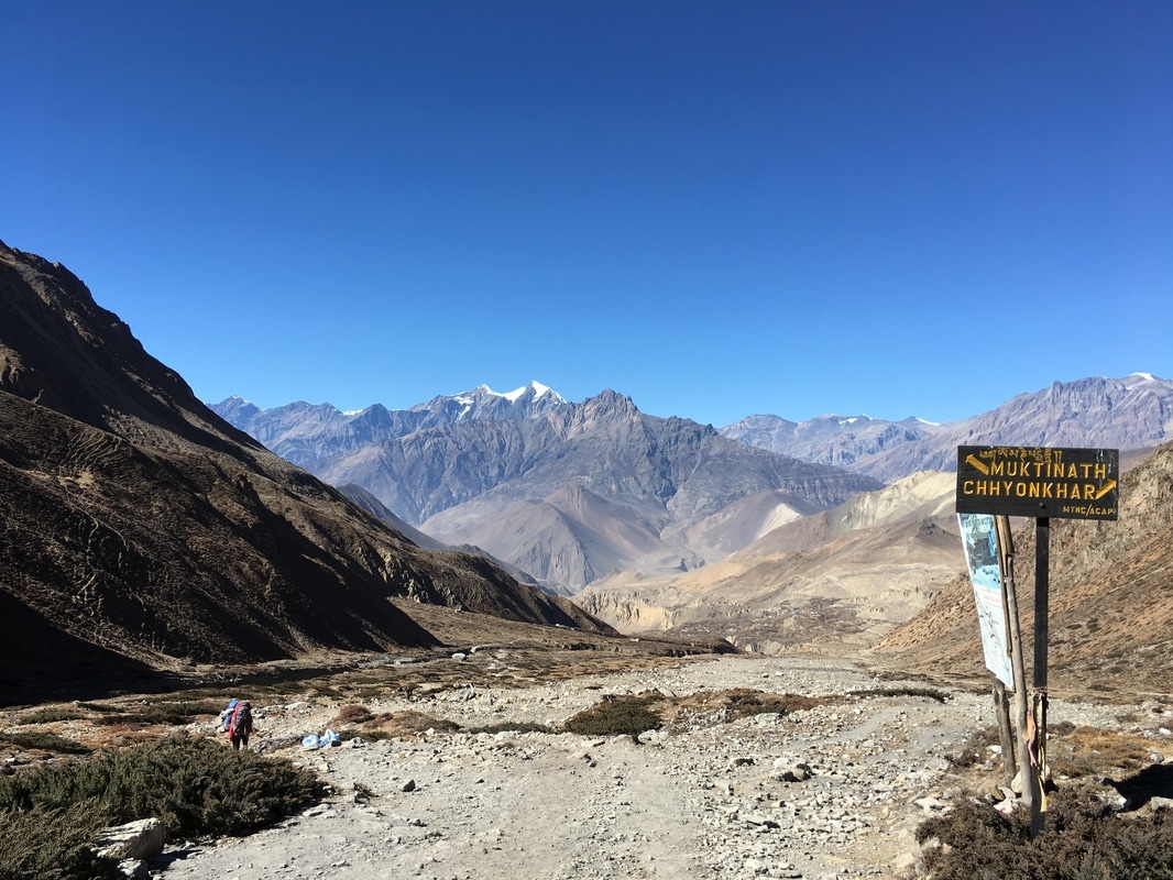 Trail toward Muktinath, Annapurna Circuit, Nepal 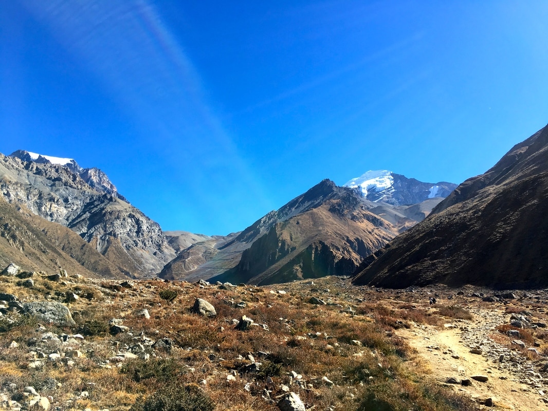 Scenery going downhill, Annapurna Circuit, Nepal There is one tiny town between Thorong La Pass and Muktinath, called Charabu. We stopped briefly to buy water and a snack, resting for a short while before continuing to Muktinath. Muktinath is a sacred place for both Hindus and Buddhists, a popular pilgrimage site for many worshippers. Just outside the town is a huge temple complex. We passed it on the way into town. Even though Muktinath sits at 3800 m (12,467 ft) in altitude, the air felt so much thicker compared with the Thorong La Pass. Because of the early morning start, we arrived around lunchtime, though we were tired from almost 7 hours of trekking. We picked a hostel in Muktinath, dropped our packs in the room, and headed up to the rooftop patio, where we ordered lunch and rested our sore bodies in the sunshine. From the rooftop, we could see the surrounding mountains. Our group spent the afternoon reading, eating, exchanging photos, and messaging our families using the wifi at the teahouse. Though many teahouses along the Circuit offer wifi, the teahouses at higher altitude either required payment for wifi or did not offer it at all, so we had been unreachable since Manang. I took a shower in the solar powered shower while the afternoon sun was still strong, and the hot water felt glorious after the tough day. At night, sitting in the dining room by the fire, I felt a sense of accomplishment. I had been nervous about the altitude and difficulty of crossing the Thorong La Pass. I was tired, but I had made it! 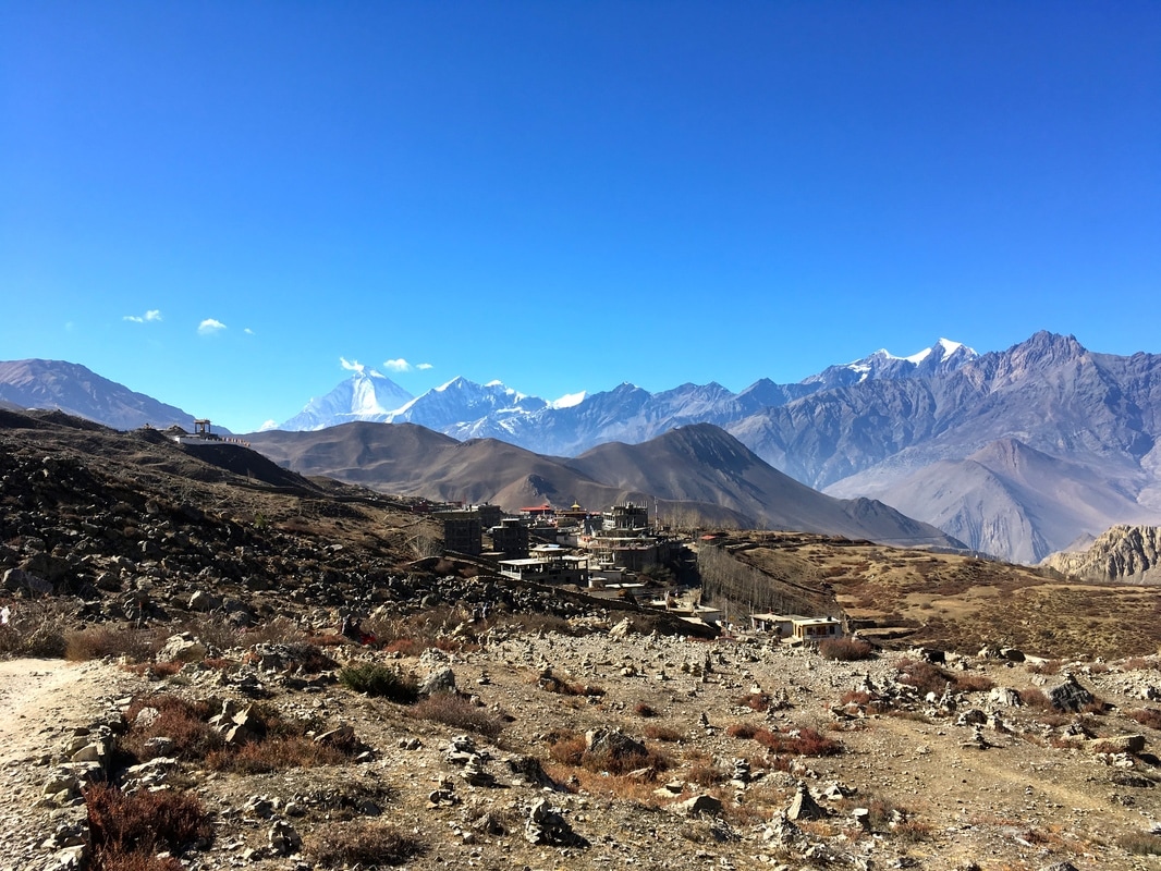 Views of Muktinath with Dhaulagiri in the background, Annapurna Circuit, Nepal 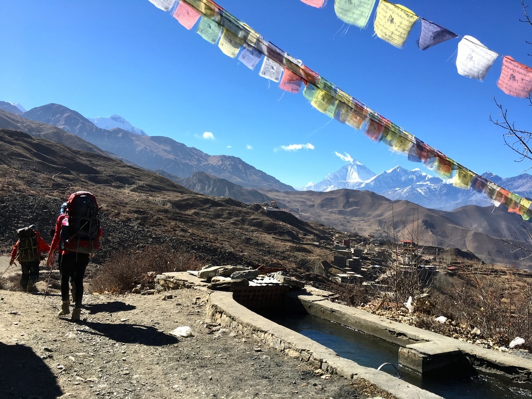 Trekking to Muktinath with Dhaulagiri in the background, Annapurna Circuit, Nepal 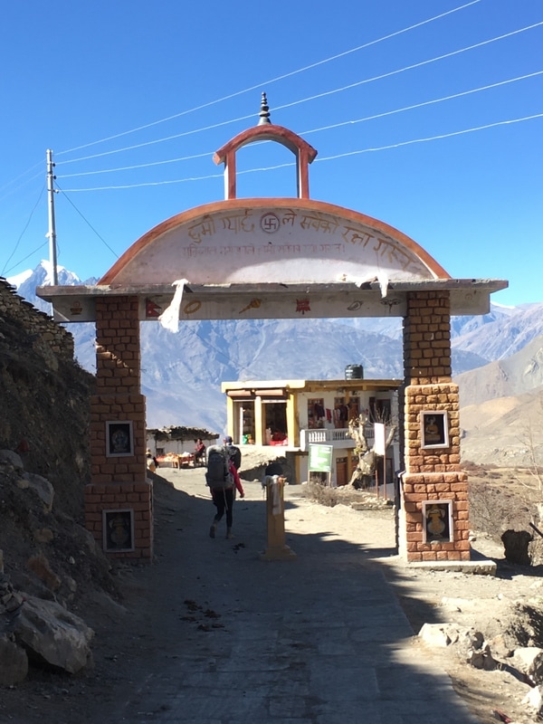 Entrance gate to Muktinath, Annapurna Circuit, Nepal Daily trekking distance: 10 km
Total trekking distance: 108 km Starting elevation (High Camp): 4850m/15,912 ft Highest elevation (Thorong La Pass): 5416m/17,770 ft Ending elevation (Muktinath): 3800m/12,467 ft Costs Room with attached bathroom + food (lunch, dinner, breakfast) Muktinath: 1480 NPR ($14.34) Safe Drinking Water Station: 40 NPR ($0.39) 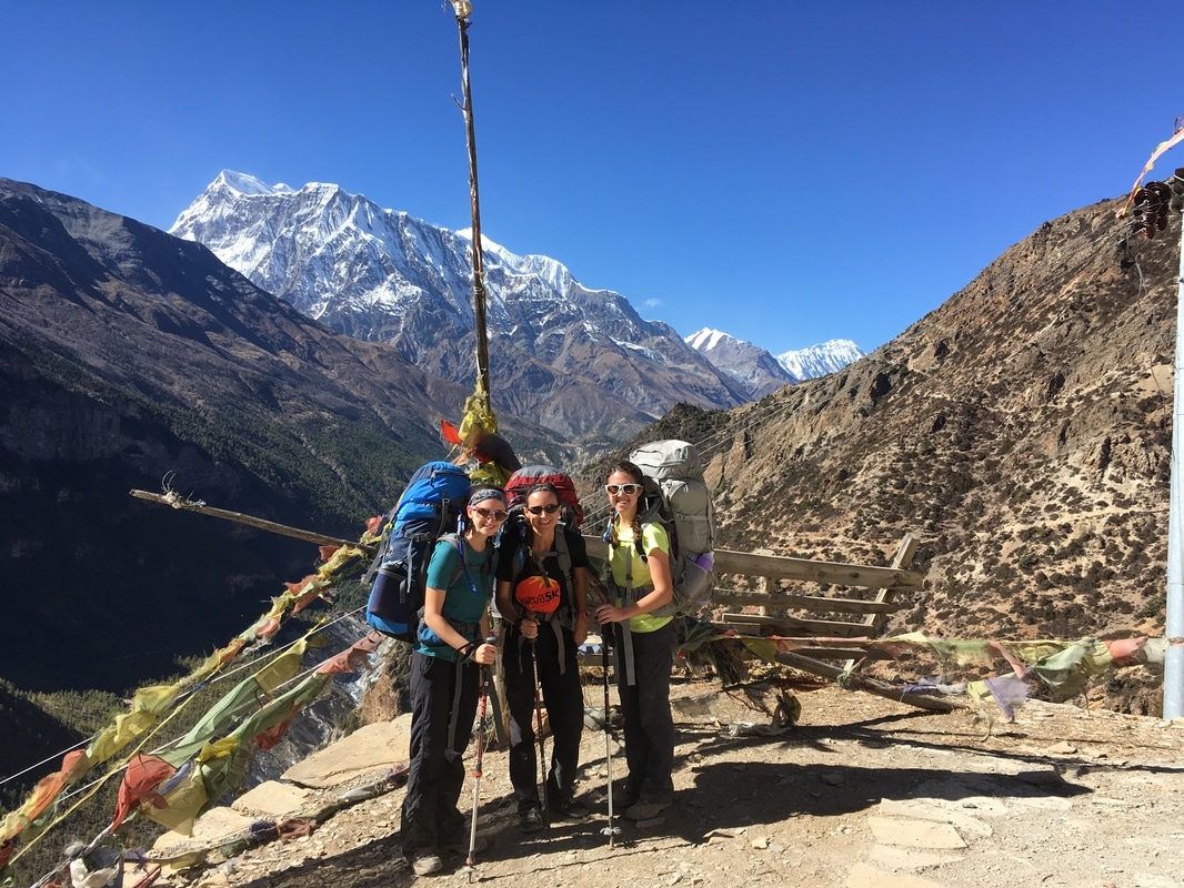 When planning our Annapurna Circuit trek, I pieced together information from the internet and got a pretty good idea of what to pack and what the route would be like. However, my friends and I found ourselves frequently starting sentences with "I wish I had known..." So, here is a list of 15 things that we discovered along the way: 1. You need passport photos for the trekking permits. I had read this online. What I didn't know was that there were abundant places to take passport photos near and in the permit office. My friend, Rachel, realized she needed more passport photos, and she was able to take them in the permit office for super cheap. I paid $45 at Walgreens. 2. There is a stand with coffee and pastries at the tourist bus stop. Take the earliest bus out of Pokhara and grab breakfast at the bus stop. With the 6:30am bus, we arrived in Besisahar around 11:00am, took a jeep a few towns further, and had the whole afternoon to start our trek. 3. If you're short on time, a jeep is worth it, and there are always other trekkers who will want to split the cost. 4. You can buy things along the way. I don't think I truly believed people who said this online, but I was able to buy cookies, Snickers bars, hand sanitizer, and pads in towns along the trail (Chame and Manang). I even bought a warmer hat. Shops in Pokhara and Kathmandu sell knock-off gear, including down jackets and sleeping bags, for cheap prices. 5. Don't stop at the first teahouse in each town. Keep walking. There is a good chance the nicer ones are further on.  6. Pay for everything at the teahouses when you leave in the morning. They keep a running total. Early on in the trek, I paid for my shower on the spot, and the teahouse owner tried to charge me again the next morning. I truly believe this was an honest mistake on his part - I threw him off by paying only part of my bill the previous night. 7. You will sweat a lot the first few days at lower altitudes. I was so worried about being cold later in the trek that I hadn't considered being too warm at the beginning. I was grateful that I had brought a clean set of clothes for sleeping at night so that I could escape my sweaty trekking clothes at the end of the day. 8. Sometimes, the teahouses will give you extra helpings of your meal for free. This was not the case with all menu items (like momos), but we frequently got more servings of dal bhat and curry with rice. 9. Some teahouses are willing to barter on the room cost, since food is where they make the majority of their money. Many offered a free room if we agreed to eat dinner and breakfast at their teahouse. 10. The domestic and international terminals at the Kathmandu airport are not connected. If you have a domestic flight, you have to fully exit the international terminal and walk down the road to get to the domestic building, as we learned for our flight from Kathmandu to Pokhara. We had to ask for help from a really nice taxi driver. 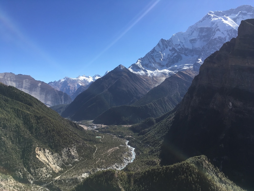 11. Buy Diamox in Pokhara or Kathmandu. In the US, you need a prescription for this medication. In Nepal, it is readily available at pharmacies without a prescription. I took Diamox above 10,000 ft to help with acclimatization. 12. Wear a buff. It is very dusty along the road as well as above treeline when its windy. Protect your lungs from all the dust being kicked up. I started using my buff later in the trip, after I had already developed a cough. 13. Do the Upper Pisang Trail! It's very challenging but unbelievably scenic and helps with acclimatization, since you climb high then sleep low at Manang. It also made the walk to High Camp and over the pass a little more bearable because we already had pushed our bodies on the steep Upper Pisang Trail. Read about our day on the Upper Pisang Trail here. 14. You can use European or American chargers almost everywhere. Prior to the trip, I had unsuccessfully scoured the internet to find out whether I needed additional power adapters to charge electronics. Ultimately, I packed my universal adapter and was totally fine. Also, electronics like iPhones and Kindles - the only two electronics I brought - don't need voltage converters, just the adapter to fit the plug into the socket. 15. Nepal will steal your heart with its breathtaking scenery, fluttering prayer flags, and kind people. You will be longing to go back again. 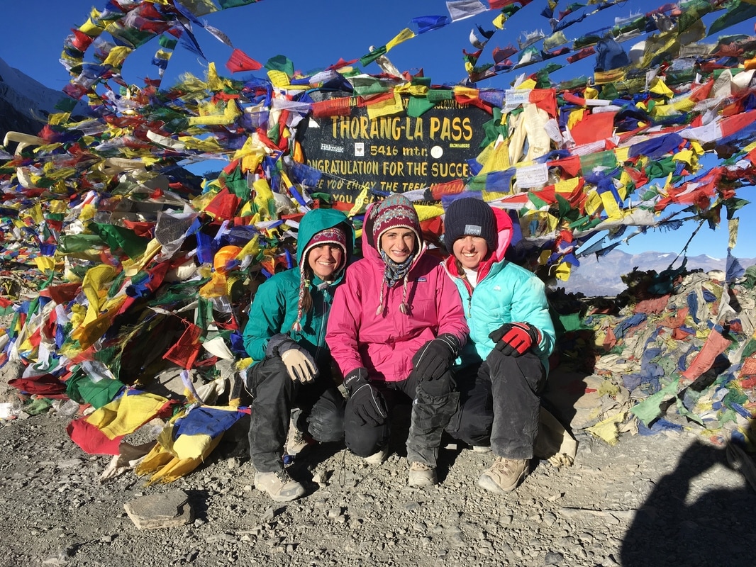 This is a continuation of my series on the Annapurna Circuit Trek, which we trekked in late November. Check out our itinerary here. 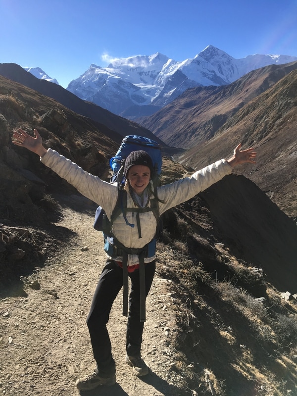 The day before THE DAY. On Day 8, we trekked to High Camp, in preparation for crossing the Thorong-La Pass the following day. I cannot lie - I was nervous about altitude sickness. I didn't want to be the person to get sick, have to descend immediately, and ruin everyone's trek. And I really did not want cerebral edema or pulmonary edema. To counteract this fear, I was in a perpetual state of what we called "water panic". I had read that staying well hydrated helps with acclimatization, and we had also heard that locals recommend garlic soup for acclimatization. So, I downed at least three or four 2-liter bladders full of water each day, plus multiple cups of tea at the teahouses each morning and night, plus bowls of garlic soup at dinner. Plus, I took Diamox, medicine known to aid acclimatization (as well as treating glaucoma). Hey, it may have been a bit much, but I didn't feel even a hint of altitude sickness throughout the trip. 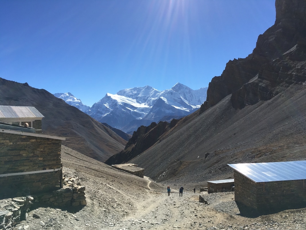 Most of our fellow trekkers from Letdar were also headed for High Camp that day. Some people choose to sleep at Thorong Phedi, completing the steep slog from Thorong Phedi to High Camp and over the pass in the morning. I was glad we slept at High Camp, since I didn't have to do the section between Thorong Phedi and High Camp at 4:00am with a headlamp. Pass day is long and tiring enough, so, if you can sleep at High Camp, it helps to shorten the day a bit. We had read in the NATT Trekking Guide that we would be walking through a landslide area between Letdar and Thorong Phedi. This made me nervous, but we were lucky enough not to see any falling or sliding rock as we trekked. We rested at Thorong Phedi, where fellow trekkers enjoyed coffee and pastries. After a quick granola bar, we continued up, wanting to reach High Camp as soon as possible. We had read that High Camp can fill up in the high season and that overflow trekkers have to sleep in the dining room. Though we were on the tail end of high season, we didn't want to risk it. The route up to High Camp was tough. I kept thinking, "Man, I'm glad we did the Upper Pisang Trail", since this climb also had a steep incline with a number of switchbacks and required numerous breaks to catch my breath. We gained 400 meters of elevation (1312 ft) in 1 kilometer (0.62 miles) of hiking. Slowly but surely, I made it, in plenty of time to get a room. 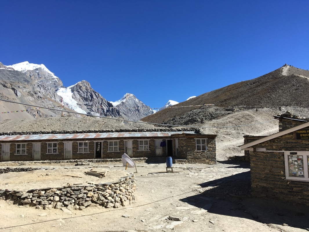 We arrived at High Camp just before lunchtime, with all afternoon to relax, eat, and socialize with our fellow trekkers. It was such a great afternoon and evening. Everyone that stays at High Camp gathers in the same dining room, so we saw all of our trail friends. We exchanged stories, shared food and hot tea, and described our lives back home to each other, as sunlight streamed in the windows. Since there is only one lodge at High Camp, they have a monopoly on food, drink, and lodging, meaning that prices are considerably higher than the rest of the trail. When darkness fell, we all migrated to the adjacent room, which housed the fireplace, and crammed our bodies into the tiny space to be as close to the heat as possible. The temperature at High Camp plummeted when the sun went down, freezing the water in the water barrel and creating icy patches on the ground by the bathrooms. Before going to bed, we all asked each other, "When are you getting up? When are you having breakfast? When are you leaving for the pass?" Daily trekking distance: 7 km
Total trekking distance: 98 km Starting elevation (Letdar): 4200m/13,780 ft Ending elevation (High Camp): 4850m/15,912 ft Costs Room + food (lunch, tea, snacks, dinner, breakfast) High Camp: 2220 NPR ($21.53) This is a continuation of my series on the Annapurna Circuit Trek, which we trekked in late November. Check out our itinerary here. 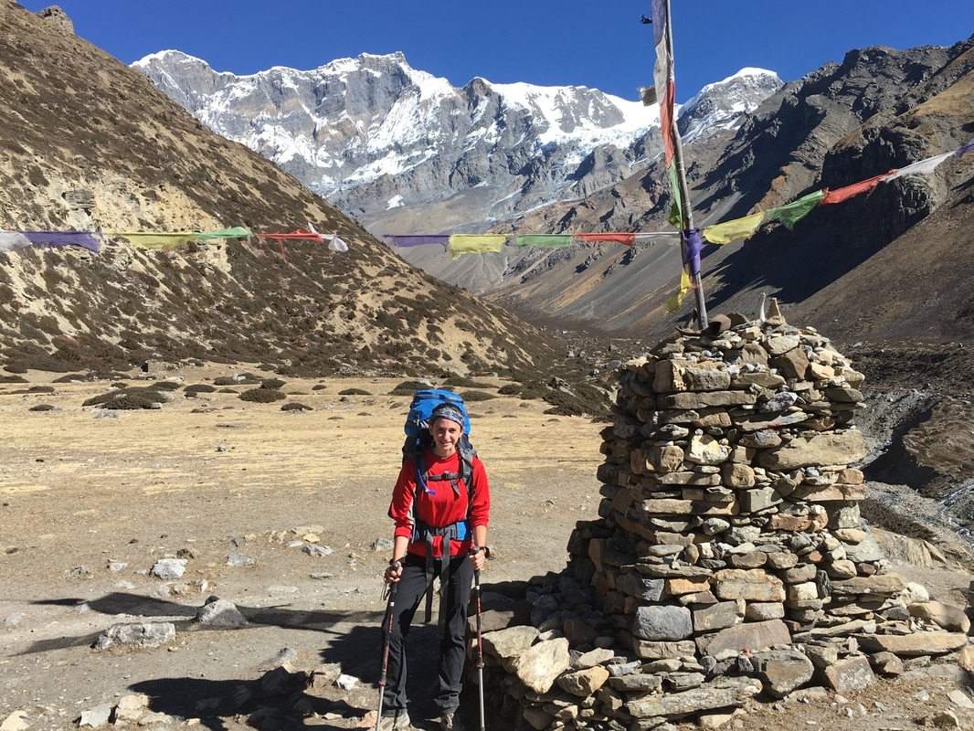 Posing with the scenery, Annapurna Circuit, Nepal Sufficiently rested after a full day in Manang, we set off again on Day 7, headed for Letdar. The landscape was a stark contrast to the first few days of trekking. We were above treeline in the alpine zone, a barren world of rocky slopes, broken up only by low shrubby plants. Still towering above us were snow-covered peaks. I had never been at an elevation this high, so the scenery was completely new to me. The hiking on Day 7 passed quickly. We had to complete shorter distances now, so that we did not gain altitude too quickly. Initially, I was breathing hard due to the altitude, but I felt stronger than at the beginning of the trek. I could tell that I was building my endurance and acclimatizing well. I was sure that we were moving slowly, but our group actually hiked faster than the estimated trekking times. 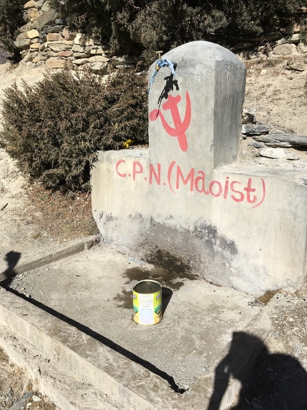 Communist Party of Nepal (Maoist) graffiti, Annapurna Circuit, Nepal Our group took our time leaving Manang, since the day's hike was shorter than usual. We mailed postcards to family and friends on the way out of town. I wrote in my journal that "people will probably get them weeks after we return", which was a bit of an underestimation. Our postcards arrived in the United States four months later! The good weather and sunshine continued on our route to Letdar, and we were able to hike without hats or jackets though it was late November. As a note, we were told that we trekked the Annapurna Circuit during an unseasonably warm year, so the best course of action is to plan for layers, just in case. When we stopped moving, we typically had to pull out our down jackets. Along the trail, we passed some Maoist graffiti. C.P.N. stands for the Communist Party of Nepal, which briefly became the ruling party of Nepal after the Civil War. We saw similar graffiti in a few places along the trek, so it seems that Maoist support continues in these areas. Also, as we were promised by a young Nepalese boy, we saw yak above Manang. We were quite excited to see these animals, as they are native to the Himalaya. 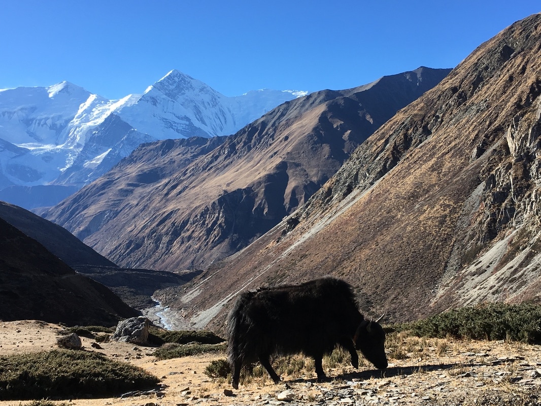 Yak, Annapurna Circuit, Nepal Letdar, pronounced like "letter", cannot really be considered a town. Rather, it is a collection of only a few buildings, and three of these buildings are teahouses for trekkers. Due to the short distance on Day 7, we arrived in the early afternoon, even though we stopped for lunch in the previous town ( Yak Kharka). This gave us plenty of time to relax, order pots of tea, and add to our circle of trekking friends. While Wikitravel says, "Yak Kharka is a small collection of 3 guesthouses and lacking in other amenities, although it is preferable to Letdar which has even less in the way of accommodation", our evening in Letdar was one of my favorites, due to the fun, social atmosphere in the dining room that night. The great thing about the limited lodging options was that the trekkers were more concentrated, so we saw many of our trail friends in the dining room. In my journal, I wrote, "This place is bustling - the first place we've stayed that has a full, busy dining room of trekkers at night." With the amount of people inside and a fire burning in the fireplace, the dining room was a cozy and pleasant place to spend the afternoon and evening. 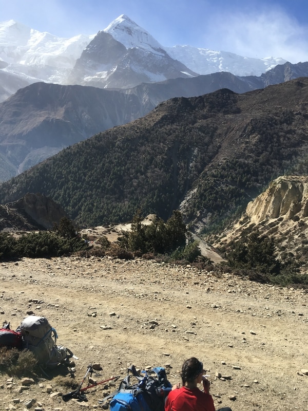 Resting along the trail, Annapurna Circuit, Nepal Daily trekking distance: 10 km
Total trekking distance: 91 km Starting elevation (Manang): 3540m/11,614 ft Ending elevation (Letdar): 4200m/13,780 ft Costs Lunch Yak Kharka: 490 NPR ($4.74) Room + food Letdar: 1085 NPR ($10.50) *The only downside to arriving in Letdar early and spending hours in the fun, social dining room atmosphere is that we ended up spending a lot more on snacks and pots of tea. This is a continuation of my series on the Annapurna Circuit Trek, which we trekked in late November. Check out our itinerary here.  In case we hadn't noticed.... REST DAY! Sitting at the end of the dusty road that follows the Annapurna Circuit, Manang is relatively large compared with some of the other villages. Large, multi-story teahouses line the street and a beautiful mountain, Gangapurna, towers above the town. When trekking the Annapurna Circuit, proper acclimatization is very important, since the Thorong-La Pass sits at 17,770 ft and ascending too quickly can increase the risk of altitude sickness. Every itinerary that I read suggests a rest day in Manang, so that's exactly what we did. 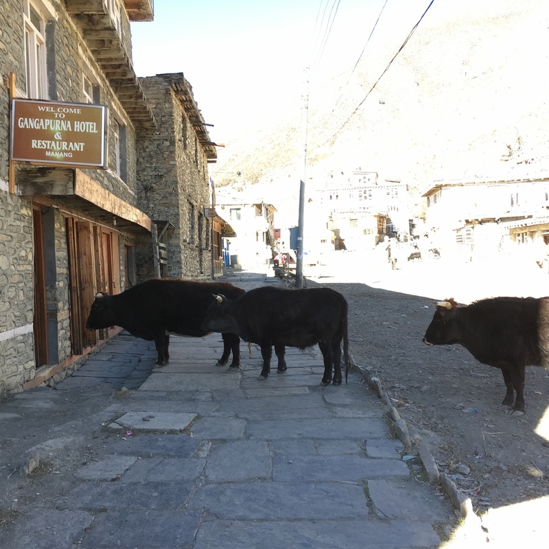 Our "yard yaks" at the Gangapurna Hotel, Manang, Annapurna Circuit, Nepal It was glorious sleeping in, eating a leisurely breakfast, and, most of all, knowing that I didn't have to pick up my backpack at all that day. After breakfast, I eschewed my hiking boots in favor of my soft, comfortable moccasins, grateful to give my feet a break after our tough trekking day on Day 5. We explored some of the small shops and were able to find some needed and wanted items, including hand sanitizer, postcards, and prayer flags. Apparently, Manang is known for its bakeries, so our plan for the day involved finding some pastry and real coffee. We wandered down the road to Sanna Bakery and Coffeehouse, where we ordered coffee, a cinnamon roll, and sat outside in the sunshine. Our intention had been to read and write in our travel journals at the bakery, but we soon became engrossed in conversation with other trekkers. This was one of my favorite parts of the Annapurna Circuit - the sense of community along the trail. We met a lot of trail friends, spent time together in the teahouses, and looked out for each other on Pass day. At the bakery, we met a 63 year old man who has hiked the Annapurna Circuit every year for 20 years. He treks with the same guide each year, now more of a friend than guide. Now, he hires a yak to cross the pass, but still comes back each year because he loves this trek so much. After he departed, a father and daughter sat down at our table. They were in Nepal for a month of trekking, starting with the Manaslu Circuit and continuing through the Annapurna Circuit. From Manang, we followed the same itinerary as this father-daughter duo and enjoyed getting to know them better along the trail. 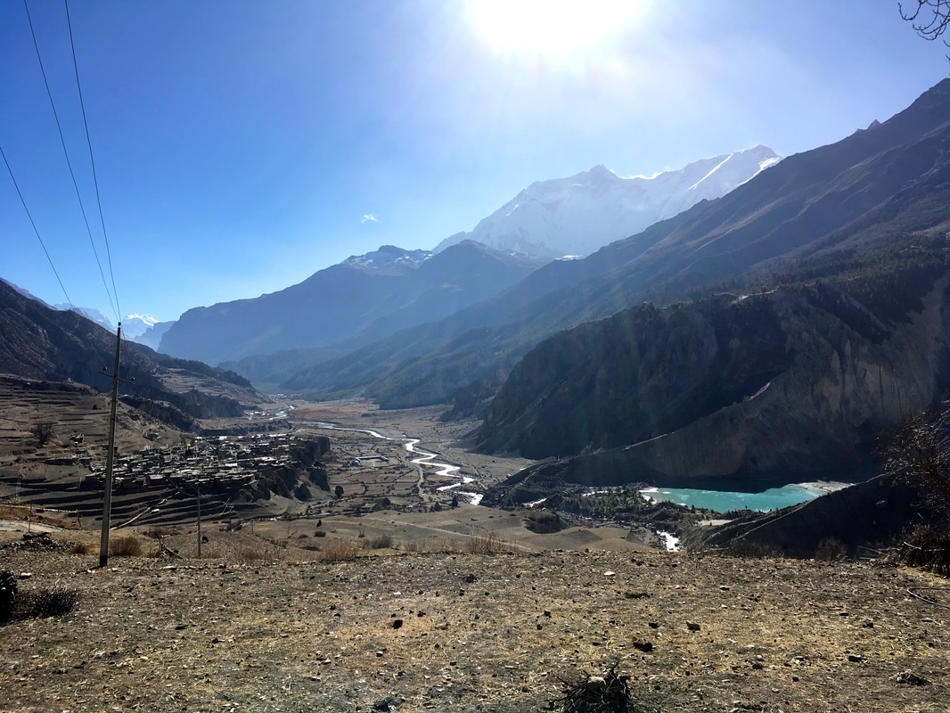 Looking down at Manang, Annapurna Circuit Nepal Before starting the trek, we had read about the numerous acclimatization hikes available from Manang. Some people even add on the Tilicho Lake trek, a multi-day trek from Manang. We did not have 4 extra days for Tilicho Lake, as much as we would have loved to complete it. We considered the option of doing a day hike from Manang, but, ultimately, we chose not to do any side treks on our rest day. People talk about "climbing high and sleeping low" to help with acclimatization, which we had done the previous day by taking the Upper Pisang route. Instead, we relaxed at the bakery with our new friends. Then, we took advantage of the sunshine at mid-day to take showers in the solar-powered shower at our teahouse. Whereas the shower I attempted in Dharapani was FREEZING, this shower was hot and steamy and wonderful. At our teahouse, the Gangapurna Hotel, we met two Argentinians, thanks to Rachel's Spanish skills. One of the Argentinians now lived in Kathmandu and spoke Nepalese. They had a lot of helpful advice for us. In the evening, our new friends mentioned that they were going to a movie theater in town and invited us to join them. The movie theater was a small, cold, concrete room with no windows. A projector and a few rows of chairs had been set up. Since we were the only group at the movie theater, we were allowed to choose the movie, and we used the row of chairs in front of us as footrests. The people working at the movie theater brought us thick blankets, which I spread across my lap to stay warm (I was wearing my down jacket and the fleece-lined hat I had purchased in Chame), and our ticket included tea and popcorn! Initially, I wasn't sure about going to a movie while trekking in Nepal, but I was glad that we did. It was such a different experience than going to a movie in America, and a relaxing experience on our rest day.  Gangapurna, Annapurna Circuit, Nepal Daily trekking distance: 0 km
Total trekking distance: 81 km Starting elevation (Manang): 3540m/11,614 ft Ending elevation (Manang): 3540m/11,614 ft Costs Items at shops (e.g. hand sanitizer, snack, prayer flags, postcards): 850 NPR ($8.23) Tea & cinnamon roll: 320 NPR ($3.10) Water bottle: 100 NPR ($0.97) Movie theater: 350 NPR ($3.39) 2 nights + 2 breakfasts + 2 dinners Manang: 2275 NPR ($22.01) This is a continuation of my series on the Annapurna Circuit Trek, which we trekked in late November. Check out our itinerary here. 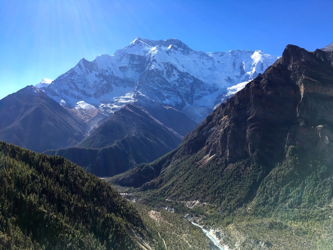 On Day 5, we took the Upper Pisang route to Manang. Trekkers have the option of following the Lower Pisang route, which sits lower in the valley and is a much easier hiking route, or the Upper Pisang route, which is significantly more strenuous BUT SO WORTH IT. I think that everyone should choose the Upper Pisang route for three reasons:
  In the morning, we trekked past prayer wheels and along the banks of the river. We had heard that this day was strenuous, so we assumed the trail would have a big ascent. Not long after Upper Pisang, it did. We were faced with switchbacks that snaked up the steep slope as high as we could see. The combination of the steep trail, the packs on our backs, and the altitude made for a difficult, slow, and steady ascent. I would trudge up two switchbacks and then pause for a sip of water or quick breather. The ascent on this part of the trail took over an hour and we climbed 420 m (1378 ft). At the top, we dropped our packs, flopped to the ground, and took in the stunning views of the river far below and the mountains around us. 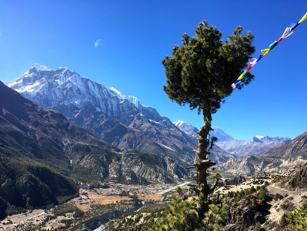 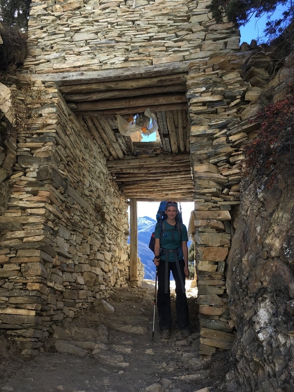 At the top of our big climb was the village of Ghyaru, a tiny village with stone buildings and flat roofs. The road to Manang doesn't follow the Upper Pisang route, so these villages are only reachable by foot or animal. In Ghyaru, a man approached us and asked if we were American. When we confirmed this, he explained that he was the headmaster at the school in Ghyaru, and he had been having computer issues. He thought that we could fix his computer since we were American. We agreed to stop by after resting for a short while. Eventually, we made our way to the school, asking for directions along the way. The headmaster greeted us enthusiastically. I know next-to-nothing about computers, but my fellow trekkers knew a bit more and began eagerly plugging in cords and pressing buttons. As they worked, I shone my cell phone light on the computer and looked around the office. There were photographs of volunteer groups who had come to the school and stacks of workbooks for the students, including English workbooks. Ultimately, we could not fix the computer. Later, as we continued our trek, we hypothesized that it might have been malfunctioning from all the dust. The computer was sitting by the open window and was covered in a coating of dust and dirt, which had clearly blown in through the open window. Rachel thought that the dust probably blew into the office and got into the computer system. Even though we were unsuccessful at fixing the computer, it was a cool experience to see the school and meet the headmaster - an unusual pit stop along the trail! 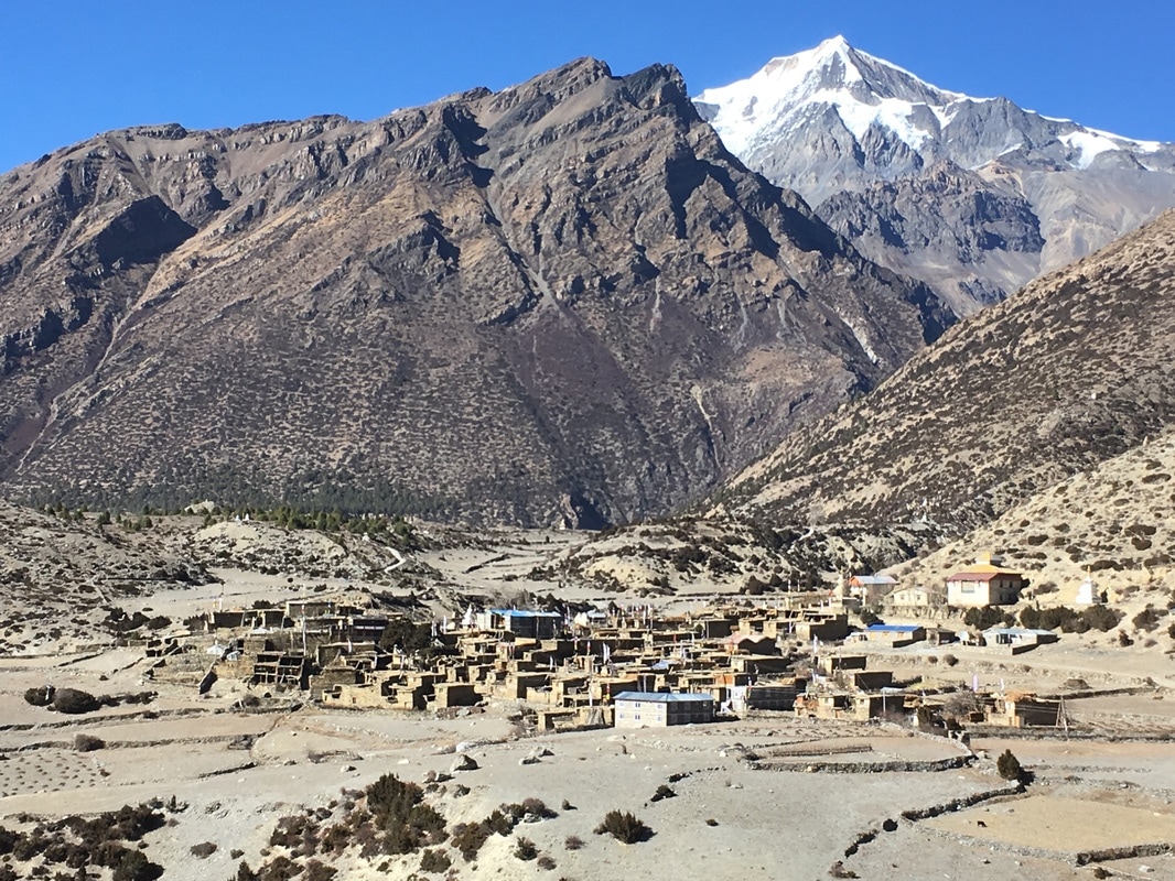 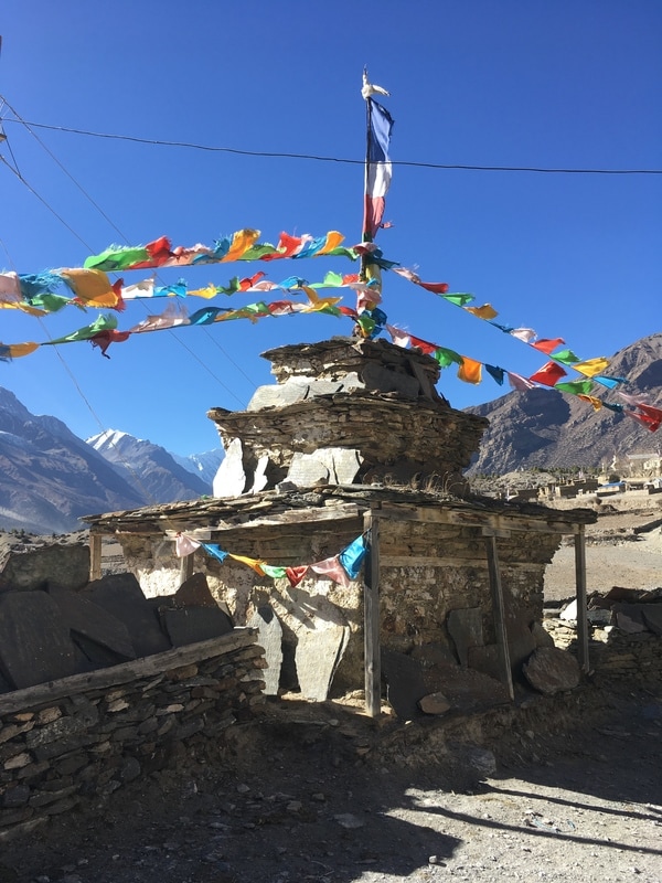 Because we had climbed higher than our stopping point of Manang, the Upper Pisang route descended steeply during the second half of the day. The downhill was hard on my joints, particularly my knees, and we lost the route at one point. After descending, the sun was starting to drop behind the mountains, and I was sure that we couldn't be far from Manang. But, we kept walking. And walking. And walking. My feet were hurting, my knees were hurting, and I was so grateful to see a town, until I realized it was not Manang. We had reached Bhraga, only 30 minutes from Manang, but I have to say that was a long 30 minutes after our strenuous day of trekking. At the end of this day, nobody in our group was speaking because we were so exhausted and were literally hobbling into Manang. 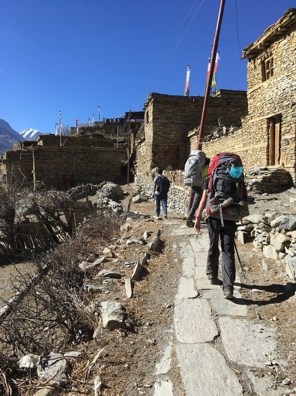 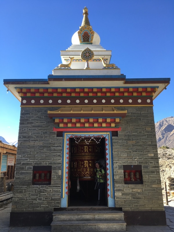 At the end of this day, I was exhausted. My joints hurt. My feet hurt. But, I would not have traded the Upper Pisang trail for anything. I was glad that I had the opportunity to hike away from the road, take in the glorious mountain views, walk through the tiny villages filled with character, and visit a school in Ghyaru. And, after all, this tough day of trekking was followed by a rest day in Manang! 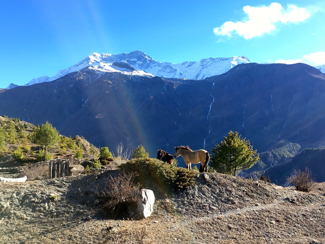 Daily trekking distance: 19.5 km
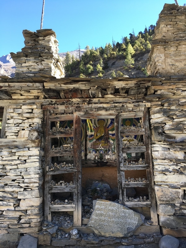
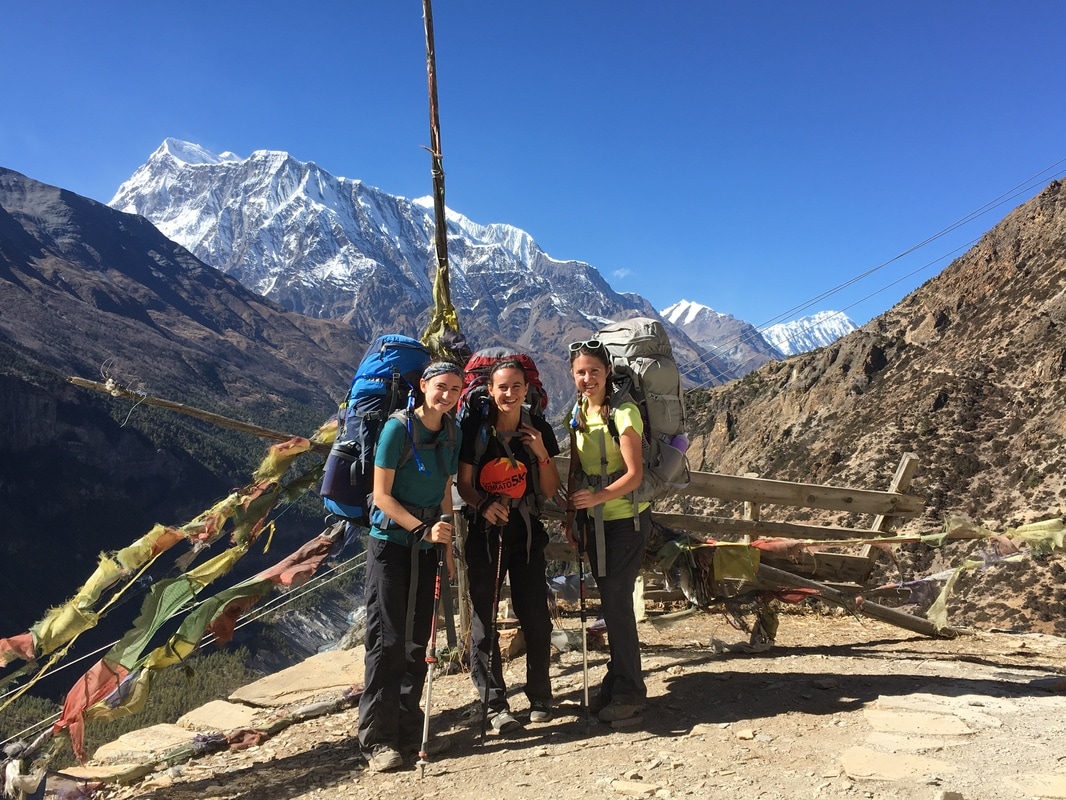
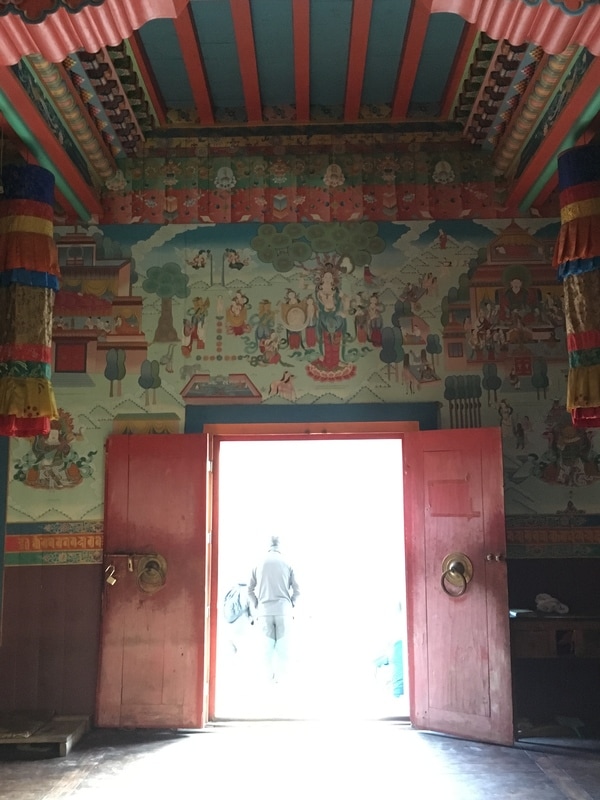
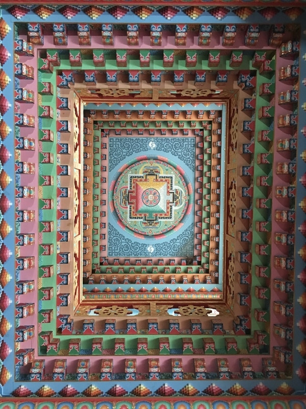
Total trekking distance: 81 km Starting elevation (Upper Pisang): 3310m/10,859 ft Ending elevation (Manang): 3540m/11,614 ft Costs Technically none, since we did not stop for lunch. We ate snacks that we carried with us rather than stopping on an already long trekking day. I will include costs from Manang on the post about our rest day. This is a continuation of my series on the Annapurna Circuit Trek, which we trekked in late November. Check out our itinerary here. 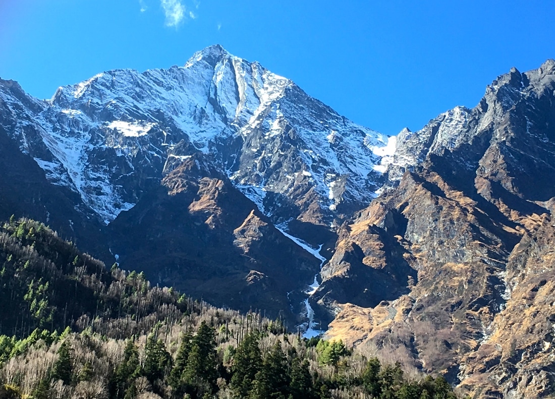 Views on Day 4 of the Annapurna Circuit, Nepal Day 4 of the Annapurna Circuit was a truly lovely day of trekking! I adored everything about this day, I thought the scenery was fabulous, and I had so much fun exploring Upper Pisang. It was reassuring to have my favorite day of the trek immediately following a difficult day. 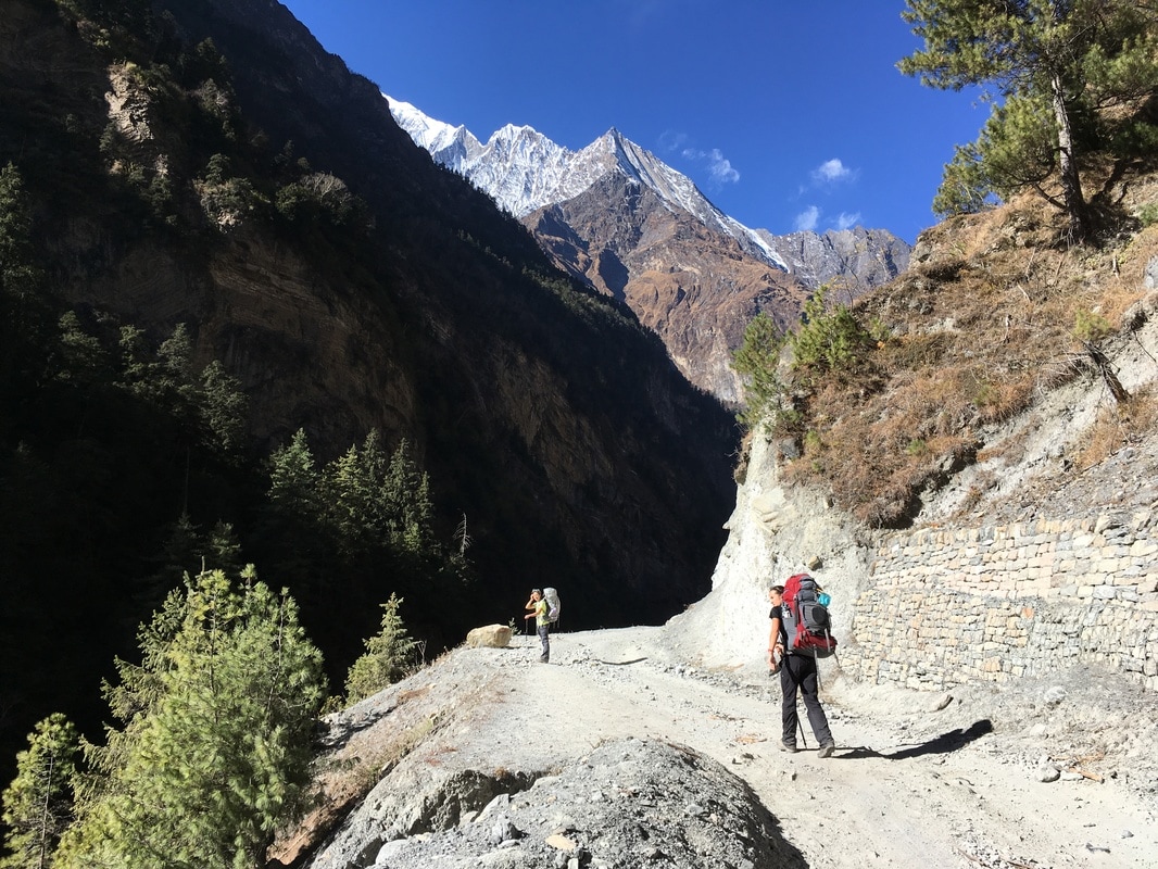 Trekking along the road, Annapurna Circuit, Nepal 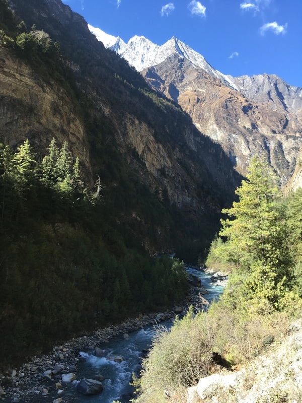 Marshyangdi River, Annapurna Circuit, Nepal As we departed from Chame, we were surrounded by evergreen trees, which smelled wonderful. The trek wound through an apple orchard, surrounded by a "No Trespassing" fence. There was a small shop at the apple orchard where many trekkers paused for a snack. We kept hiking without a stop until we reached the top of a hill, where we paused, refueled with snacks, and enjoyed the view of the snow-covered peaks with the river rushing below us. We had not been away from the sound of the water since beginning our trek, and, later that day, I wrote in my journal: "The river feels like a friend at this point."  Trekking selfie, Annapurna Circuit, Nepal  Trekking group Day 4, Annapurna Circuit, Nepal 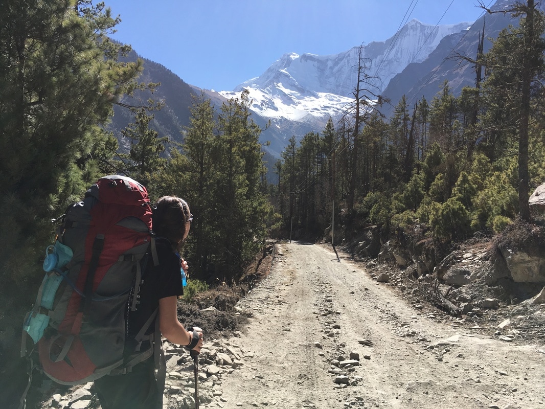 The road to Dhukur Pokhari, Annapurna Circuit, Nepal We continued uphill through a forest until we reached the town of Dhukur Pokhari, a perfect lunch stop. The day was warm, and we stopped for lunch at a teahouse with outdoor tables in the sunshine. Our table also offered beautiful mountain views. Because we were only one town from our stopping point in Upper Pisang, we stayed for awhile after lunch, soaking up the sunshine and journaling as we admired the scenery. Eventually, we packed up and headed toward Upper Pisang. On this particular leg of the hike, I was really beginning to notice the effects of altitude, namely that my breathing felt slightly more labored.  Sign in Dhukur Pokhari, Annapurna Circuit, Nepal 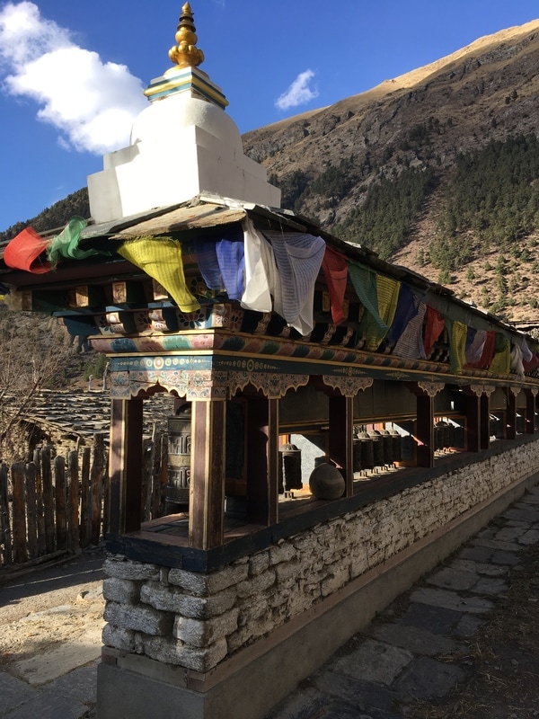 Entering Upper Pisang, Annapurna Circuit, Nepal 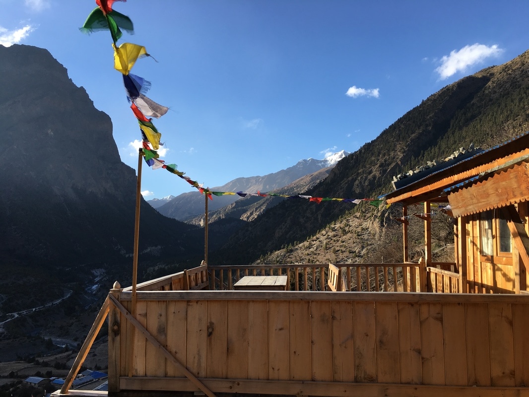 Our teahouse in Upper Pisang, Annapurna Circuit, Nepal 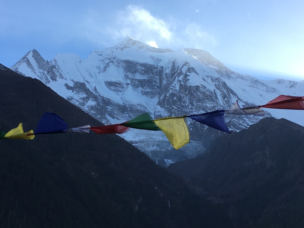 Annapurna II from Upper Pisang, Annapurna Circuit, Nepal Our stopping point for the night was Upper Pisang. When we walked into Upper Pisang, past rows and rows of prayer wheels, we spotted the monastery perched at the top of the village. Our group immediately decided that we wanted to stay at the top of the village, so we hiked up to the highest teahouse. The views of Annapurna II from the teahouse were unbelievable. First, we dropped our packs in a room. Next, we took a ton of photos of the mountain, prayer flags and the mountain, us and the mountain. Then, we immediately headed up to check out the monastery, a short staircase up above our teahouse. To enter the monastery, we passed under an ornately decorated gate. The monastery building itself was small, with a gong outside the door. We took our shoes off to enter and made a donation. The interior of the building was painted with bright colors and smelled of incense. Against the back wall sat a statue of Buddha and two other deities with various offerings in front of them. When we looked back out the front door of the building, all we could see were the snow-covered slopes of Annapurna II. It was certainly an inspiring place for a house of worship. As we wandered out of the building and stood admiring the view, a monk crossed the compound and began ringing the gong, in what I assume was a call to worship. 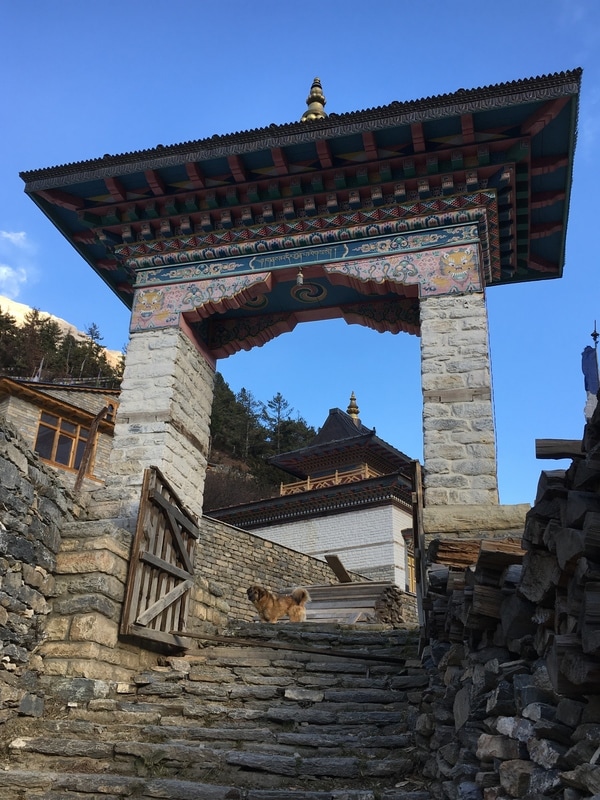 Monastery entrance, Annapurna Circuit, Nepal 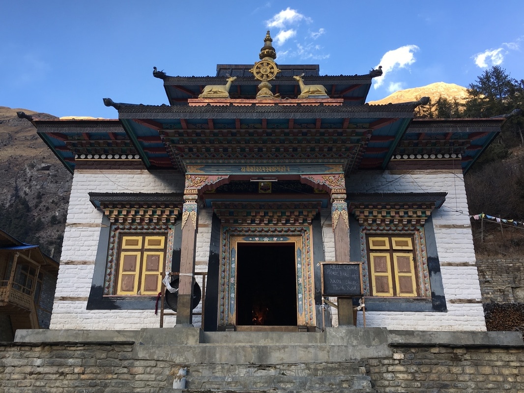 Buddhist monastery in Upper Pisang, Annapurna Circuit, Nepal 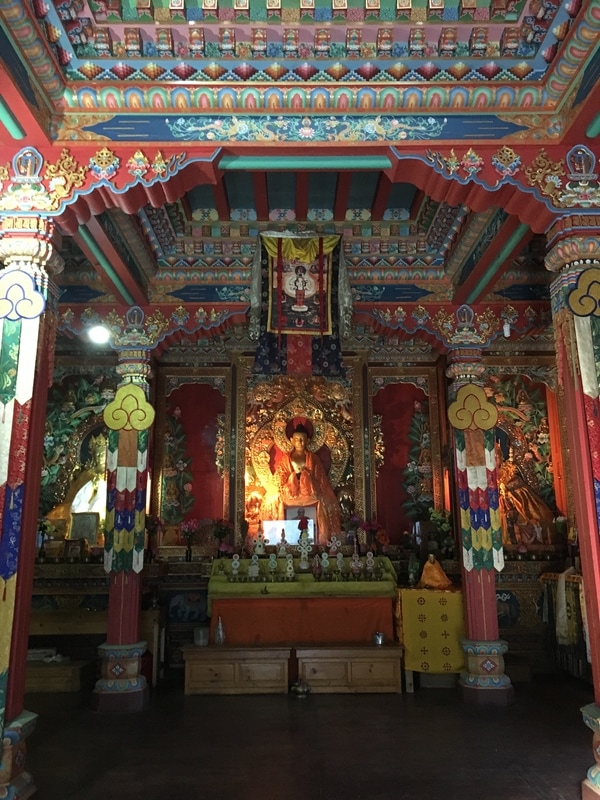 Buddhist monastery in Upper Pisang, Annapurna Circuit, Nepal
The sun had already started to set when we visited the monastery, so the temperature began to drop. Our teahouse room wasn't heated, but, luckily, there was a fireplace in the dining room. We brought our Kindles and journals and maps of the route to the dining room, where we enjoyed views of Annapurna II with our dinner. We stayed in the dining room, cozy and warm, until it was time to run for our puffy sleeping bags. 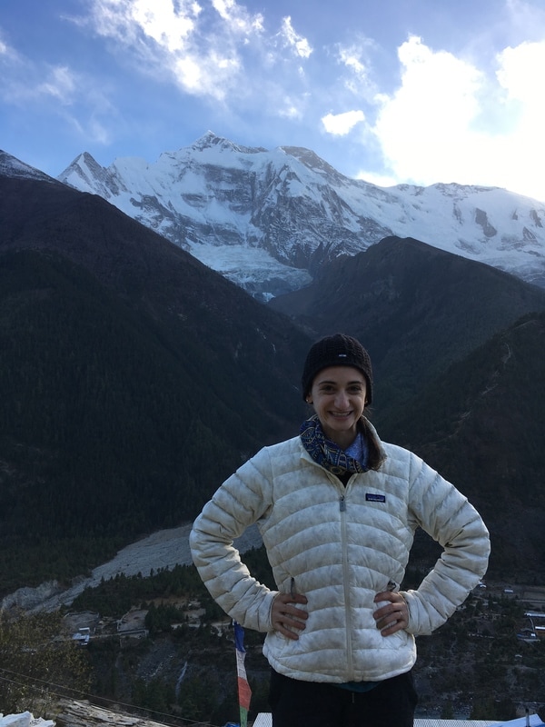 Me and Annapurna II, Annapurna Circuit, Nepal 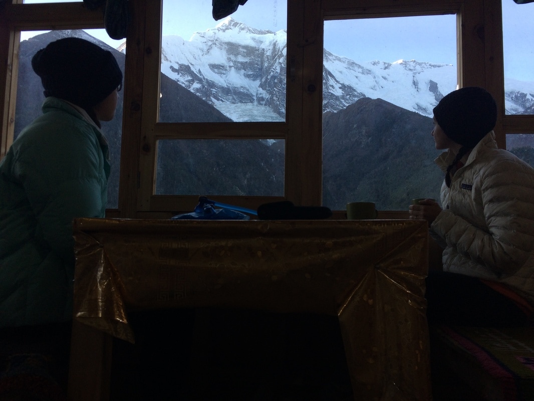 Dinner with the mountain, Annapurna Circuit, Nepal On Day 3, I was frozen and doubting the trip, Day 4 was filled with warmth, new cultural experiences, and stunning landscapes. I felt like this was the day I needed to remind me of all the reasons that I wanted to trek the Annapurna Circuit. Moments like listening to the rushing river, sitting in the sunshine at lunch, walking through a serene monastery, and watching the sun set behind the majestic peak of Annapurna II made me feel grateful to be in the Himalayas and experiencing this part of the world. 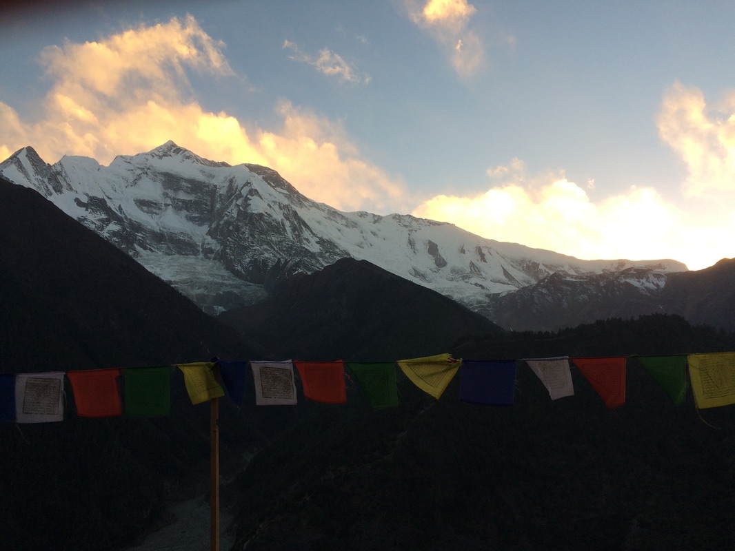 Sunset behind Annapurna II, Annapurna Circuit, Nepal Daily trekking distance: 14.5 km
Total trekking distance: 61.5 km Starting elevation (Chame): 2710m/8891 ft Ending elevation (Upper Pisang): 3310m/10,859ft Costs Lunch Dhukur Pokhari: 510 NPR ($4.95) Monastery donation in Upper Pisang: 300 NPR ($2.91) Dinner + Room + Breakfast Upper Pisang: 995 NPR ($9.65) |
AuthorMy name is Alyssa Good and I have a passion for travel, adventure, culture, and new experiences! I focus on budget friendly travel, trip planning resources, and seeking out new experiences. Archives
December 2017
Categories
All
|
 RSS Feed
