|
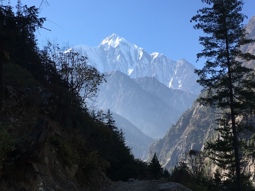
This is a continuation of my series on the Annapurna Circuit Trek, which we trekked in late November. Check out our itinerary here. 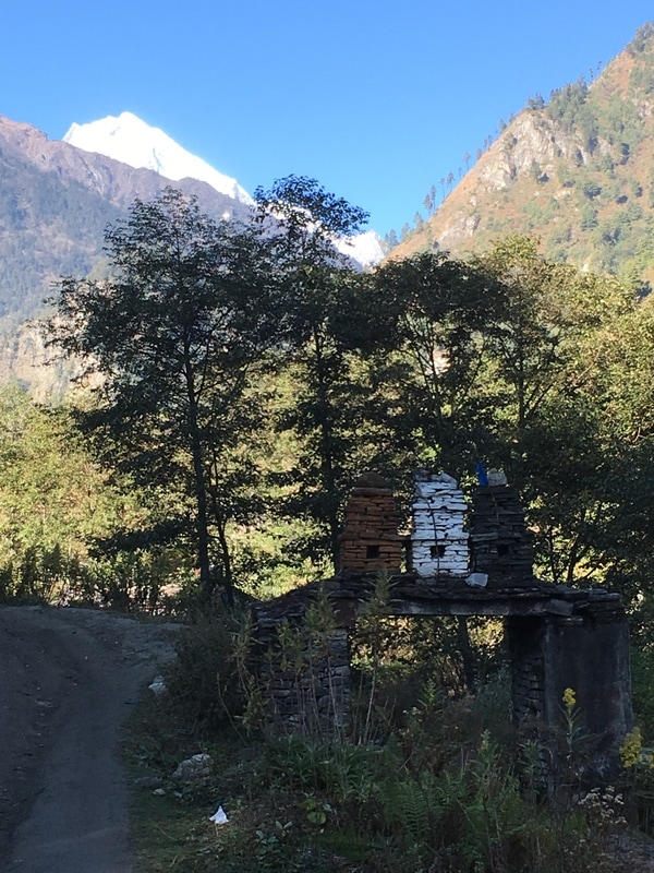 Mountain views, Annapurna Circuit, Nepal When we headed out of Dharapani in the morning, the air was chilly. It gave me a taste of what to expect as we continued up into higher altitudes. In the morning, I started out wearing long sleeves, a hat, and gloves. I was also really grateful that we had had nothing but clear blue skies for our trekking thus far. Our goal for the day was to reach the town of Chame, which we had heard was a larger town. 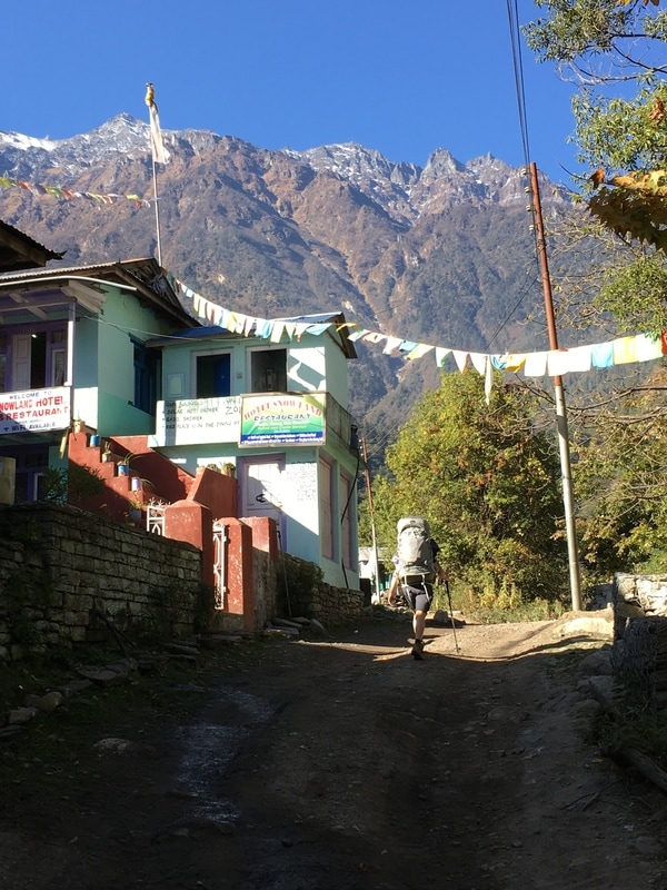 Beginning our trek on Day 3, Annapurna Circuit, Nepal 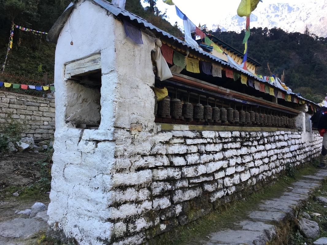 Prayer wheels on the Annapurna Circuit, Nepal 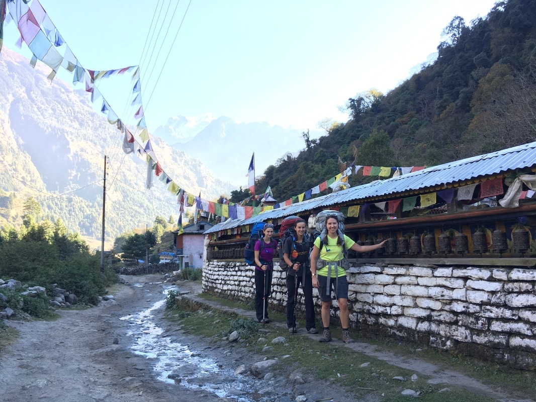 Our group spinning the prayer wheels, Annapurna Circuit, Nepal Hands down, the best part of the day was our first views of the Annapurna massif and other snow-covered peaks. Up to this point, we had been accustomed to lower elevations, rolling mountains with rounded tops, brown and green hues, and terraced rice fields. Now, we were getting views of jagged peaks, barren ridges above the tree line, and snow covered summits. I couldn't stop looking at these mountains and taking pictures of them! 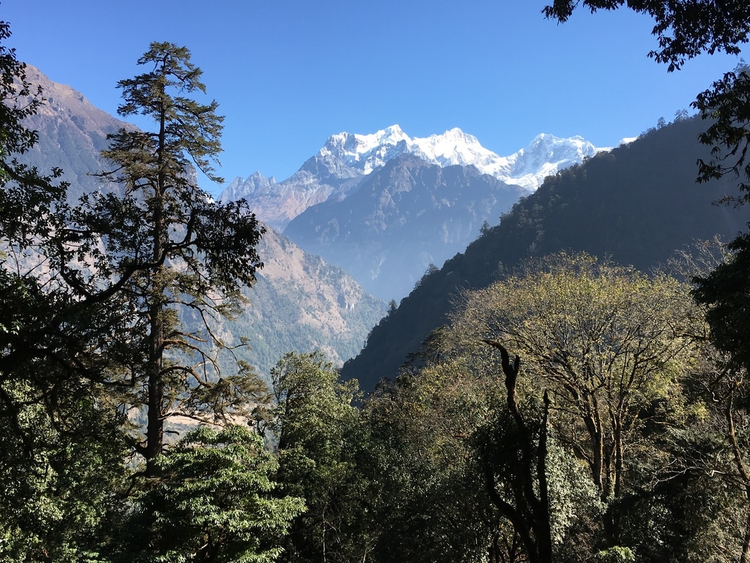 Snow covered peaks, Annapurna Circuit, Nepal 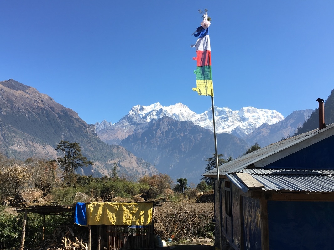 More snow-covered peaks, Annapurna Circuit, Nepal 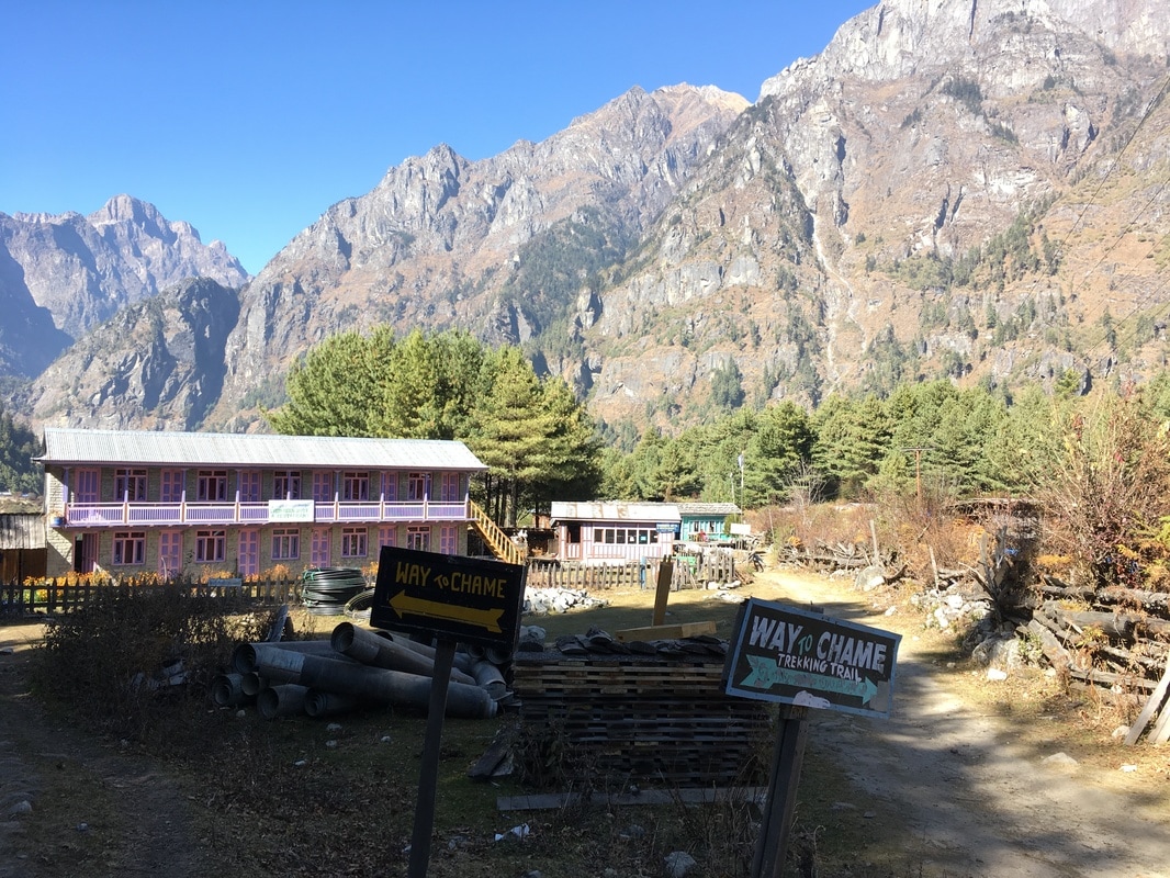 Two routes to Chame, Annapurna Circuit, Nepal 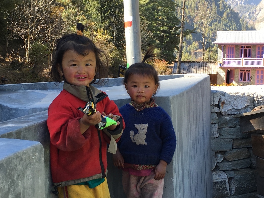 Children along the Annapurna Circuit, Nepal Today's uphills didn't feel quite as bad as the previous day's uphill portions to me, so either it was easier or my body was beginning to adjust to this trekking routine. I hoped it was the latter, since we still had a lot of elevation to gain before Thorong-La Pass at 17,770 ft. We stopped for lunch in the village of Koto, one town before Chame. Lunch was, unfortunately, cold as well, since we were eating in the shade. The down jackets had to come out once we sat down for lunch.
 Our first view of the Annapurna Massif, Annapurna Circuit, Nepal 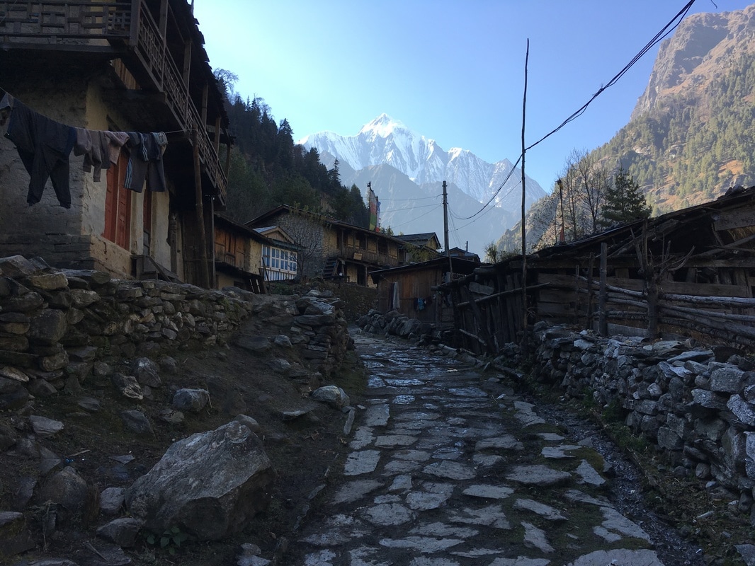 We entered Chame, once again, at rush hour on the Annapurna Circuit, accompanied by a herd of goats. A young boy, about 12 years old, also walked into town with us, asking questions about the United States, telling us that we would see yak in Manang, and urging us to stay at his family's teahouse. We had an idea of where we wanted to stay, based on one of our trail friend's guidebooks, so we declined as politely as we could. Unfortunately, when we reached that teahouse, it was full - the only time this happened to us on the Circuit. We went next door to another teahouse. It wasn't busy at all, and someone had to hunt down the the owner somewhere else in the town, which didn't inspire confidence. But the room was decent, and there was actual insulation on the walls. After putting our stuff down, we headed out into Chame in search of a few items. This was the first village that had a variety of items to buy, from extra hand sanitizer and toilet paper to candy bars to warm clothing. I had been so cold all day that I was having "cold panic". If I had been cold all day on Day 3, I was terrified that I would be a walking popsicle at higher altitude. In my cold panic, I bought a fleece lined, wool hat and a long sleeved "North Face" knock-off shirt. The logo was clearly not actually The North Face, and it smelled like a plastic bag, but it eased my cold panic a bit. I loved my hat. Combined, these two items cost me less than $10. Before going to Nepal, I had read online that it was possible to buy everything you need for The Annapurna Circuit in Kathmandu or Pokhara. I didn't actually believe it, but it's true. I felt relieved that I was able to buy things I needed, particularly when I was down to an empty bottle of hand sanitizer and had a sudden need for feminine hygiene products. 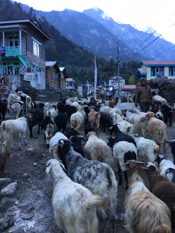 Chame was one of my least favorite stops, but I think that had a lot to do with the teahouse we stayed in. There weren't other trekkers to hang out with in the evening. We were the only people staying there. The food was ok. The room was ok. Chame seemed dreary to me - was that the village itself or a reflection of my mood? It's hard to say in retrospect. Overall, I can't say that this day was my favorite. The Annapurna Circuit is SO WORTH IT, but it is not always an easy journey. I didn't write a lot in my travel journal on Day 3. What I did write was: "Today I was cold. All day. It was pretty miserable and one of those days when I had those 'why did I think this was a good idea' thoughts...It is so cold. I am so cold. I feel like I will not be warm for the next ten days and that is so disheartening." 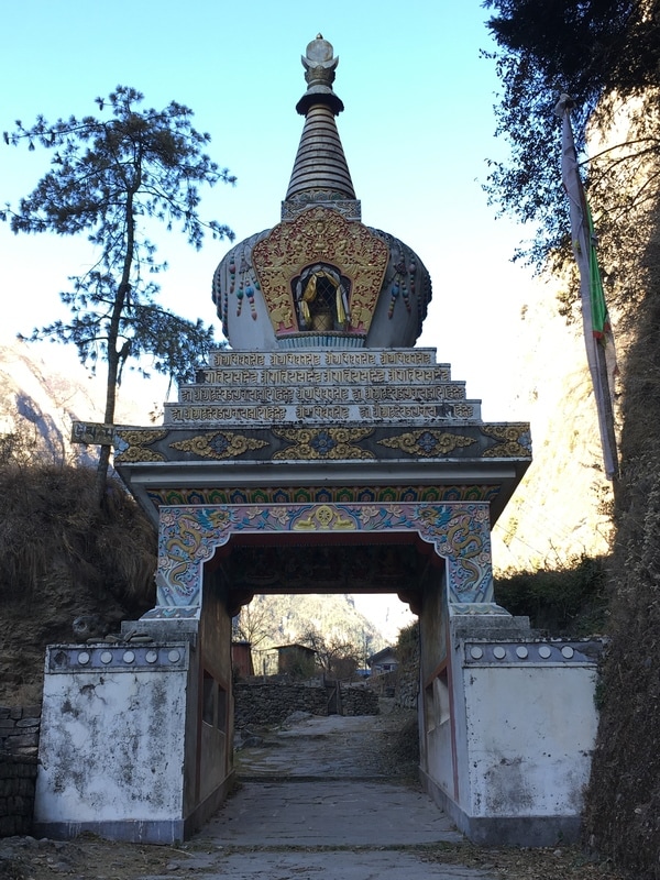 Daily trekking distance: 16 km
Total trekking distance: 47 km Starting elevation (Dharapani): 1900m/6234 ft Ending elevation (Chame): 2710m/8891 ft Costs Lunch Koto: 450 NPR ($4.22) Hat & Shirt in Chame: 1050 NPR ($9.84) Dinner + Shower + Room + Breakfast Chame: 1040 NPR ($9.74)
0 Comments
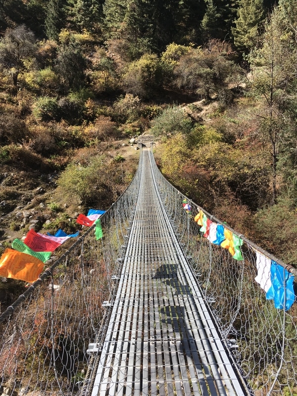
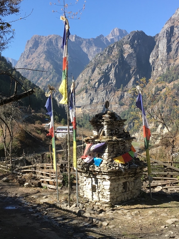
This is a continuation of my series on the Annapurna Circuit Trek, which we trekked in late November. Check out our itinerary here.  Leaving Ghermu with a waterfall cascading in the background, Annapurna Circuit, Nepal Our second day on the Annapurna Circuit began with breakfast on the porch in Ghermu. My breakfast was oatmeal and black tea. Unfortunately for me, I really dislike oatmeal, the world's easiest breakfast when trekking. However, I knew I would need energy for a full day of trekking, so I ate the oatmeal. We lingered a bit over breakfast, since the morning view from the porch over the fields and mountains was so lovely. Our new British and Belgian friends had long since left. Panicked about the idea of trekking during the hottest part of the day, they had set off as early as possible. After a leisurely breakfast, we wrestled our belongings back into our packs, paid the teahouse owners, and headed out on the trail. 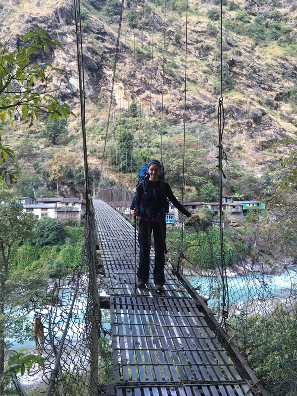 One of many suspension bridges, Annapurna Circuit, Nepal We immediately crossed a suspension bridge and immediately realized that there were a lot more buildings and teahouses in Ghermu. This was the point when we realized that we should walk further into each town before selecting a teahouse. All along the trail we saw signs pointing toward Manang, as shown in the photo below. Parts of the trail were also marked by red and white blazes, though this was inconsistent in some areas. If we were unsure about which way to go, we asked the locals by pointing and saying the name of the next town ("Chame?"). Everyone we met along the Circuit was super helpful and friendly, and, even if they didn't speak much English, they pointed us in the right direction using gestures. 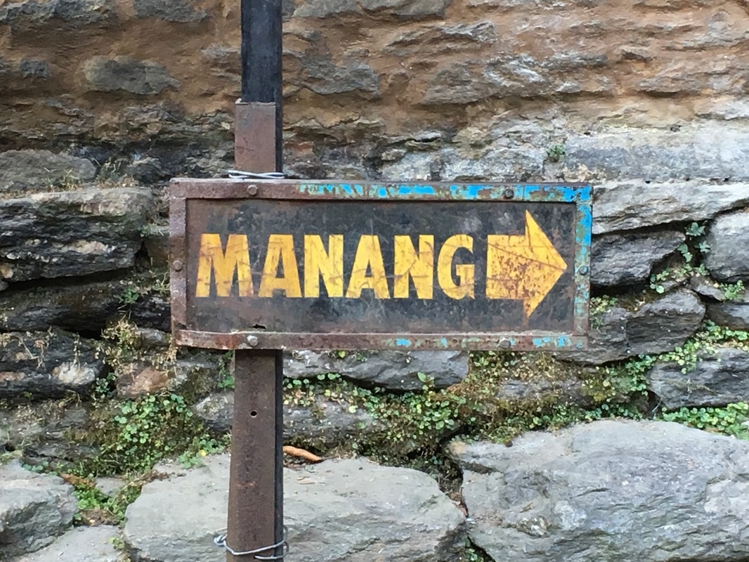 This way to Manang, Annapurna Circuit, Nepal 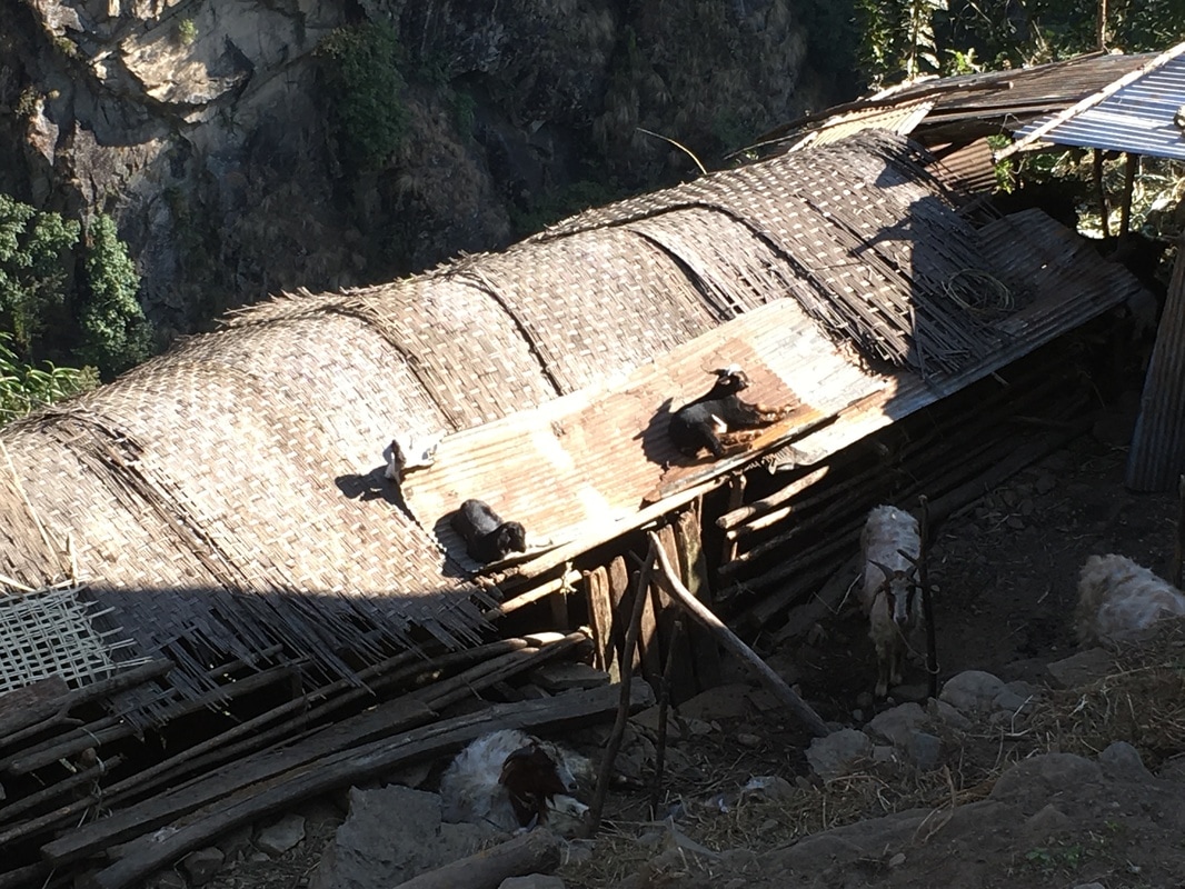 I call this one "Goats on Roof", Annapurna Circuit, Nepal Most of our morning was spent trekking on the newly "constructed" road. I say "constructed" because the dirt road was extremely bumpy, filled with uneven rocks and potholes. We had to stop frequently to let jeeps and motorbikes pass. Though the road is technically two-way, there is really only space for one vehicle at a time. Each time a vehicle passed, dust and exhaust was kicked up. Eventually, we learned to look away and cover our faces with a shirt or a scarf. The road extends all the way to Manang, previously reachable solely by foot or animal. Before coming to Nepal, I had read numerous blogs or articles complaining about the road and how it is ruining the Annapurna trekking area. I get it. I get how trekkers dislike having dust kicked up in their faces and hearing the roar of motorbikes rushing past. But I can't complain too much. Imagine living in a place where the only way to get help, supplies, everything is walking for days at a time. We choose to trek for a short period of time, but this is daily life for so many people and the road will only make their lives easier. I can't expect them to reject progress so that I can spend two weeks away from cars. As the NATT Guide says, "In fact a road means a better possibility to sell theirs own farm products like apples, thus earning more, and in the same time other goods brought by the road are much cheaper than carried by mule or porter. This results in a higher life standard." The Annapurna Circuit is not a "get away from people and lose yourself in the wilderness" kind of trek. You are passing through towns, sleeping in teahouses, having someone cook for you, and interacting with locals. I had never been on a backpacking trip like the Annapurna Circuit, and I loved how it combined STUNNING scenery with local villages. All you can do is enjoy the trek for what it has to offer, bring a scarf/buff/bandana to cover your nose and mouth, and take the NATT scenic trails as much as possible to avoid the road. NATT stands for New Annapurna Trekking Trails. In 2006, the Annapurna Conservation Area Project began planning alternative trails so that trekkers could enjoy the area while avoiding the new road. We downloaded this version of the NATT Guide for free, printed it out, and used it along the trek. This version was published in 2011, but, while it is already 5 years old, it is SO HELPFUL. The NATT Guide is packed with great information, indicating when there is an alternative trail option, providing information about trekking times, and giving tips for safety.  Church in Jagat, Annapurna Circuit, Nepal We passed through the village of Jagat, with its brightly painted buildings. Just past Jagat, there were hot springs, a 10 minute climb down from the road to the river. We did not choose to go down to the hot springs, since it was still early in the day, we had a lot of trekking left to do, and we did not want to be wet for the rest of the day. We continued through the small village of Chamje, where we diverged from the road onto one of the NATT trails. This trail was a beautiful, shaded path through lush, green forest and past a cascading waterfall. 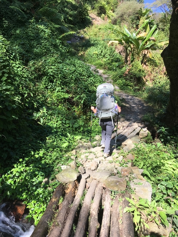 NATT Trail near Chamje, Annapurna Circuit, Nepal 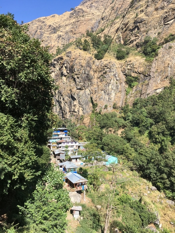 Hillside village, Annapurna Circuit, Nepal 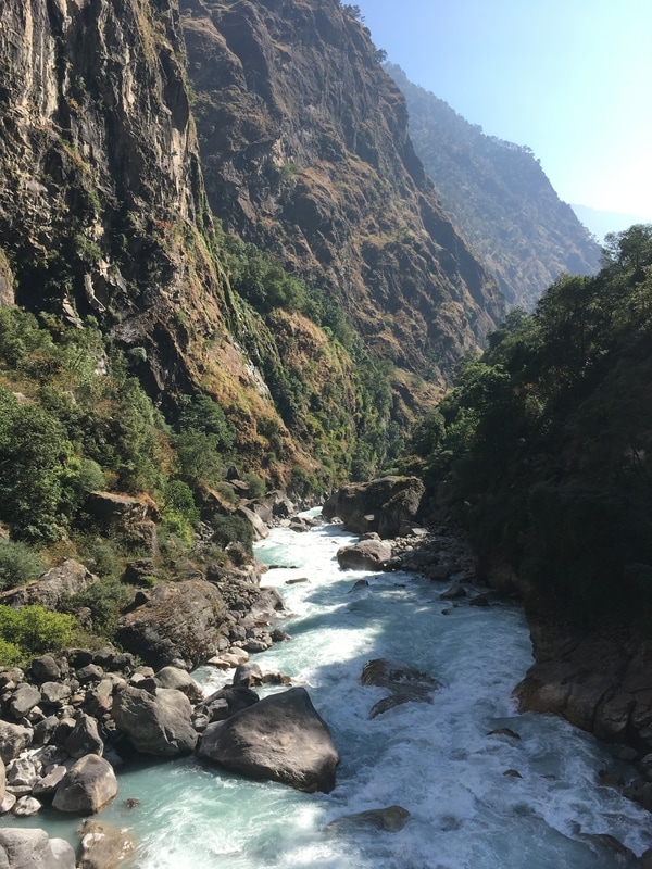 Marsyangdi River, Annapurna Circuit, Nepal 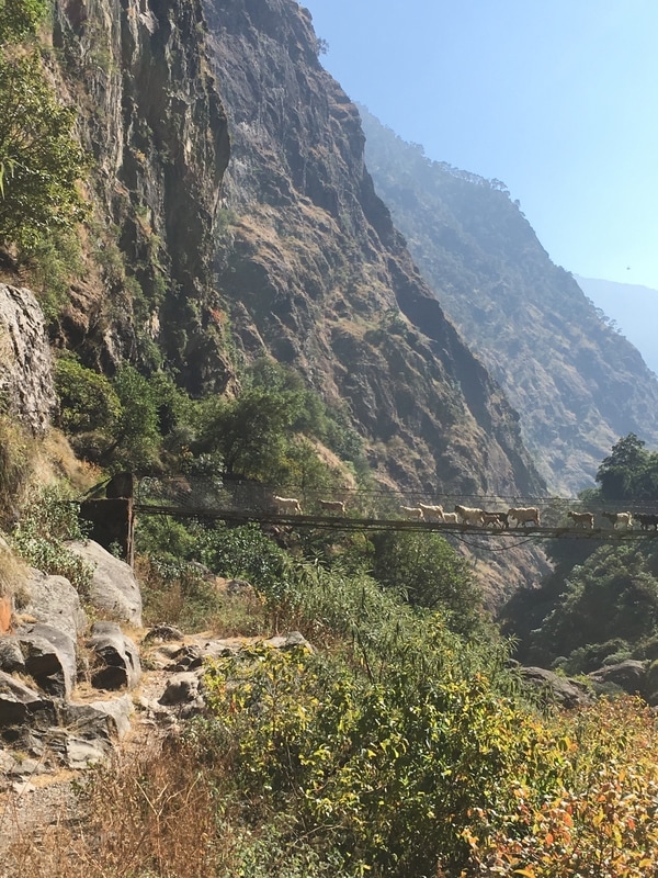 Goats on bridge, Annapurna Circuit, Nepal After exiting the forest, we joined a herd of goats in crossing the Marsyangdi River and began the very steep climb to Tal. Luckily for us, the road stayed on the opposite side of the river. At this point, I was really feeling the trek in my legs, particularly with the steep climb before Tal and all the stone steps that we ascended throughout the day. I took my time with the ascent and reminded myself that lunch awaited me in Tal. At the top of the hill, we found the sign pictured below, with altitude trekking times. I took a picture of it, and we constantly referred to the photo throughout the trek. Every day, multiple times per day, because it was so accurate. We might think that we were hiking faster than normal or taking an extra long break, but somehow the time between villages was always right on target! 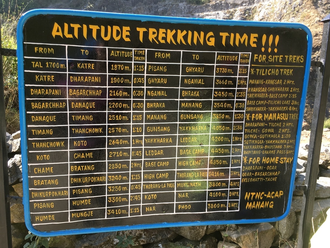 The most helpful sign, Annapurna Circuit, Nepal 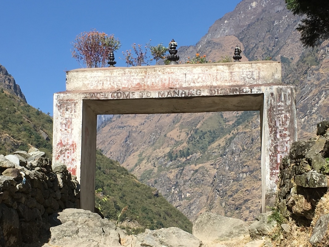 Gate entering Manang District, Annapurna Circuit, Nepal Lunch in Tal was glorious. Tal sits right on the river and is filled with charming teahouses. We found this adorable pink and green teahouse with a lovely, well-kept garden where we sat at an outdoor table, took our packs off, and enjoyed the afternoon sun. The sweet lady who ran the teahouse made truly excellent dal bhat and momos. It was the best food we ate on the trek. Also, she had a big container of boiled water where we could fill up our water bottles before continuing on our hike, and the bathroom situation was better than most. Overall, a truly lovely lunch stop. 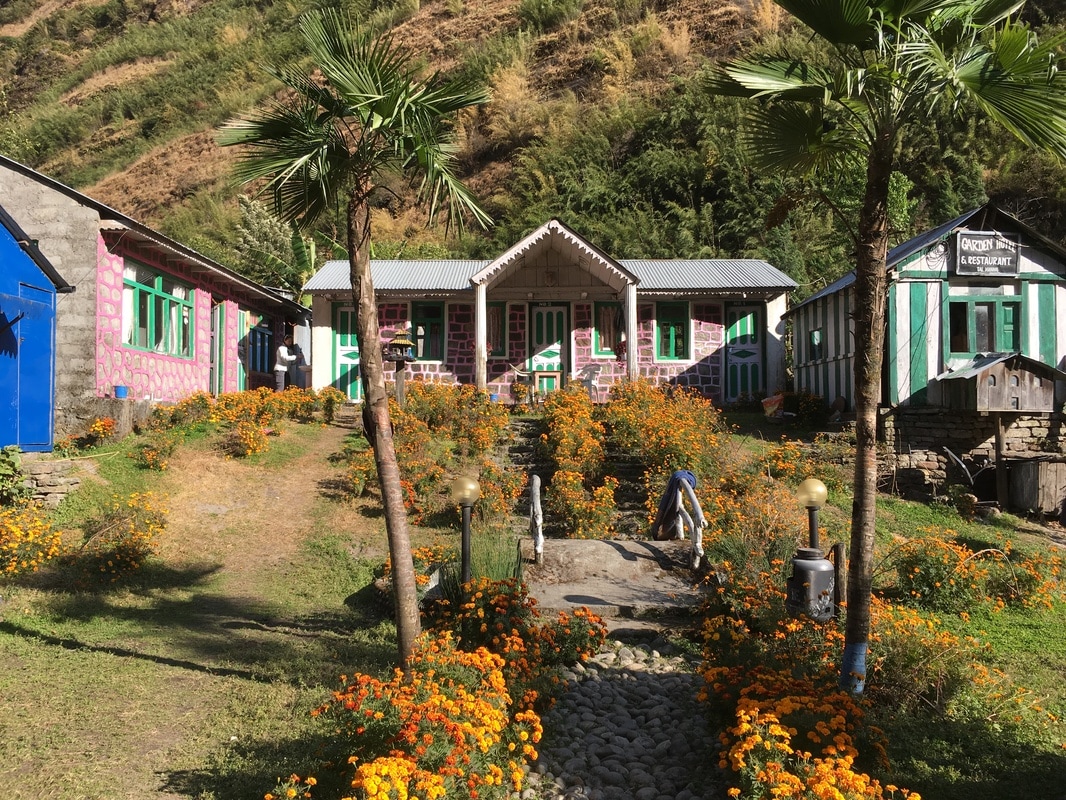 Our lunch stop in Tal, Annapurna Circuit, Nepal From Tal, we had about 2 hours left to trek until we stopped for the night in Dharapani. I can't lie, motivation was difficult after our relaxing lunch. But, the trekking wasn't too challenging. When we got to Dharapani, we reminded ourselves to keep walking further into the village before selecting a teahouse. Unfortunately, this led to some indecision and resulted in us walking through the village 4 times before selecting a teahouse. Dharapani is quite spread out, so it was hard to tell whether there were more options down the trail. We did find a nicer teahouse further into the village and settled into our triple room that had a clothesline to hang our sweaty clothes. The teahouse had a gas-powered shower for 100 rupees, which seemed like a good idea at the time. I opted to take a shower because I had been sweating the past two days and I didn't know when my next opportunity to shower would be. Unfortunately, with the gas shower, the window in the shower room had to remain open. As the sun had gone behind the mountains, the temperature had dropped drastically and cold air poured into the room, negating any warmth from the hot water. I was already wet, so I shivered through shampooing my hair and washing my body, telling myself, "Almost done." Easily the coldest shower of my life. After drying off and bundling up, I headed down to the dining room. Tonight, Rachel was exhausted and climbed into bed early, as I had the previous night. Ciara joined me in the dining room after her shower, and we met a female trekker from Colorado who was doing the circuit by herself. Spending time with fellow trekkers in the teahouses at night was one of my favorite parts of the Annapurna Circuit. I felt like I got to meet so many people from around the world. I was still fairly full from our late lunch in Tal, so I opted for hot tea and sharing a dessert with Ciara. As we waited for our food, we realized that a yak was being chopped up in the kitchen. I was exhausted from the day, so I enjoyed my tea, chatted for awhile, and then headed to bed. 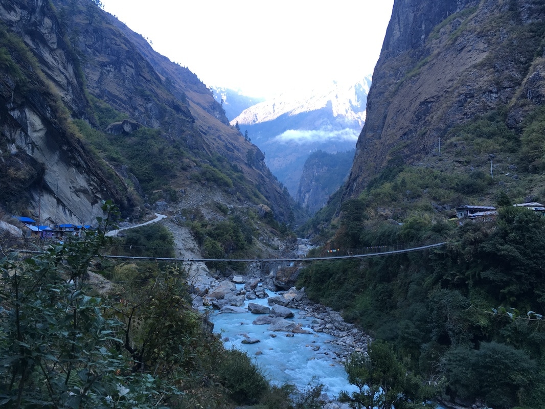 Looking down the valley from Dharapani, Annapurna Circuit, Nepal Daily trekking distance: 18 km
Total trekking distance: 31 km Starting elevation (Ghermu): 1130m/3707 ft Ending elevation (Dharapani): 1900m/6234 ft Costs Lunch Tal: 383 NPR ($3.52) Dinner + Shower + Room + Breakfast Dharapani: 800 NPR ($7.35) |
AuthorMy name is Alyssa Good and I have a passion for travel, adventure, culture, and new experiences! I focus on budget friendly travel, trip planning resources, and seeking out new experiences. Archives
December 2017
Categories
All
|
 RSS Feed
