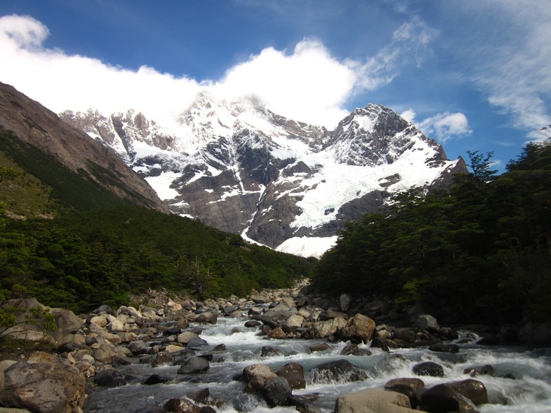
 W-Circuit, Torres del Paine National Park In December 2012, four friends and I embarked on a trip to Chilean Patagonia, where we explored Torres del Paine National Park. This national park is awe-inspiringly beautiful. No, that photo above is not from somewhere on the internet. I took it on our hike. Pretty incredible, right? Here are some quotes from my travel journal: "Torres del Paine National Park is unbelievable and beautiful and almost unreal. It is unlike anything I have ever seen." "I was in awe of the scenery. Even the part of the forest where the trees had been burned by fire had a stark, desolate kind of beauty with some new life springing up in the form of grass and flowers. And, no matter which way we turned our heads, there was beautiful scenery - to our right, the mountain peaks, and, to our left, the lake, glacier, and more mountains in the distance." "Everything out here is so other-worldly beautiful that it's easy to see God's hand. Patagonia is beautiful and I am content." This was my first multi-day backpacking trip, and I believe that the "W" circuit in Torres del Paine National Park is the perfect place for someone with any level of experience. First of all, you will be hard-pressed to find a more beautiful place with such diverse scenery. Have I made this point enough? It's beautiful. Another awesome thing about the park is that you can drink any water in the park because it's all fresh glacier run-off, meaning that the water is fresh, cold, clean-tasting, and readily available. You don't have to worry about hanging your food when camping because there are not bears or other scavenging animals in the area. Finally, if camping is not your thing, you can always hike between the refugios with a lighter pack, sleep in a bed every night, and eat meals in the refugio restaurants. We went the cheaper route by carrying our own camping equipment and food, but I really enjoyed camping in the park each night and the sense of camaraderie among the backpackers at campsites. 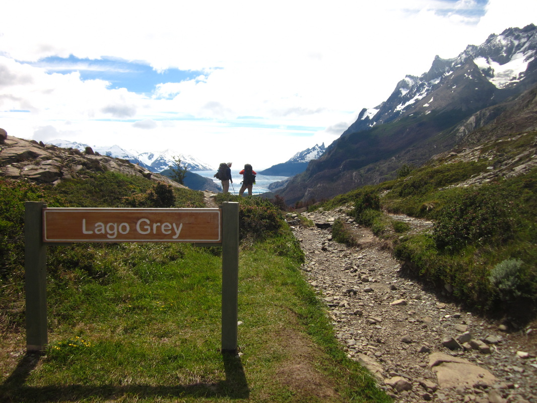 Mirador by Lago Gray, W-Circuit, Torres del Paine National Park 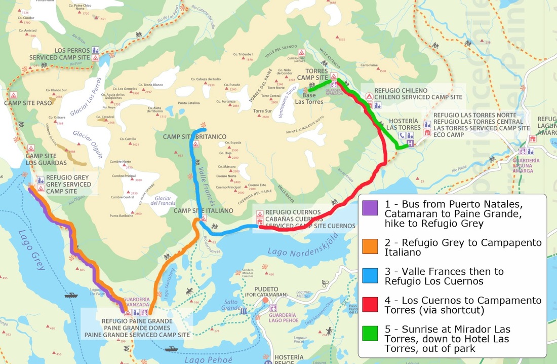 Map Credit: http://www.stephandben.com/2012/04/map-how-to-hike-w-in-torres-del-paine.html The "W" RouteDay 1 Hiking Distance: 11 km From the bus drop-off, we had to take a ferry across Lago Pehoe before we could start hiking. I was taking pictures like crazy from the ferry, but I had no idea that even more spectacular scenery awaited me on our 5-day hike. The ferry dropped us off by Refugio Paine Grande, and we set off on our hike. Our destination was the Refugio Gray campsite. We were treated to stunning views of Lago Gray and Glacier Gray as we hiked. I was in awe the entire time, particularly at the intense blue color of the water contrasted with the dark mountains rising behind it. Unfortunately, the picture below doesn't portray the vibrant color of the water. We camped near Refugio Gray. From the refugio and campsite, there is a short trail that leads to a glacier overlook. Our group decided to take the short walk and was rewarded with views over Glacier Gray. At the campsite, there was a shelter with tables that campers could use to cook. Even though we were blessed with beautiful weather, I could see the shelter being useful in high winds and during rainstorms. On the night we camped, the bugs swarmed around our tents, so we turned in early, partially to escape the bugs and partially because we were exhausted from the day's hike. 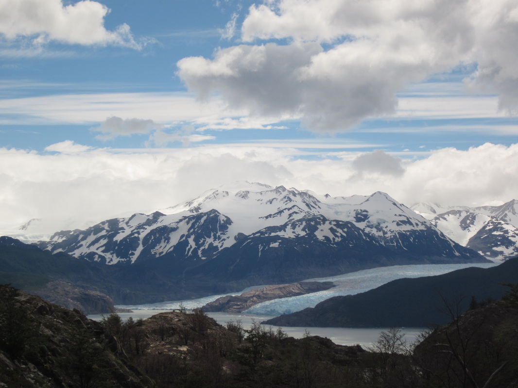 Lago Gray and Glacier Gray, W-Circuit, Torres del Paine National Park 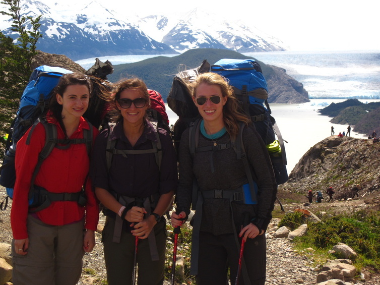 The girls with Glacier Gray in the background, W-Circuit, Torres del Paine National Park Day 2 Hiking Distance: 18.6 km The second day's section of the "W" required us to retrace our steps back to Refugio Paine Grande and on to Camp Italiano. It might seem annoying to retrace the steps that you hiked yesterday, but, trust me, looking at those views never gets old. Plus, part of the hike is through new terrain. This isn't a problem if you do the longer "O" Circuit, where the loop is completed, so there is no retracing of your steps. The views of Paine Grande and other mountains made for excellent hiking scenery, but the best part of the day actually came at the end. When our feet were throbbing and our shoulders were aching and all we wanted was to arrive at the campsite, we came to a wooden bridge over a river. Only two people were allowed to cross the bridge at a time, so the rest of us were unaware of the treat that awaited us until we reached the middle of the bridge. I kept thinking, "Why is everyone stopping to take pictures in the middle of this bridge?" Then, I reached the middle and was rewarded with a spectacular mountain view - the one in the picture at the top of this post - and that gave all of us renewed energy at the end of a long day, 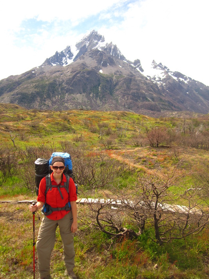 Me by Paine Grande, W-Circuit, Torres del Paine National Park 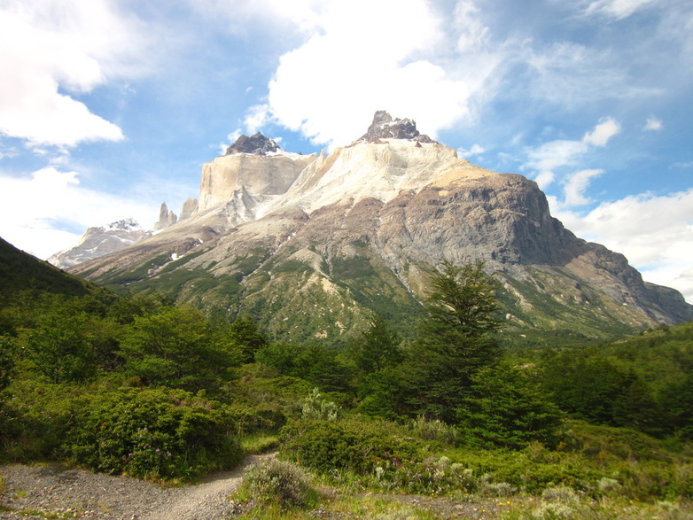 Cuernos del Paine, W-Circuit, Torres del Paine National Park 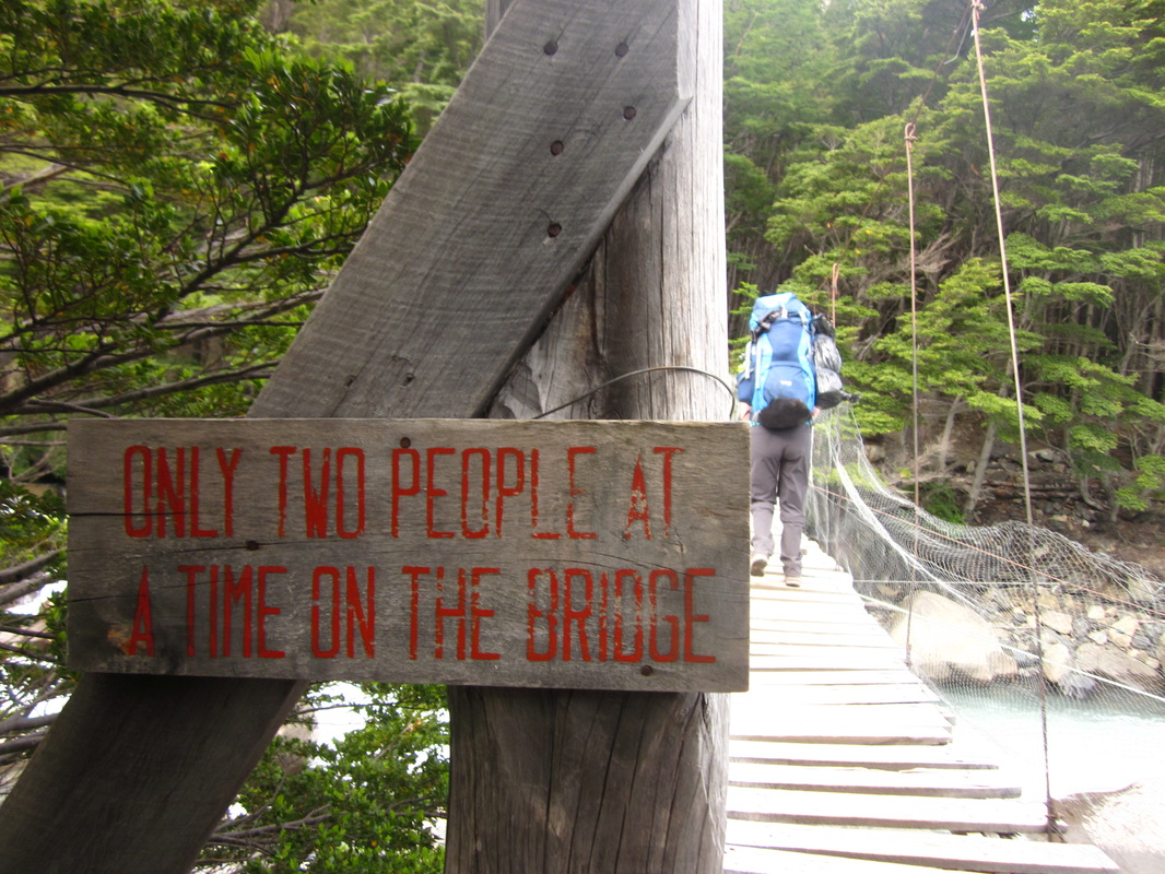 Bridge with spectacular views, W-Circuit, Torres del Paine National Park Day 3 Hiking Distance: 20.5 km We started the day by taking our instant coffee from the campsite down to the river with the beautiful mountain view that you see at the top of this post. Let me tell you, instant coffee has never tasted so good as it did with fresh air, beautiful views, and the sound of rushing water nearby. Today's hike was up into the Valle Frances, the middle portion of the "W", meaning we would hike into the valley and then retrace our steps to continue on the next branch of the route. Which meant that we could leave our packs at the campsite and pick them up when we came back through! After carrying our big backpacks, carrying just water and a snack was heavenly! The Valle Frances was incredible. The hike in ended on top of a big rock in the middle of the valley, with snow capped mountains rising up around us in a 360 degree panorama. After taking it in and heading back to our campsite, we grabbed our packs and continued on to camp at Los Cuernos. On the way, we walked on the shore of a lake, taking a quick break in the sunshine on the beach. I loved the campsite at Los Cuernos because our tents were on platforms with views of the lake and mountains. I took my boots off of my aching feet and ate dinner with my legs hanging over the edge of the platform, soaking up the view. 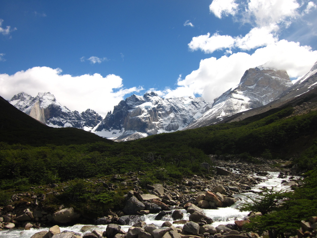 Valle Frances, W-Circuit, Torres del Paine National Park 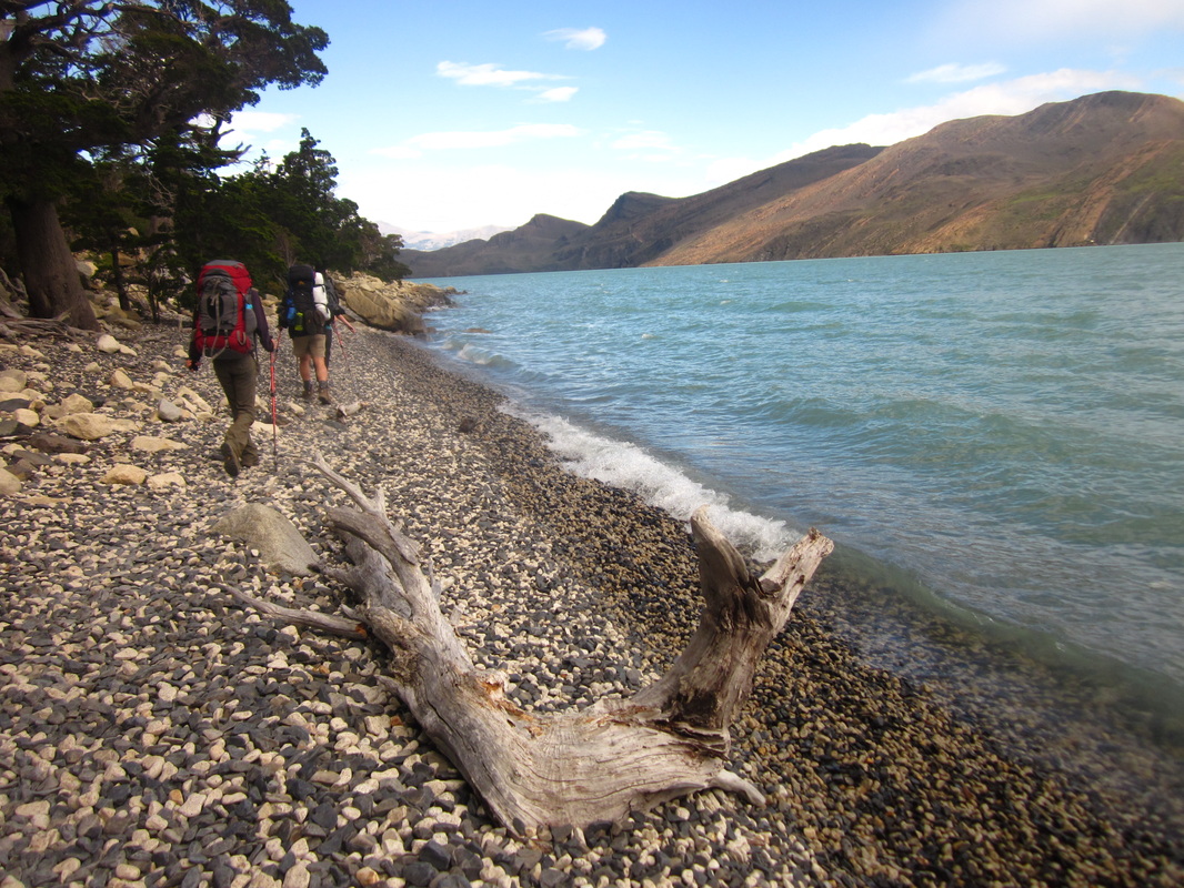 Hiking by Lago Nordenskjöld, W-Circuit, Torres del Paine National Park Day 4 Hiking distance: 20 km Today's hiking took us through rolling hills covered in green foliage, past bright blue lakes, and by wild horses grazing in the meadows. We commented that it reminded us of Scotland, despite nobody having been to Scotland at that point. But, hey, pictures. Much of the hike was uphill so it was hard on my feet and knees. Toward the end of our hiking for the day, we crossed the river pictured below, and began a climb upward to Campamento Torres. Luckily, we were able to stop at Refugio Chileno before the last part of the trail to grab a quick snack and rest for a few minutes. Our plan was to camp at Campamento Torres, wake up before sunrise, and complete the hour-long climb to the Torres lookout just in time to see the sunrise over the Torres with some breakfast. 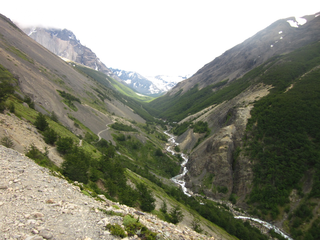 Views on Day 4, W-Circuit, Torres del Paine National Park 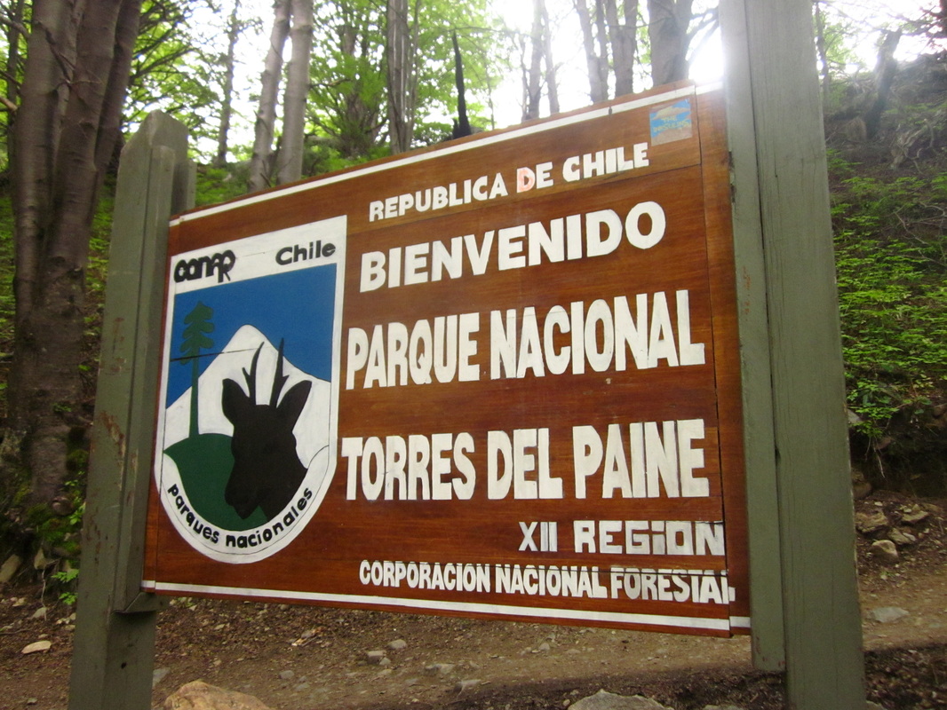 Welcome sign as we were leaving, W-Circuit, Torres del Paine National Park Day 5 Hiking distance: 10 km (approximately) As you may notice, I have no pictures of the actual Torres, the most famous landmark in Torres del Paine National Park. The reason for the lack of photo evidence is that, despite us waking up at 3:45am and climbing up to Mirador Torres, we were completely engulfed in a blizzard. Snow was falling heavily, our gloves and hats got soaked from the snow, and visibility was extremely low. We couldn't even see the outline of the Torres after the sun rose. Eventually, we had to accept the fact that we were cold, wet, and going to leave without seeing the Torres. It is important to note that the climb to the Mirador Torres is very steep and quite challenging. Headlamps are crucial if you are trying to climb before sunrise, particularly in the areas where you have to scramble over rocks and boulders. I hear the view at the top is worth it. I hope to experience it another time in my life! By the time we descended to camp, our group was freezing, soaked, and ready to be done. We threw our gear into our bags (to be sorted and dried later at our hostel) and practically ran down the trail to Hosteria Las Torres, where we changed into warm, dry clothes, scarfed down an amazing breakfast buffet, and waited for the bus to Puerto Natales in the cozy lobby. I would say that I was a little disappointed that we didn't get to see the Torres, but I wasn't crushed. I felt that so many scenic and impressive views occurred in the first 3 days of our trek - Glacier Gray, Paine Grande, Los Cuernos, Valle Frances - and I was incredibly grateful that we had perfect weather for those days. We missed one landmark but got to enjoy so many others throughout the W Circuit that I can't say the blizzard ruined our trek. Some people propose going the reverse direction, starting with the Torres and ending with Glacier Gray and the catamaran. I was happy with the route we took, and I think that either direction will give you opportunities for beautiful memories. Remember, there's no guarantee for nice weather on any given day! Plus, we actually got to see the Torres from the estancia we stayed at following our hike. They weren't as close as they would have been from Mirador Torres, but they were still majestic in the distance. 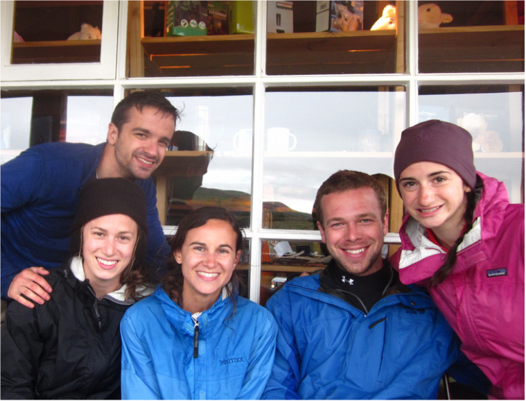 Our post-hike "best photo ever" TipsI highly recommend going to the free Erratic Rock information session in Puerto Natales before you head to the park. It happens every afternoon, and the sessions are given by people who have hiked and guided in the park. Like I mentioned above, some people choose to hike west to east and others choose east to west. You don't have to follow their recommendations, but the Erratic Rock information session is full of great tips on logistics and gear. It's always nice to hear from people who have done the route before. Besides, it's free! What's better than that? 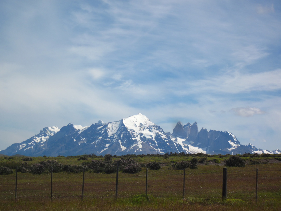 Torres from a distance, Estancia Cerro Guido
0 Comments
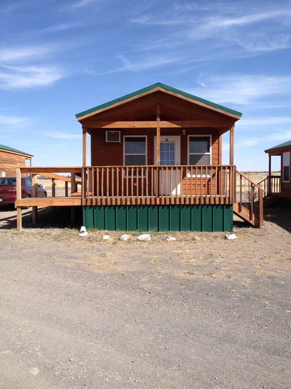
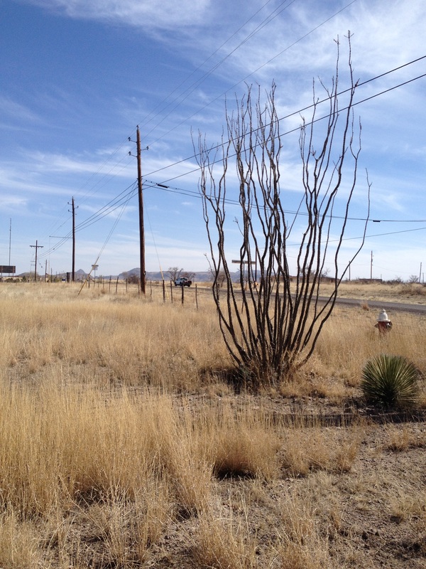 Outside Fort Davis, TX Last year for spring break, my husband, Brett, and I wanted to plan a spring break trip on a budget. We tried to figure out where we could drive to stay on our budget, but the problem in Texas is that you can drive for a whole day and still be in the same state. There are places I want to go in Texas, like Padre Island National Seashore, but no way were we heading to the beaches on spring break. So, after considering our options within driving distance, we decided to head west to Marfa and Big Bend National Park. Though Big Bend National Park is in Texas, it took us an entire day's drive to get there. Before heading to the park, we stopped in Marfa and Fort Davis. Read on to hear about our adventures in west Texas! 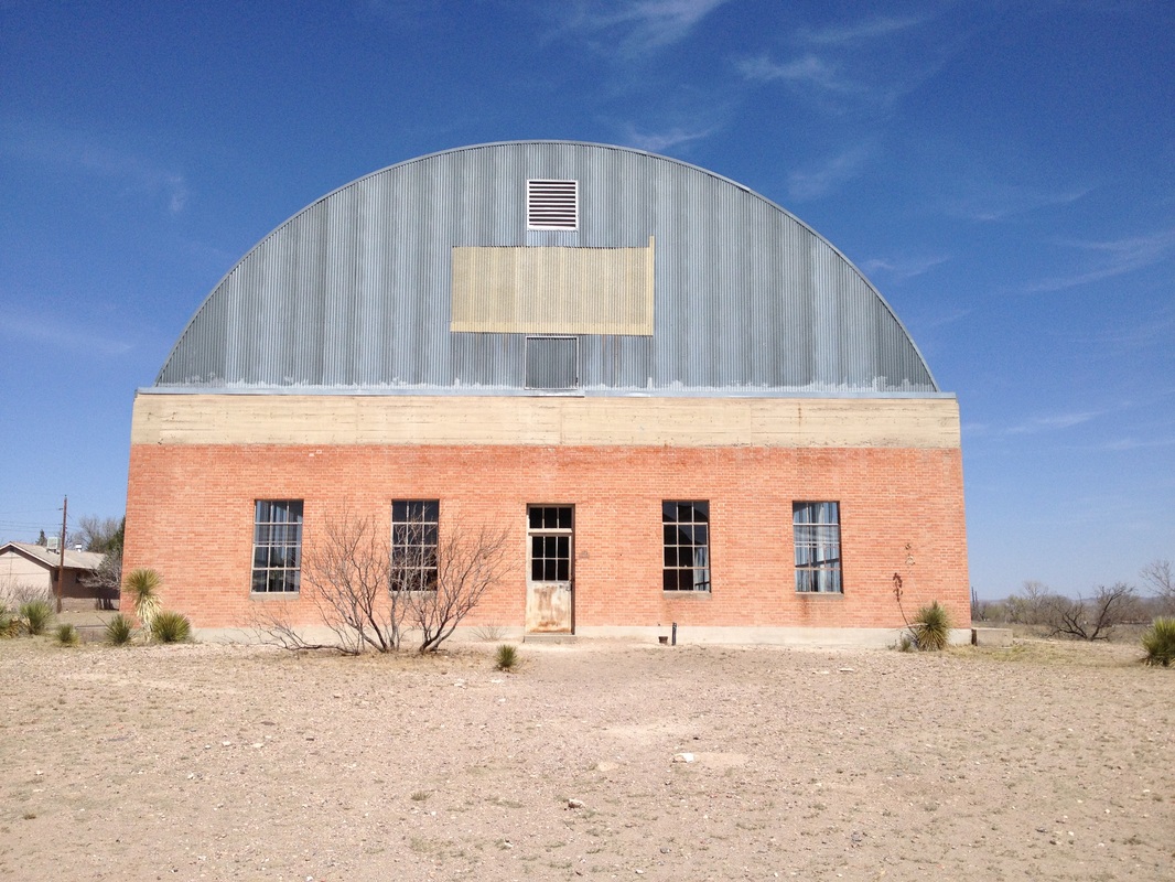 Chinati Foundation, Marfa, TX MarfaMarfa is an odd town. It is a tiny, dusty, west Texas town, seemingly no different than the other tiny, dusty, west Texas towns. However, it has gained legendary status for a couple of reasons. First of all, in 1971, artist Donald Judd moved to Marfa and created large scale, minimalist art installations there. Now, Marfa is known as a hub for minimalist art. You can visit Judd's minimalist art at the Chinati Foundation, where there are indoor and outdoor art pieces. The pieces play with light, shadow, and angle to create different effects from different perspectives. Inspired by Judd, other minimalist artists have taken up residence in Marfa and have left their imprint on the town. Unassuming storefronts in the town disguise art galleries. We walked into Marfa Book Company, which sold a variety of books, including some about art and Texas. When we walked through a doorway in the back of the shop, Brett and I found ourselves in yet another art gallery. Even if you drive 26 miles outside of town, you'll find Prada Marfa, a permanent sculpture installation. Exploring Marfa is like being in Alice's Adventures in Art Wonderland: just when you think you have the little town figured out, you might fall down a rabbit hole to find a whole new experience with minimalist art. Marfa is also famous for the mysterious "Marfa lights", mentioned in the song "No Spare Parts" by the Rolling Stones. I learned that fun fact from Brett, who loves the Stones. The Marfa lights can be found just outside of town in a specific spot, where there is a viewing platform set up just for visitors who want to see the famed lights. They are glowing orbs that appear to dance, move, converge, and diverge in midair. People have seen the lights since the 1880s and have offered countless explanations, from paranormal phenomena to car headlights to aliens to gases. They do not appear every night, so some would-be viewers drive away disappointed. Unfortunately, on our spring break trip, we did not have time to drive out to the platform and wait for the lights. 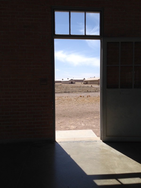 Chinati Foundation, Marfa, TX Fort DavisThough we visited Marfa for a day, Brett and I stayed in Fort Davis, which is near Davis Mountains State Park. If you are in the area, go to Davis Mountains State Park. We drove through it at sunset and were amazed at the landscape that was illuminated in pinks and purples. There are hiking trails and camping opportunities in the state park. Fort Davis is unincorporated and tiny, the majority of the town confined to one street. Fort Davis only had a few restaurants, but we were able to find a grocery store for provisions before heading to Big Bend. Though it is a tiny town, staying in Fort Davis gave us a great location for exploring the area. The towns of Alpine and Marfa are an easy drive, Davis Mountains State Park is nearby, the McDonald Observatory overlooks Fort Davis, and Big Bend National Park is a few hours away. We stayed at Mountain Trails Lodge & Outdoor Learning Center, which I highly recommend. Brett and I stayed in one of these cute little cabins, which contained a queen-sized bed, kitchenette, and porch. I really enjoyed the breakfast that was included in our room rate. It was a hearty, home-cooked meal. We could help ourselves from the buffet and savor the meal at brightly colored tables and chairs in the dining room. The main lodge and dining room had huge framed maps of Texas from centuries past, when it covered more territory and when it was its own country. I adore maps and, not being familiar with Texas state history, found them fascinating. With breakfast, they served coffee from Big Bend Coffee Roasters in Marfa. There was something that felt very adventurous and exciting about holding my warm coffee that was locally roasted and looking out the window at the desert landscape, planning that day's adventure. It felt very full of possibilities.
McDonald ObservatoryGo to a Star Party. I cannot recommend this highly enough. Should I say it again? Go to a Star Party. Brett and I visited McDonald Observatory one night for a Star Party, and it was our favorite activity on the whole spring break trip. McDonald Observatory is located in the Davis Mountains, over 400 miles from Austin, but it is still property of the University of Texas at Austin. The observatory sits far out in west Texas, on top of a mountain, where there is little to no light pollution. The observatory hosts Star Parties a few nights a week, led by astronomers, for the general public to learn about the objects in the night sky. We began our party in an amphitheater. The presenter has a laser light that he used to point out stars, planets, nebulas, and constellations. Now, I don't get very excited about technology but the laser was cool. It seemed to extend all the way to the actual objects, so the presenter could circle stars and connect them to make constellations. If you go to a Star Party, remember that the McDonald Observatory is in the northern Chihuahuan Desert, and it can get cold at night. We went in March, brought coats and gloves, and still had to ask the family next to us to borrow a blanket. Despite the cold, we loved the orientation to the night sky and hearing facts about outer space. After the presentation, we had the opportunity to look through various telescopes at the observatory, staffed by University of Texas at Austin students. I saw a close-up view of the moon's surface, craters and all. I also saw Jupiter and its famous spot. I was able to see a few nebulas, though I can't remember the specific names. When you live in the city, sometimes you forget how much the night sky is affected by light pollution. It was really amazing to experience the night sky in the Davis Mountains, where the velvety blackness was packed with brightly lit stars. 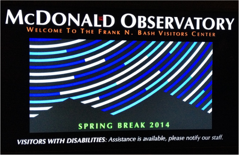 STAR PARTY at the observatory! Big Bend National ParkFrom Fort Davis, Brett and I headed down to Big Bend National Park, which lies on the Rio Grande River, just north of the Mexican border. Big Bend is a desert park, but it contains a wide variety of landscapes, from desert plants to the Chisos Mountains to the Rio Grande River. Visitors can camp at one of three campgrounds (Chisos Basin, Cottonwood, Rio Grande Village) or at primitive backcountry sites. Or if hotels are more your speed, you can stay at the Chisos Mountain Lodge. Brett and I chose to camp in the Chisos Basin campground, since we both prefer to be up in the mountains. The campground sits in a basin, so peaks of the Chisos Mountains rise up around the campsites. Our favorite part of the park was the Chisos Mountians. However, another beautiful natural feature is the Santa Elena Canyon, created by the Rio Grande River flowing through it. Many visitors choose to swim in the river or to take guided river rafting trips through the canyon. Fun fact about Big Bend National Park: "In 2012, the park was named as an International Dark Sky Park by the Internationsl Dark-Sky Association, which recognized the park as one of only ten places on the planet certified for dark sky stargazing. In addition, the Association recognized the park as having the darkest measured skies in the lower 48 United States. " (Wikipedia) 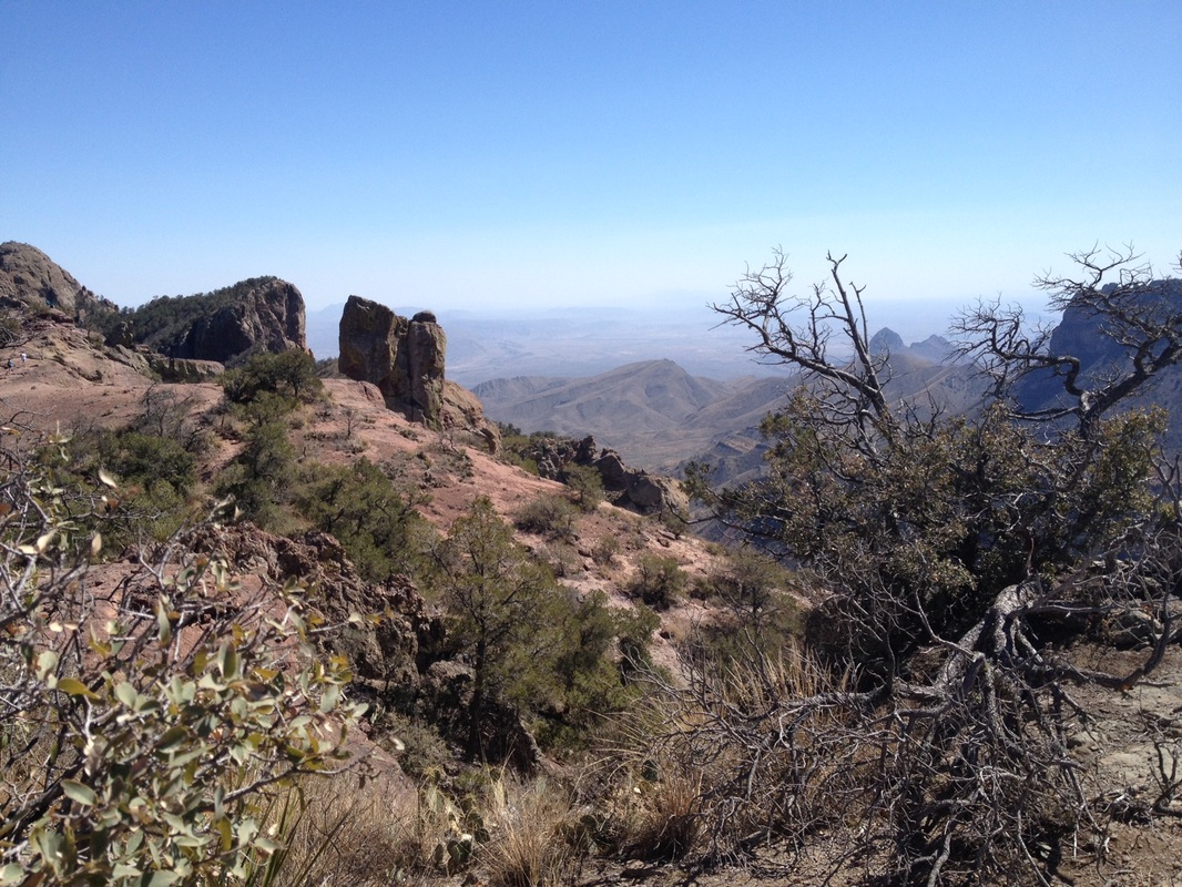 Big Bend National Park, seen from Lost Mine Trail 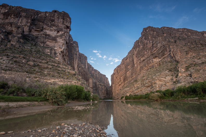 Santa Elena Canyon II / Steven Leggett / CC BY-NC-SA 2.0 Lost Mine TrailLooking at the map of trails for a moderate hike, Brett and I chose the Lost Mine Trail in the Chisos Mountains, which is 4.8 miles round trip. The trail was moderately difficult, with some steep sections. The Lost Mine Trail wound up to a beautiful overlook, where we could see the Chisos Mountains, the desert, and beyond into Mexico. At the top, we rested, enjoyed some water and energy bars, and took in the expansive views. We were able to do the whole trail, round-trip in a few hours one afternoon. At the trailhead, signs warned us of crossing paths with wildlife, including mountain lions, but Brett and I saw no trace of wildlife other than birds. Though we passed other people on the trail, it was not overly crowded, despite us visiting during spring break. A great hike in the park for people who want a little bit of a challenge but don't want to commit all day to one of the more strenuous hikes, like South Rim or Emory Peak. For some other trail suggestions, visit the Big Bend National Park website to see mountain hikes, desert hikes, and river hikes. 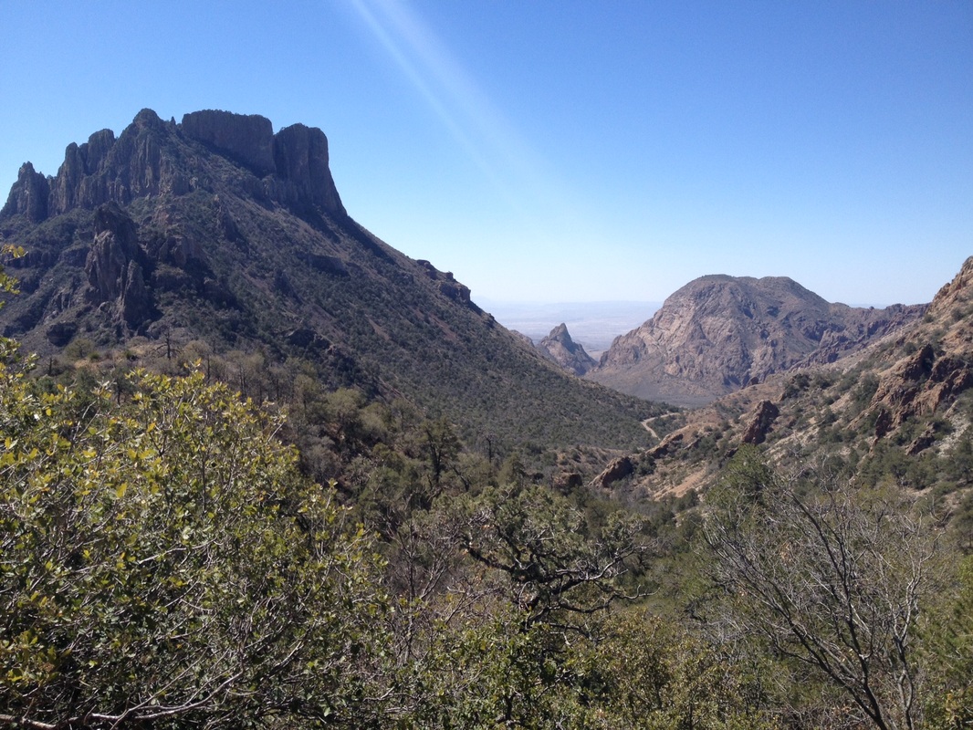 Big Bend National Park, seen from the Lost Mine Trail 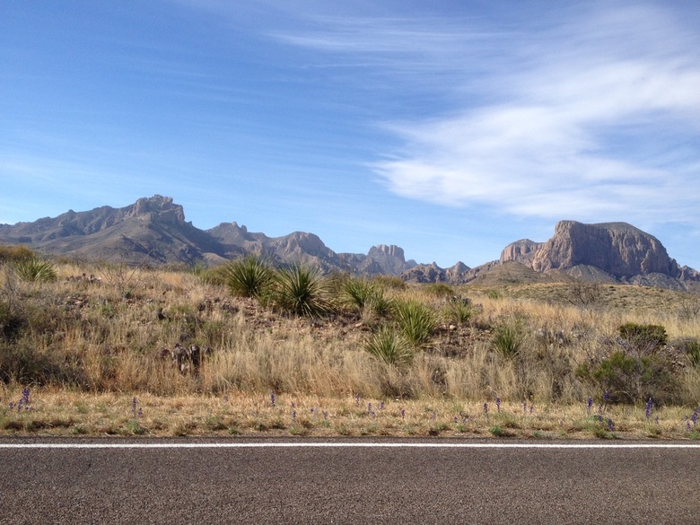 Chisos Mountains and desert plants from a park road Window View TrailThis trail is not about the hiking; rather, it's about the view at the end. The Window View Trail is only about a quarter of a mile, and the path is paved. It leads to "the window", a view between the peaks of the Chisos Mountains that is perfect for watching a Big Bend desert sunset. As the sun sinks behind the mountains, the sky is painted with hues of yellow and orange, framed by dark, jagged rocks. There are benches to sit on while watching the sunset, and be sure you have a flashlight or headlamp for the way back, as the path is not well lit after dark. Viewing the sunset at the window is the perfect ending to a day outdoors at Big Bend National Park. 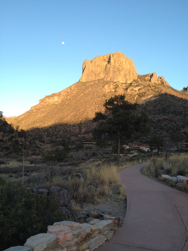 The beginning of the Window View Trail at dusk 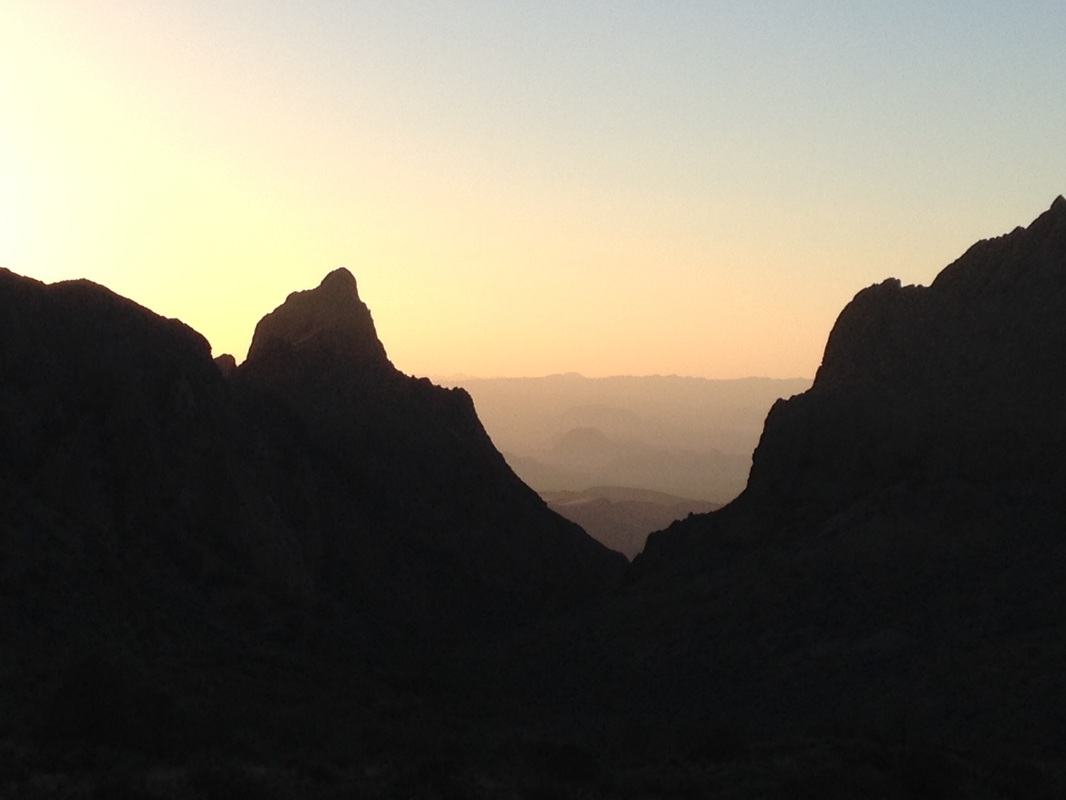 Sunset at the window in Big Bend National Park |

AuthorMy name is Alyssa Good and I have a passion for travel, adventure, culture, and new experiences! I focus on budget friendly travel, trip planning resources, and seeking out new experiences. Archives
December 2017
Categories
All
|
 RSS Feed
