|
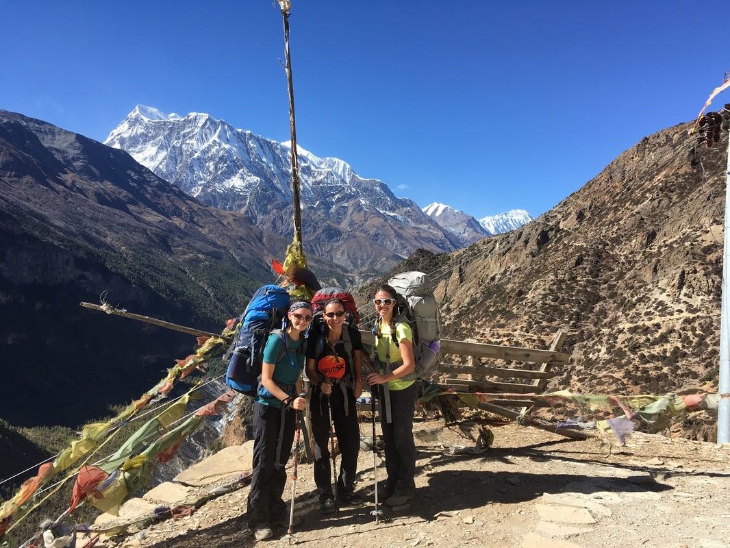
This is a continuation of my series on the Annapurna Circuit Trek, which we trekked in late November. Check out our itinerary here. 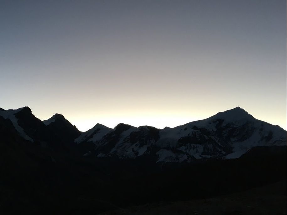 Sunrise, Annapurna Circuit, Nepal When my phone alarm went off at 3:45am, I had a difficult time getting out of my sleeping bag because the temperature was extremely cold and it was extremely early. I peeled myself out of my sleeping bag and began putting on layer after layer clothing, in order to keep warm while crossing Thorong La Pass. I was wearing nearly every piece of clothing I had packed - thick socks, two pairs of leggings, hiking pants over the leggings, gaiters, tank top, long-sleeved shirt, fleece, down jacket, rain coat, buff, warm hat, thin gloves, ski gloves over the top. When we had dressed most of the way, we headed to the dining room to eat breakfast, sitting with some of our trail friends and discussing the day ahead. Group after group trickled out of the dining room, so we decided we should hit the trail as well. As we gathered our packs, we saw a line of headlamps coming up from Thorong Phedi and passing through High Camp. These were the people who had slept at the lower camp and completed the steep uphill to High Camp that morning. Once again, I was grateful to have stayed at High Camp the night before. Everyone starts before sunrise because it is a long day of trekking and the winds at the pass pick up around 10:00am, meaning that hikers want to be across the pass well before 10:00am. The estimated time from High Camp to Thorong La Pass was 3 hours of hiking, so that means an early start is essential. Overnight, water had frozen in the barrel where you could fill up your water bottle. This meant we were unable to top off our water bottles before setting off toward Thorong La Pass. We left the water barrel and headed for the trail...except, in the dark, it was impossible to orient myself. Even with my headlamp, I couldn't tell where the trail up to the pass began, and most of the groups had departed ahead of us. I think this is important to mention because it hadn't even occurred to me that I would have trouble finding the route in the dark. Luckily, with the headlamps of other trekkers, we were able to find the trail and began the journey up to Thorong La Pass. Day 9 of the Annapurna Circuit was a long, grueling, and emotional day, but it was also incredibly rewarding to cross the Thorong La Pass, which we had been climbing toward for eight days! 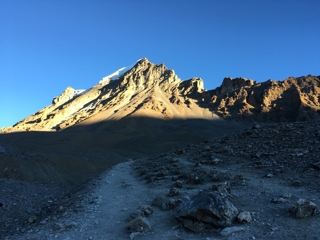 Landscape on the way to Thorong La Pass, Annapurna Circuit, Nepal 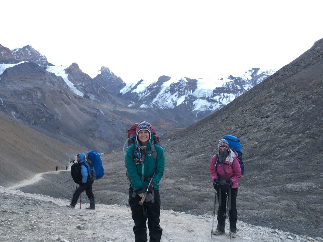 Ciara and I heading up to Thorong La Pass, Annapurna Circuit, Nepal During the first section, we hiked completely in the dark with only our headlamps lighting the way. Slowly, the sky took on a rosy tint behind the mountain peaks, and the landscape began to lighten as the sun rose. The scenery looked remarkable in the glow of the sunrise. The air was cold, and I felt it in my hands, even with ski gloves. Breathing was difficult due to the altitude and - though I didn't realize it at the time - a cold that I had developed along the Circuit. The icy air irritated my lungs with every breath and caused coughing fits, so I pulled my buff over my nose and mouth. It was a little suffocating but protected me from the cold air and eased my breathing. For the most part, the trail was less steep than the hike between Thorong Phedi and High Camp. However, this doesn't mean that the hike was easy. Because breathing was extra hard for me, I lagged behind our group a bit and had to stop frequently to cough. Time became a fluid concept because I was so concerned with the effort of breathing, moving uphill, and staying warm. The morning seemed to simultaneously fly by and drag on. It seemed as though there would never be a moment when I wasn't trudging uphill. Luckily, I realized that I needed to enjoy the moment and paused to take in my surroundings, not caring about anyone else's pace. The surrounding peaks with the sun rising behind them were awesome. I hadn't ever started a trek before dawn, so seeing the sun rise in the mountains was a special treat. The nearby mountains were beautiful with the contrast between dark rock and white snow drifts. And, despite the effort, I was grateful that I was in Nepal. As I admired the scenery and gave myself a pep talk, I heard Rachel and Ciara shouting down to me, "THAT'S THE PASS!" My first thought was, 'No way. I will be hiking forever before I get to the pass.' But, I looked up, and there were prayer flags waving just above the spot where my friends were standing. I was SO CLOSE to the top. 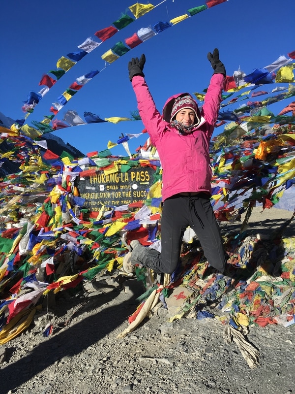 At the top of Thorong La Pass, Annapurna Circuit, Nepal 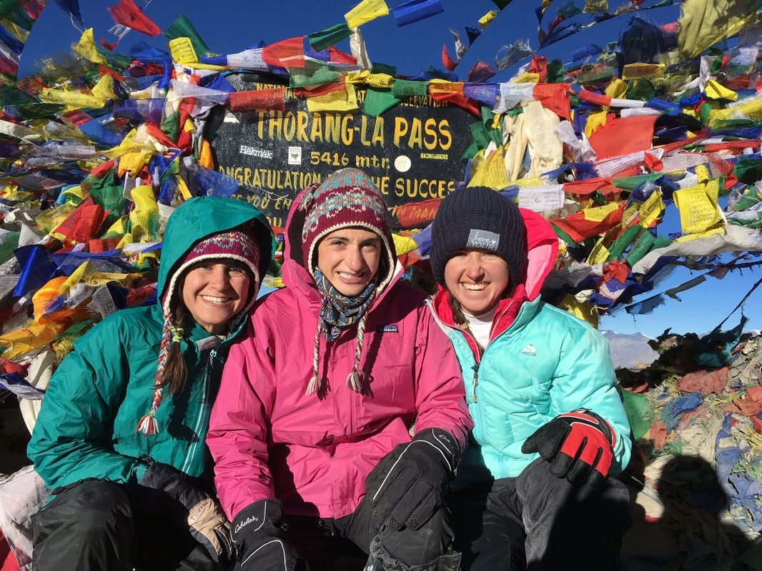 Trekking group on top of Thorong La, Annapurna Circuit, Nepal Together, we hiked the last few meters to Thorong La Pass, where I saw the sign draped with strings of prayer flags. A little teahouse stood by the side of the path, and cold trekkers huddled near the entrance for warmth.
After working so hard to reach the pass, our group took a lot of pictures by the sign and the prayer flags, commemorating our achievement. I also strung prayer flags that I had bought in Manang, took a moment to say a prayer, and watched the flags flutter in the wind, carrying my intention out into the world. Thorong La Pass was cold and windy. I had to step in the teahouse for a minute, just to get out of the wind, which cut through my layers and chilled me quickly. Around us, mountains were capped with snow, but we did not encounter any snow or ice on the pass itself. We were told that this was unusual for late November and that it was an unseasonably warm year. I didn't end up needing the gaiters for snow protection, but they did act as leg warmers, helping to shield the wind a bit. I was glad that I had worn all my layers. Even wearing all our warmest clothes, we were ready to head down after about 20 minutes. 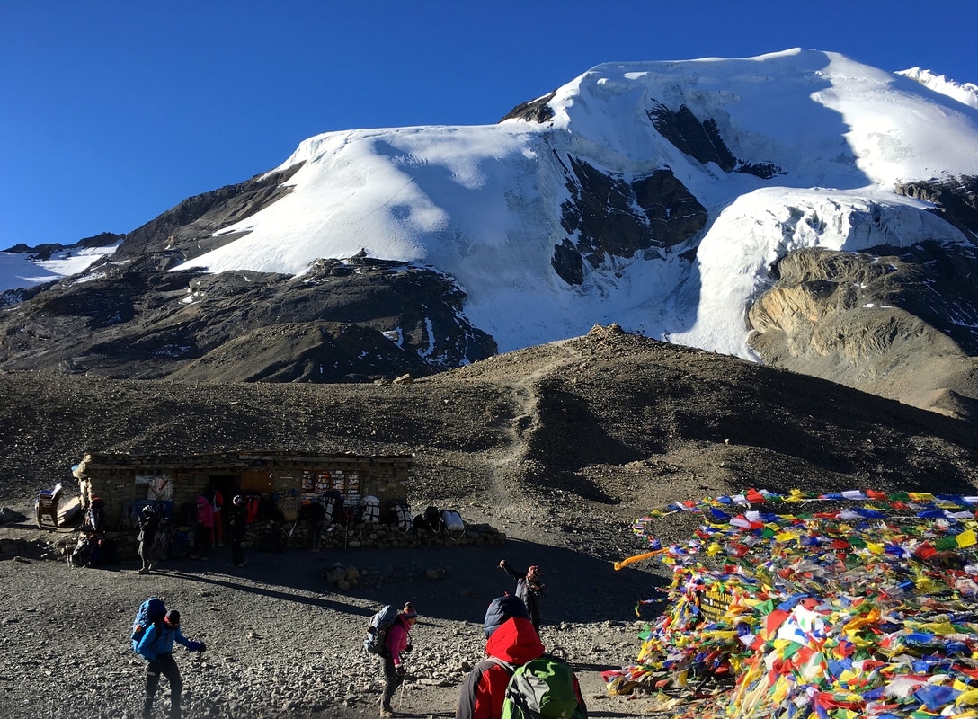 Thorong La Pass Teahouse, Annapurna Circuit, Nepal 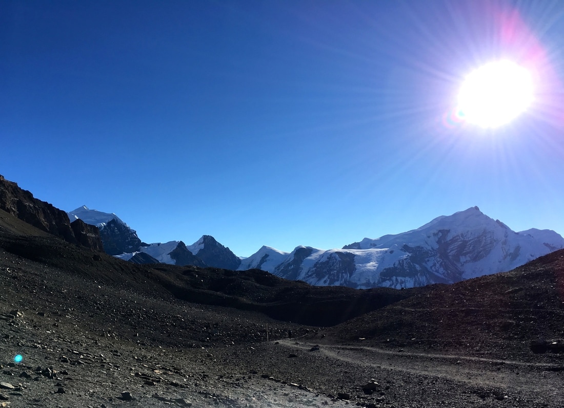 View from Thorong La Pass, Annapurna Circuit, Nepal The trusty "Altitude Trekking Time" sign from earlier in the trek had estimated 3 hours from High Camp to Thorong La Pass, and we had reached the pass in 2.5 hours. I felt so proud of myself, and it was literally all downhill from there. From Thorong La Pass, we headed down to Muktinath, descending 1600 meters (5249 feet) in 4 hours. The descent was very hard on my knees, calves, and toes, but I was able to move a lot faster than the uphill portion of the day. As we descended, the temperature increased, a result of decreasing altitude, moving out of the wind at the top of the pass, and the sun rising higher in the sky. We began shedding layers. Eventually, I was down to one pair of leggings and a long sleeved shirt, removing my rain coat, down jacket, fleece, extra long sleeved shirt, gaiters, hiking pants, extra pair of leggings, gloves, and hat. On the other side of the Thorong La Pass, we entered the Mustang region of Nepal, a region with an interesting history and landscape. The Annapurna Circuit cuts through Lower Mustang, whereas Upper Mustang was restricted to visitors until recently, meaning it is a remote and isolated region. Due to this isolation, Upper Mustang area is one of the most well-preserved regions of Tibetan culture and traditional Tibetan languages in the world. Even today, though visitors are allowed, they cannot enter Upper Mustang without a special permit and guide. We did not need any special permits to trek through Lower Mustang on the Annapurna Circuit. Visually, Lower Mustang was very different than the part of the Circuit that we had already completed. Almost immediately, I noted the very dry, brown, rocky, desert-like landscape. To me, it looked almost otherworldly. In the distance, we could see the tops of more snow-capped mountains, including Dhaulagiri, an 8000 meter peak and the seventh highest mountain in the world. 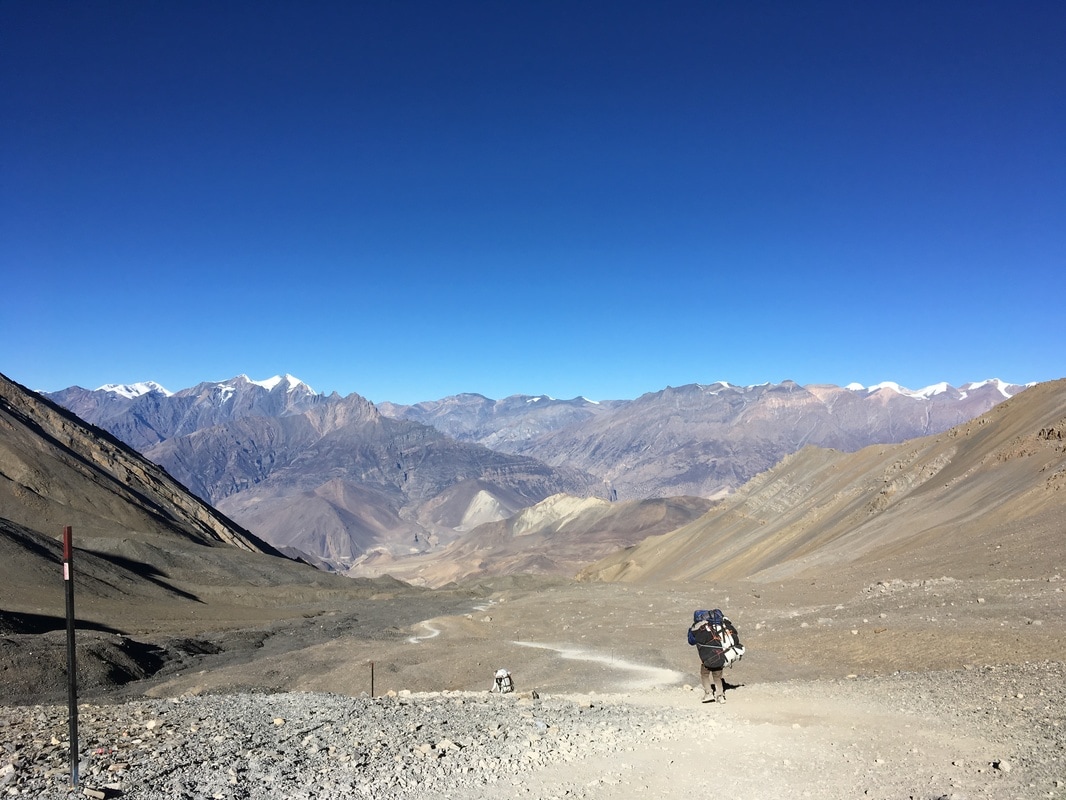 Headed down to Muktinath, Annapurna Circuit, Nepal 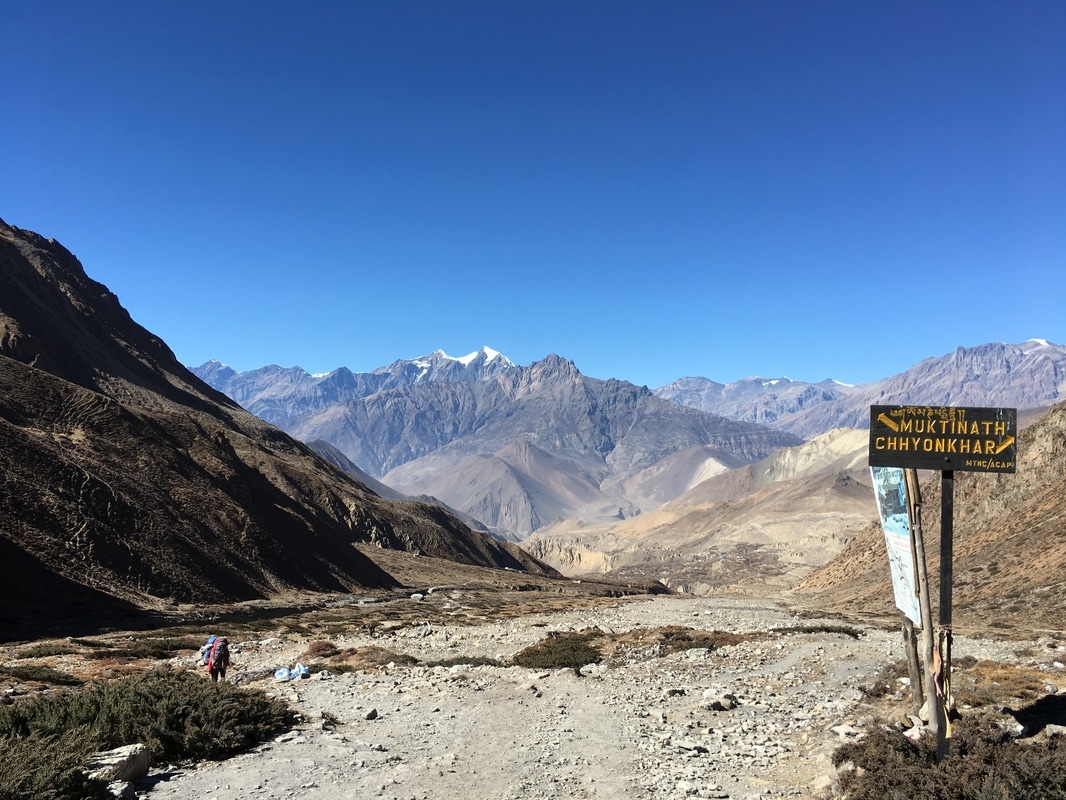 Trail toward Muktinath, Annapurna Circuit, Nepal 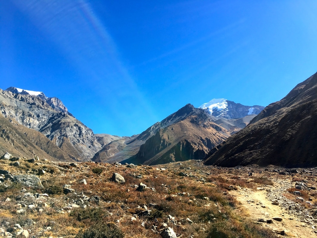 Scenery going downhill, Annapurna Circuit, Nepal There is one tiny town between Thorong La Pass and Muktinath, called Charabu. We stopped briefly to buy water and a snack, resting for a short while before continuing to Muktinath. Muktinath is a sacred place for both Hindus and Buddhists, a popular pilgrimage site for many worshippers. Just outside the town is a huge temple complex. We passed it on the way into town. Even though Muktinath sits at 3800 m (12,467 ft) in altitude, the air felt so much thicker compared with the Thorong La Pass. Because of the early morning start, we arrived around lunchtime, though we were tired from almost 7 hours of trekking. We picked a hostel in Muktinath, dropped our packs in the room, and headed up to the rooftop patio, where we ordered lunch and rested our sore bodies in the sunshine. From the rooftop, we could see the surrounding mountains. Our group spent the afternoon reading, eating, exchanging photos, and messaging our families using the wifi at the teahouse. Though many teahouses along the Circuit offer wifi, the teahouses at higher altitude either required payment for wifi or did not offer it at all, so we had been unreachable since Manang. I took a shower in the solar powered shower while the afternoon sun was still strong, and the hot water felt glorious after the tough day. At night, sitting in the dining room by the fire, I felt a sense of accomplishment. I had been nervous about the altitude and difficulty of crossing the Thorong La Pass. I was tired, but I had made it! 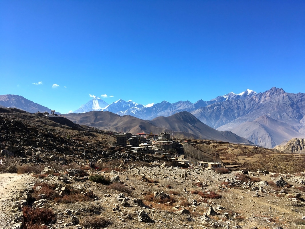 Views of Muktinath with Dhaulagiri in the background, Annapurna Circuit, Nepal 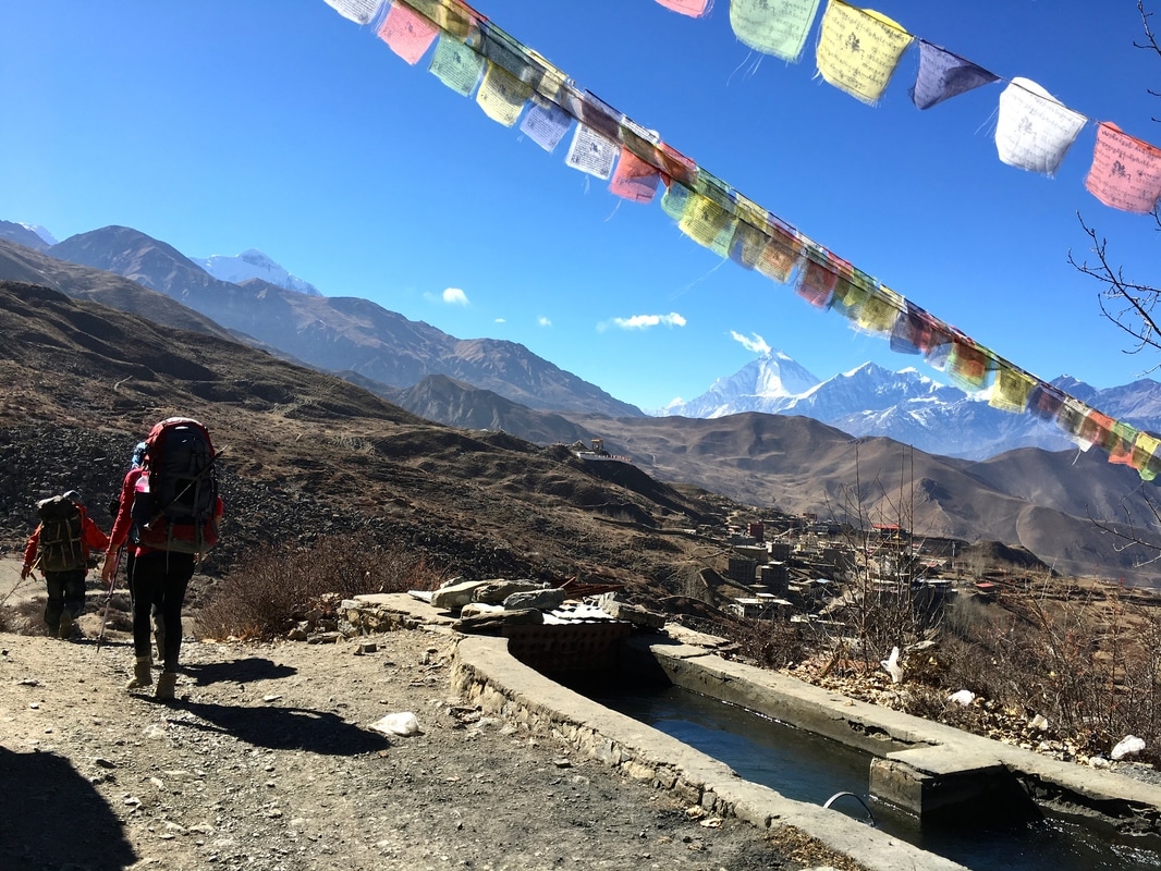 Trekking to Muktinath with Dhaulagiri in the background, Annapurna Circuit, Nepal 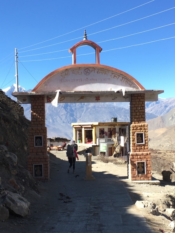 Entrance gate to Muktinath, Annapurna Circuit, Nepal Daily trekking distance: 10 km
Total trekking distance: 108 km Starting elevation (High Camp): 4850m/15,912 ft Highest elevation (Thorong La Pass): 5416m/17,770 ft Ending elevation (Muktinath): 3800m/12,467 ft Costs Room with attached bathroom + food (lunch, dinner, breakfast) Muktinath: 1480 NPR ($14.34) Safe Drinking Water Station: 40 NPR ($0.39)
0 Comments
 When planning our Annapurna Circuit trek, I pieced together information from the internet and got a pretty good idea of what to pack and what the route would be like. However, my friends and I found ourselves frequently starting sentences with "I wish I had known..." So, here is a list of 15 things that we discovered along the way: 1. You need passport photos for the trekking permits. I had read this online. What I didn't know was that there were abundant places to take passport photos near and in the permit office. My friend, Rachel, realized she needed more passport photos, and she was able to take them in the permit office for super cheap. I paid $45 at Walgreens. 2. There is a stand with coffee and pastries at the tourist bus stop. Take the earliest bus out of Pokhara and grab breakfast at the bus stop. With the 6:30am bus, we arrived in Besisahar around 11:00am, took a jeep a few towns further, and had the whole afternoon to start our trek. 3. If you're short on time, a jeep is worth it, and there are always other trekkers who will want to split the cost. 4. You can buy things along the way. I don't think I truly believed people who said this online, but I was able to buy cookies, Snickers bars, hand sanitizer, and pads in towns along the trail (Chame and Manang). I even bought a warmer hat. Shops in Pokhara and Kathmandu sell knock-off gear, including down jackets and sleeping bags, for cheap prices. 5. Don't stop at the first teahouse in each town. Keep walking. There is a good chance the nicer ones are further on.  6. Pay for everything at the teahouses when you leave in the morning. They keep a running total. Early on in the trek, I paid for my shower on the spot, and the teahouse owner tried to charge me again the next morning. I truly believe this was an honest mistake on his part - I threw him off by paying only part of my bill the previous night. 7. You will sweat a lot the first few days at lower altitudes. I was so worried about being cold later in the trek that I hadn't considered being too warm at the beginning. I was grateful that I had brought a clean set of clothes for sleeping at night so that I could escape my sweaty trekking clothes at the end of the day. 8. Sometimes, the teahouses will give you extra helpings of your meal for free. This was not the case with all menu items (like momos), but we frequently got more servings of dal bhat and curry with rice. 9. Some teahouses are willing to barter on the room cost, since food is where they make the majority of their money. Many offered a free room if we agreed to eat dinner and breakfast at their teahouse. 10. The domestic and international terminals at the Kathmandu airport are not connected. If you have a domestic flight, you have to fully exit the international terminal and walk down the road to get to the domestic building, as we learned for our flight from Kathmandu to Pokhara. We had to ask for help from a really nice taxi driver.  11. Buy Diamox in Pokhara or Kathmandu. In the US, you need a prescription for this medication. In Nepal, it is readily available at pharmacies without a prescription. I took Diamox above 10,000 ft to help with acclimatization. 12. Wear a buff. It is very dusty along the road as well as above treeline when its windy. Protect your lungs from all the dust being kicked up. I started using my buff later in the trip, after I had already developed a cough. 13. Do the Upper Pisang Trail! It's very challenging but unbelievably scenic and helps with acclimatization, since you climb high then sleep low at Manang. It also made the walk to High Camp and over the pass a little more bearable because we already had pushed our bodies on the steep Upper Pisang Trail. Read about our day on the Upper Pisang Trail here. 14. You can use European or American chargers almost everywhere. Prior to the trip, I had unsuccessfully scoured the internet to find out whether I needed additional power adapters to charge electronics. Ultimately, I packed my universal adapter and was totally fine. Also, electronics like iPhones and Kindles - the only two electronics I brought - don't need voltage converters, just the adapter to fit the plug into the socket. 15. Nepal will steal your heart with its breathtaking scenery, fluttering prayer flags, and kind people. You will be longing to go back again. 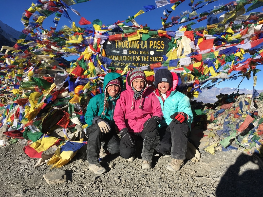 |
AuthorMy name is Alyssa Good and I have a passion for travel, adventure, culture, and new experiences! I focus on budget friendly travel, trip planning resources, and seeking out new experiences. Archives
December 2017
Categories
All
|
 RSS Feed
