|
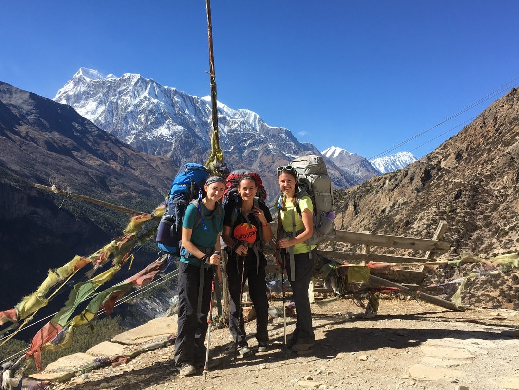
This is a continuation of my series on the Annapurna Circuit Trek, which we trekked in late November. Check out our itinerary here. 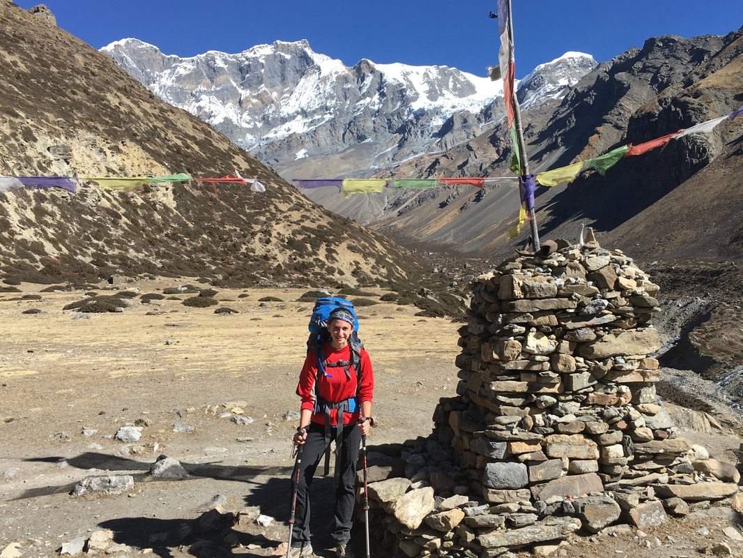 Posing with the scenery, Annapurna Circuit, Nepal Sufficiently rested after a full day in Manang, we set off again on Day 7, headed for Letdar. The landscape was a stark contrast to the first few days of trekking. We were above treeline in the alpine zone, a barren world of rocky slopes, broken up only by low shrubby plants. Still towering above us were snow-covered peaks. I had never been at an elevation this high, so the scenery was completely new to me. The hiking on Day 7 passed quickly. We had to complete shorter distances now, so that we did not gain altitude too quickly. Initially, I was breathing hard due to the altitude, but I felt stronger than at the beginning of the trek. I could tell that I was building my endurance and acclimatizing well. I was sure that we were moving slowly, but our group actually hiked faster than the estimated trekking times. 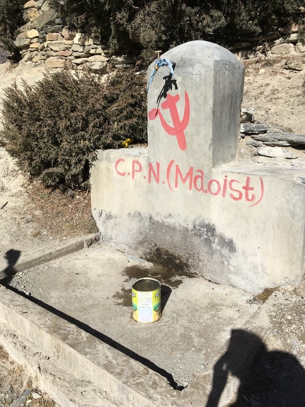 Communist Party of Nepal (Maoist) graffiti, Annapurna Circuit, Nepal Our group took our time leaving Manang, since the day's hike was shorter than usual. We mailed postcards to family and friends on the way out of town. I wrote in my journal that "people will probably get them weeks after we return", which was a bit of an underestimation. Our postcards arrived in the United States four months later! The good weather and sunshine continued on our route to Letdar, and we were able to hike without hats or jackets though it was late November. As a note, we were told that we trekked the Annapurna Circuit during an unseasonably warm year, so the best course of action is to plan for layers, just in case. When we stopped moving, we typically had to pull out our down jackets. Along the trail, we passed some Maoist graffiti. C.P.N. stands for the Communist Party of Nepal, which briefly became the ruling party of Nepal after the Civil War. We saw similar graffiti in a few places along the trek, so it seems that Maoist support continues in these areas. Also, as we were promised by a young Nepalese boy, we saw yak above Manang. We were quite excited to see these animals, as they are native to the Himalaya. 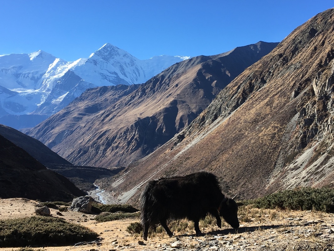 Yak, Annapurna Circuit, Nepal Letdar, pronounced like "letter", cannot really be considered a town. Rather, it is a collection of only a few buildings, and three of these buildings are teahouses for trekkers. Due to the short distance on Day 7, we arrived in the early afternoon, even though we stopped for lunch in the previous town ( Yak Kharka). This gave us plenty of time to relax, order pots of tea, and add to our circle of trekking friends. While Wikitravel says, "Yak Kharka is a small collection of 3 guesthouses and lacking in other amenities, although it is preferable to Letdar which has even less in the way of accommodation", our evening in Letdar was one of my favorites, due to the fun, social atmosphere in the dining room that night. The great thing about the limited lodging options was that the trekkers were more concentrated, so we saw many of our trail friends in the dining room. In my journal, I wrote, "This place is bustling - the first place we've stayed that has a full, busy dining room of trekkers at night." With the amount of people inside and a fire burning in the fireplace, the dining room was a cozy and pleasant place to spend the afternoon and evening. 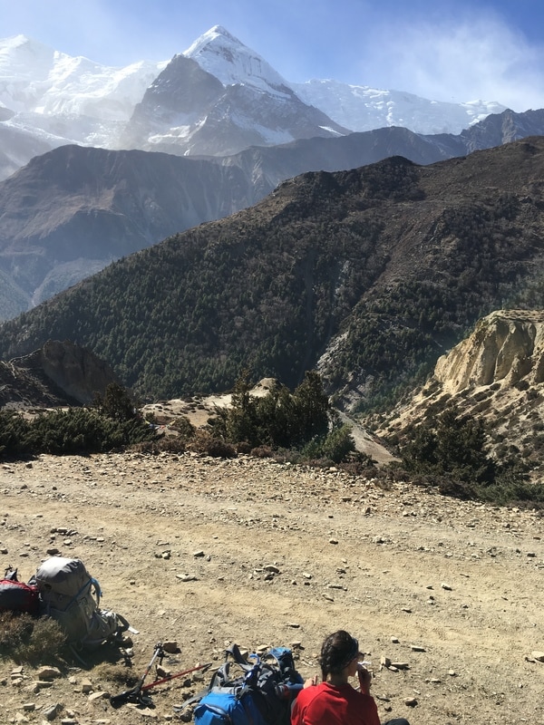 Resting along the trail, Annapurna Circuit, Nepal Daily trekking distance: 10 km
Total trekking distance: 91 km Starting elevation (Manang): 3540m/11,614 ft Ending elevation (Letdar): 4200m/13,780 ft Costs Lunch Yak Kharka: 490 NPR ($4.74) Room + food Letdar: 1085 NPR ($10.50) *The only downside to arriving in Letdar early and spending hours in the fun, social dining room atmosphere is that we ended up spending a lot more on snacks and pots of tea.
0 Comments
This is a continuation of my series on the Annapurna Circuit Trek, which we trekked in late November. Check out our itinerary here. 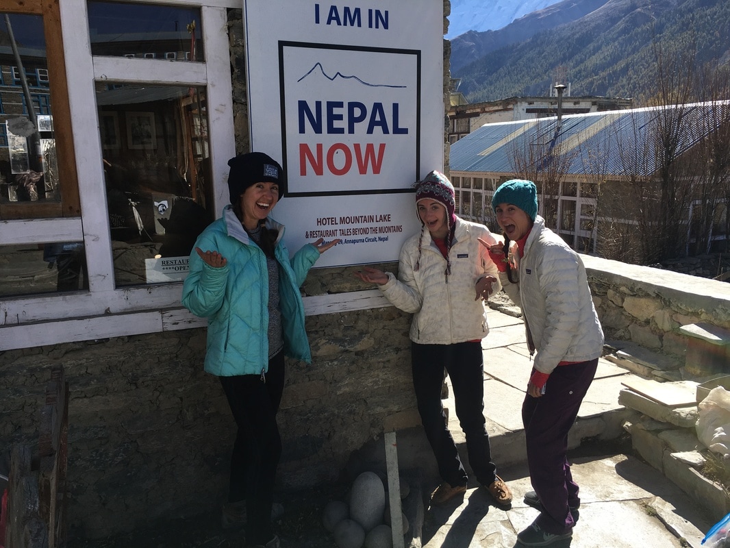 In case we hadn't noticed.... REST DAY! Sitting at the end of the dusty road that follows the Annapurna Circuit, Manang is relatively large compared with some of the other villages. Large, multi-story teahouses line the street and a beautiful mountain, Gangapurna, towers above the town. When trekking the Annapurna Circuit, proper acclimatization is very important, since the Thorong-La Pass sits at 17,770 ft and ascending too quickly can increase the risk of altitude sickness. Every itinerary that I read suggests a rest day in Manang, so that's exactly what we did. 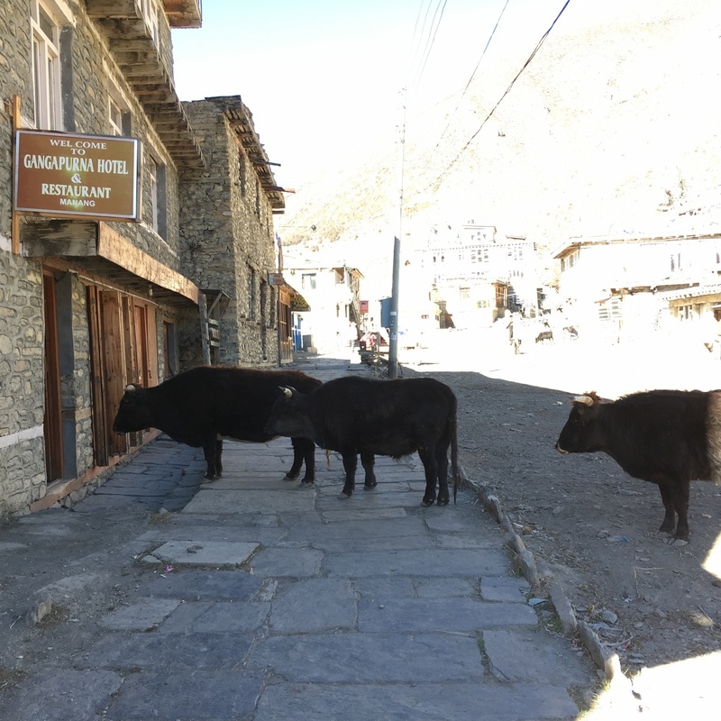 Our "yard yaks" at the Gangapurna Hotel, Manang, Annapurna Circuit, Nepal It was glorious sleeping in, eating a leisurely breakfast, and, most of all, knowing that I didn't have to pick up my backpack at all that day. After breakfast, I eschewed my hiking boots in favor of my soft, comfortable moccasins, grateful to give my feet a break after our tough trekking day on Day 5. We explored some of the small shops and were able to find some needed and wanted items, including hand sanitizer, postcards, and prayer flags. Apparently, Manang is known for its bakeries, so our plan for the day involved finding some pastry and real coffee. We wandered down the road to Sanna Bakery and Coffeehouse, where we ordered coffee, a cinnamon roll, and sat outside in the sunshine. Our intention had been to read and write in our travel journals at the bakery, but we soon became engrossed in conversation with other trekkers. This was one of my favorite parts of the Annapurna Circuit - the sense of community along the trail. We met a lot of trail friends, spent time together in the teahouses, and looked out for each other on Pass day. At the bakery, we met a 63 year old man who has hiked the Annapurna Circuit every year for 20 years. He treks with the same guide each year, now more of a friend than guide. Now, he hires a yak to cross the pass, but still comes back each year because he loves this trek so much. After he departed, a father and daughter sat down at our table. They were in Nepal for a month of trekking, starting with the Manaslu Circuit and continuing through the Annapurna Circuit. From Manang, we followed the same itinerary as this father-daughter duo and enjoyed getting to know them better along the trail. 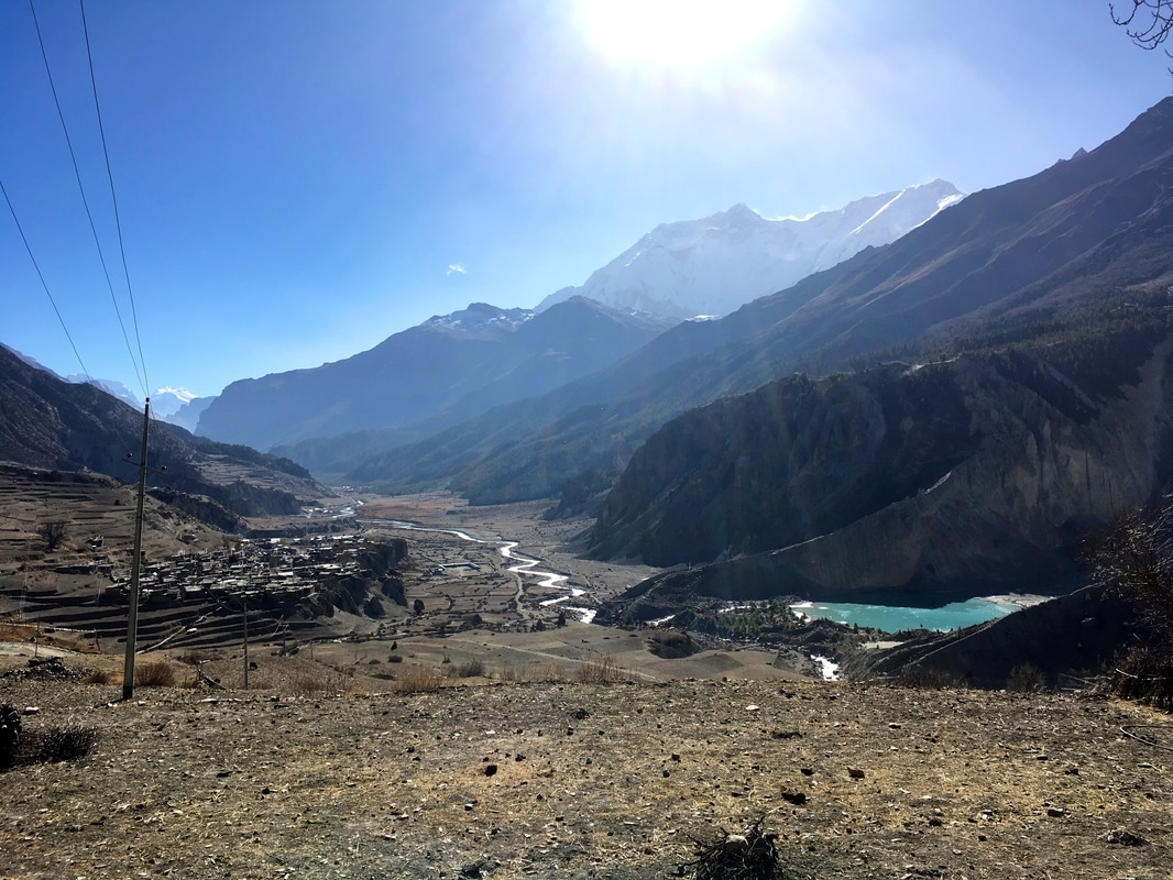 Looking down at Manang, Annapurna Circuit Nepal Before starting the trek, we had read about the numerous acclimatization hikes available from Manang. Some people even add on the Tilicho Lake trek, a multi-day trek from Manang. We did not have 4 extra days for Tilicho Lake, as much as we would have loved to complete it. We considered the option of doing a day hike from Manang, but, ultimately, we chose not to do any side treks on our rest day. People talk about "climbing high and sleeping low" to help with acclimatization, which we had done the previous day by taking the Upper Pisang route. Instead, we relaxed at the bakery with our new friends. Then, we took advantage of the sunshine at mid-day to take showers in the solar-powered shower at our teahouse. Whereas the shower I attempted in Dharapani was FREEZING, this shower was hot and steamy and wonderful. At our teahouse, the Gangapurna Hotel, we met two Argentinians, thanks to Rachel's Spanish skills. One of the Argentinians now lived in Kathmandu and spoke Nepalese. They had a lot of helpful advice for us. In the evening, our new friends mentioned that they were going to a movie theater in town and invited us to join them. The movie theater was a small, cold, concrete room with no windows. A projector and a few rows of chairs had been set up. Since we were the only group at the movie theater, we were allowed to choose the movie, and we used the row of chairs in front of us as footrests. The people working at the movie theater brought us thick blankets, which I spread across my lap to stay warm (I was wearing my down jacket and the fleece-lined hat I had purchased in Chame), and our ticket included tea and popcorn! Initially, I wasn't sure about going to a movie while trekking in Nepal, but I was glad that we did. It was such a different experience than going to a movie in America, and a relaxing experience on our rest day.  Gangapurna, Annapurna Circuit, Nepal Daily trekking distance: 0 km
Total trekking distance: 81 km Starting elevation (Manang): 3540m/11,614 ft Ending elevation (Manang): 3540m/11,614 ft Costs Items at shops (e.g. hand sanitizer, snack, prayer flags, postcards): 850 NPR ($8.23) Tea & cinnamon roll: 320 NPR ($3.10) Water bottle: 100 NPR ($0.97) Movie theater: 350 NPR ($3.39) 2 nights + 2 breakfasts + 2 dinners Manang: 2275 NPR ($22.01) This is a continuation of my series on the Annapurna Circuit Trek, which we trekked in late November. Check out our itinerary here. 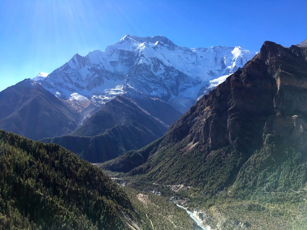 On Day 5, we took the Upper Pisang route to Manang. Trekkers have the option of following the Lower Pisang route, which sits lower in the valley and is a much easier hiking route, or the Upper Pisang route, which is significantly more strenuous BUT SO WORTH IT. I think that everyone should choose the Upper Pisang route for three reasons:
  In the morning, we trekked past prayer wheels and along the banks of the river. We had heard that this day was strenuous, so we assumed the trail would have a big ascent. Not long after Upper Pisang, it did. We were faced with switchbacks that snaked up the steep slope as high as we could see. The combination of the steep trail, the packs on our backs, and the altitude made for a difficult, slow, and steady ascent. I would trudge up two switchbacks and then pause for a sip of water or quick breather. The ascent on this part of the trail took over an hour and we climbed 420 m (1378 ft). At the top, we dropped our packs, flopped to the ground, and took in the stunning views of the river far below and the mountains around us.  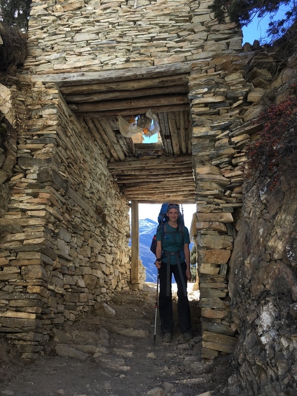 At the top of our big climb was the village of Ghyaru, a tiny village with stone buildings and flat roofs. The road to Manang doesn't follow the Upper Pisang route, so these villages are only reachable by foot or animal. In Ghyaru, a man approached us and asked if we were American. When we confirmed this, he explained that he was the headmaster at the school in Ghyaru, and he had been having computer issues. He thought that we could fix his computer since we were American. We agreed to stop by after resting for a short while. Eventually, we made our way to the school, asking for directions along the way. The headmaster greeted us enthusiastically. I know next-to-nothing about computers, but my fellow trekkers knew a bit more and began eagerly plugging in cords and pressing buttons. As they worked, I shone my cell phone light on the computer and looked around the office. There were photographs of volunteer groups who had come to the school and stacks of workbooks for the students, including English workbooks. Ultimately, we could not fix the computer. Later, as we continued our trek, we hypothesized that it might have been malfunctioning from all the dust. The computer was sitting by the open window and was covered in a coating of dust and dirt, which had clearly blown in through the open window. Rachel thought that the dust probably blew into the office and got into the computer system. Even though we were unsuccessful at fixing the computer, it was a cool experience to see the school and meet the headmaster - an unusual pit stop along the trail! 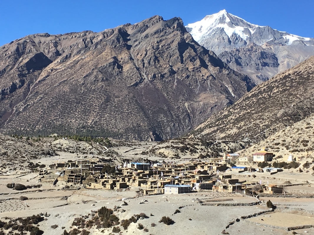 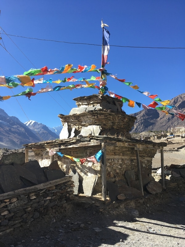 Because we had climbed higher than our stopping point of Manang, the Upper Pisang route descended steeply during the second half of the day. The downhill was hard on my joints, particularly my knees, and we lost the route at one point. After descending, the sun was starting to drop behind the mountains, and I was sure that we couldn't be far from Manang. But, we kept walking. And walking. And walking. My feet were hurting, my knees were hurting, and I was so grateful to see a town, until I realized it was not Manang. We had reached Bhraga, only 30 minutes from Manang, but I have to say that was a long 30 minutes after our strenuous day of trekking. At the end of this day, nobody in our group was speaking because we were so exhausted and were literally hobbling into Manang. 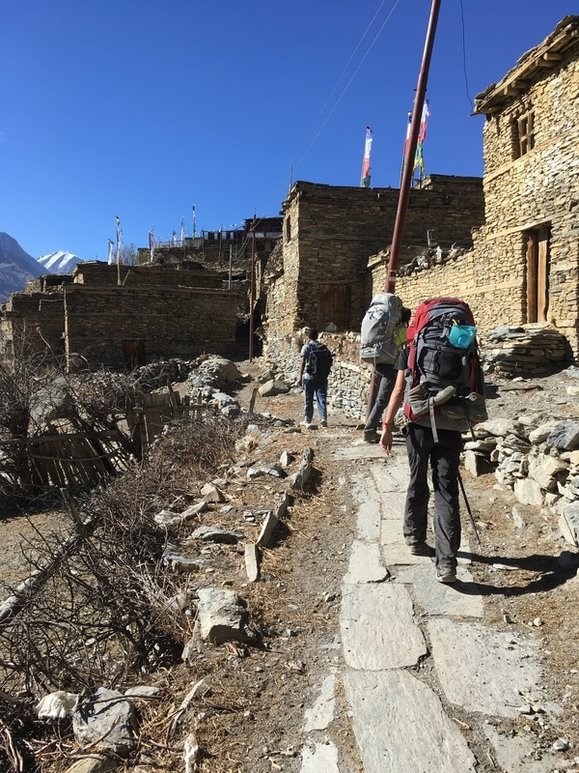  At the end of this day, I was exhausted. My joints hurt. My feet hurt. But, I would not have traded the Upper Pisang trail for anything. I was glad that I had the opportunity to hike away from the road, take in the glorious mountain views, walk through the tiny villages filled with character, and visit a school in Ghyaru. And, after all, this tough day of trekking was followed by a rest day in Manang! 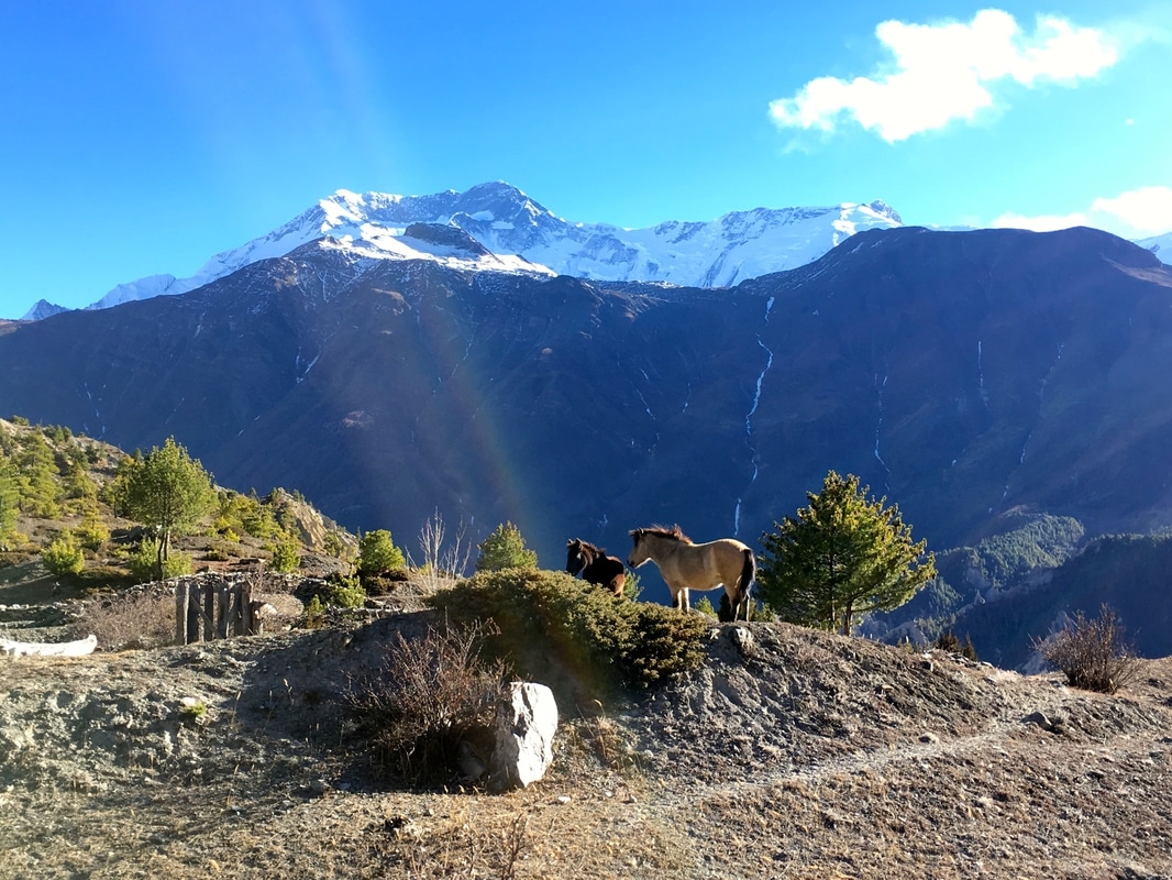 Daily trekking distance: 19.5 km
Total trekking distance: 81 km Starting elevation (Upper Pisang): 3310m/10,859 ft Ending elevation (Manang): 3540m/11,614 ft Costs Technically none, since we did not stop for lunch. We ate snacks that we carried with us rather than stopping on an already long trekking day. I will include costs from Manang on the post about our rest day. |
AuthorMy name is Alyssa Good and I have a passion for travel, adventure, culture, and new experiences! I focus on budget friendly travel, trip planning resources, and seeking out new experiences. Archives
December 2017
Categories
All
|
 RSS Feed
